Old Maps of Bernalillo County, New Mexico for Academic Research
Study the evolution of Bernalillo County with 270 high-resolution historic maps. Whether you're teaching, researching, or modeling changes in land use, these maps provide essential visual documentation of urban, environmental, and geographic change.
- Analyze long-term change: Track patterns in development, transportation, and natural features.
- Ideal for environmental or urban studies: Support academic projects with primary historical map data.
- Use in the classroom or lab: Educators and researchers rely on these maps to bring historical context to life.
These maps are a powerful tool for teaching, research, and visualizing how Bernalillo County has changed over the decades.
Bernalillo County, NM maps
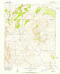
(270)- 1883 Map of Mt. Taylor
 1883 Mt. Taylor1883 Print · USGSThe high-desert frontier of New Mexico comes to life in the 1880s, centered on the towering Mt Taylor. Researchers can trace the early path of the Atlantic and Pacific Railroad and locate settlements like Old Fort Wingate and Laguna.
 - 1886 Map of Mt. Taylor
 1886 Mt. Taylor1886 Print · USGSNorthwestern New Mexico in the mid-1880s reveals a high-desert territory where early rail commerce meets long-standing mountain settlements. Researchers can trace the path of the Atlantic and Pacific Railroad past Old Fort Wingate and the historic villages of Laguna and Cebolletta.
 - 1888 Map of Bernalillo, 1951 Print
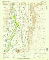
 1888 Bernalillo1951 Print · USGSThe Middle Rio Grande valley appears here in the late nineteenth century, just as the railroad began to reshape the high desert. Genealogists and historians can trace the early footprints of Albuquerque, Bernalillo, and traditional communities like Atrisco and Santa Ana.
 - 1889 Map of Albuquerque
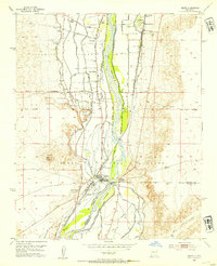
 1889 Albuquerque1889 Print · USGSAlbuquerque and the Rio Grande Valley appear here during the expansion of the territorial railroad system. Local historians can trace the early rail corridor of the Atchison Topeka and Santa Fe Railroad and find early river settlements like Bernalillo, Alameda, and Artisco.
 - 1892 Map of San Pedro
 1892 San Pedro1892 Print · USGSNew Mexico's high desert and mountain mining districts come alive in the late nineteenth century as the rail lines reached the interior. Genealogists and historians can trace old wagon routes and rail stops near Dolores, the mining activity at Golden, and early adobe settlements like Algodones and San Pedro.5 unique versions available
 - 1892 Map of Mt. Taylor, 1896 Print
 1892 Mt. Taylor1896 Print · USGSNorthwestern New Mexico in the late nineteenth century was a territory of rail expansion and ancient volcanic landmarks. Researchers can trace the path of the Atlantic and Pacific Railroad past Old Fort Wingate and the pueblo at Laguna.
 - 1893 Map of Albuquerque
 1893 Albuquerque1893 Print · USGSThe Rio Grande valley in the late nineteenth century is a study in river-fronting settlements and the emerging rail economy. Genealogists can trace the early footprints of Albuquerque, Bernalillo, and the traditional community at Artisco.5 unique versions available
 - 1899 Map of Mt. Taylor
 1899 Mt. Taylor1899 Print · USGSNorthwestern New Mexico in the late nineteenth century is a landscape of vast mesas and early rail stops before modern highways arrived. Genealogists and historians can trace the foundations of Grant, San Mateo, and Old Fort Wingate along the Santa Fe Pacific Railroad.5 unique versions available
 - 1917 Map of Estancia
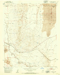
 1917 Estancia1917 Print · USGSThe Estancia Valley and Manzano foothills come alive in this Great War-era survey, showing a landscape defined by massive land grants and new rail lines. Trace family roots and vanished ranch sites across the Manzano Grant or locate early buildings in Mountainair, Willard, and Chilili.
 - 1917 Map of Cerro Verde
 1917 Cerro Verde1917 Print · USGSNorthwestern New Mexico’s high desert landscape is captured here during the First World War era, showing a mix of ancient land grants and rail-side outposts. Genealogists and historians can trace family-named sites like Vigil, Baca, and the Correo Post Office along the Atchison Topeka and Santa Fe line.
 - 1934 Map of Alameda
 1934 Alameda1934 Print · USGSThe Rio Grande valley in the mid-1930s reveals a landscape of deep-rooted land grants and modernizing infrastructure. Genealogists and historians can trace the irrigation ditches around Alameda and find landmarks like the Nazareth Sanatorium and KOB Radio Transmitter.
 - 1934 Map of West Albuquerque
 1934 West Albuquerque1934 Print · USGSThe Rio Grande Valley near Albuquerque was a complex landscape of irrigation and industry during the mid-thirties. Genealogists and historians can trace family-named schools and early city infrastructure, from the US Indian School to the Old Town Bridge and Hubble Lake.
 - 1934 Map of Griegos
 1934 Griegos1934 Print · USGSThe Rio Grande valley north of Albuquerque is shown here in the mid-thirties as a landscape of historic land grants and complex irrigation. Genealogists and historians can trace the early rail-and-road network near Hahn Station and the Alameda Bridge.
 - 1934 Map of East Albuquerque
 1934 East Albuquerque1934 Print · USGSAlbuquerque's eastern reaches are captured in the mid-1930s just as federal and institutional growth began defining the city. Local historians can trace the early University of New Mexico campus and the original Albuquerque Landing Field.
 - 1938 Map of Albuquerque
 1938 Albuquerque1938 Print · USGSAlbuquerque and the Rio Grande Valley are shown in the late 1930s, when irrigation ditches still defined the rural landscape between the river and the mountains. Researchers can trace ancestral lands through the Town of Atrisco Grant or locate landmarks like the U S Indian School and Old Albuquerque.
 - 1952 Map of Wind Mesa, 1953 Print
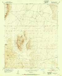 1952 Wind Mesa1953 Print · USGSTraditional tribal lands and volcanic geology define this mid-century survey of the New Mexico desert. Researchers can trace the boundaries of the Isleta Pueblo Grant and Pajarito Grant across the volcanic flows of Wind Mesa.3 unique versions available
 - 1952 Map of Dalies, 1953 Print
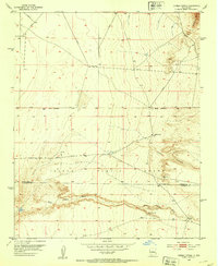
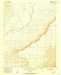
 1952 Dalies1953 Print · USGSThe high desert south of Albuquerque was a land of sprawling rail junctions and historic land grants in the early fifties. Genealogists and historians can trace the rail networks at Dalies or locate the New Mexico Penitentiary Farm and El Cerro de los Lunas.2 unique versions available
 - 1952 Map of Rio Puerco, 1953 Print
 1952 Rio Puerco1953 Print · USGSSpanish land grants still shaped the landscape of central New Mexico during the early fifties. Genealogists and historians can trace property lines through the San Clemente Grant and locate the small riverside stop of Rio Puerco near the Atchison Topeka and Santa Fe railroad.2 unique versions available
 - 1952 Map of Hubbell Spring, 1953 Print
 1952 Hubbell Spring1953 Print · USGSThe Isleta Pueblo region in the early fifties shows a rugged landscape of ranching and early aviation infrastructure. Researchers can trace the boundaries of Mc Cormick Ranch and locate remote landmarks like Hubble Spring and the Ojo de la Cabra spring.4 unique versions available
 - 1952 Map of Los Lunas, 1954 Print
 1952 Los Lunas1954 Print · USGSThe Rio Grande valley comes alive in this mid-century survey of Valencia County, showing the intricate network of canals and historic land grants. Genealogists can locate family landmarks like Romero Ranch, El Camposanto de la Liverta, and the Chical Indian School.3 unique versions available
 - 1952 Map of Isleta, 1954 Print
 1952 Isleta1954 Print · USGSThe Rio Grande valley south of Albuquerque was a complex network of irrigation and transit in the early fifties. Local historians can trace the foundations of Pajarito and Isleta Pueblo alongside landmarks like St Andres Ch and the Isleta Diversion Dam.3 unique versions available
 - 1952 Map of Dalies NW, 1954 Print
 1952 Dalies NW1954 Print · USGSNew Mexico's high desert reveals its historic land partitions during the early fifties, where the Rio Puerco cuts through traditional territories. Researchers can trace the massive boundaries of the Isleta Pueblo Indian Land Grant and locate the remote Community Well.3 unique versions available
 - 1954 Map of Sandia Crest, 1955 Print
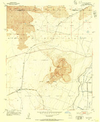
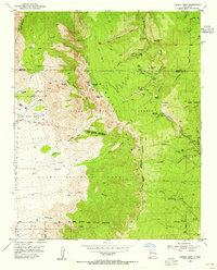 1954 Sandia Crest1955 Print · USGSThe high peaks and deep canyons of Bernalillo County come into sharp focus in the mid-1950s as recreation and infrastructure began to expand. Genealogists and hikers can trace old routes like the La Luz Trail or locate remote landmarks like Ellis Ranch and Cañoncito Cemetery.2 unique versions available
 - 1954 Map of Herrera, 1955 Print
 1954 Herrera1955 Print · USGSTribal lands and early ranching infrastructure converge in this mid-fifties New Mexico survey of Bernalillo and Sandoval counties. Genealogists and historians can locate the Herrera settlement, the Capilla de San Ignacio, and the now-vacant CCC Camp (Aban'd).3 unique versions available
 - 1954 Map of Alameda, 1955 Print
 1954 Alameda1955 Print · USGSThe Rio Grande valley and the Sandia foothills meet in this mid-century survey of the historic land grants north of Albuquerque. Researchers can trace early irrigation canals, the path of El Camino Real, and landmarks like Sandia View Academy and San Ysidro Ch.
Showing maps 1-25 of 270
Top cities of Bernalillo County
- Albuquerque historical maps
- South Valley historical maps
- Los Ranchos de Albuquerque historical maps
- Paradise Hills historical maps
- Cedar Crest historical maps
- Tijeras historical maps
Frequently asked questions
- What are the different types of historical maps available for Bernalillo County?
- What is the oldest map of Bernalillo County?
- Where can I purchase historical maps of Bernalillo County for my home or office?
- Where can I download high-res historical maps of Bernalillo County?
- Are there historical topographic maps available for Bernalillo County?
- Is there historical aerial imagery available for Bernalillo County?
- Where are historical maps of Bernalillo County sourced from?