
1952 Map of Dalies NW
USGS Topo · Published 1954About this map
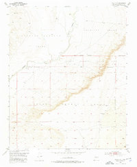
The Rio Puerco meanders through a landscape defined by significant historic land partitions in this 1952 survey of the high desert south of Albuquerque. The terrain is divided into expansive historic tracts, most notably the Isleta Pueblo Indian Land Grant, alongside the Antonio Sedillo Grant and the Pajarito Grant. These Spanish and Pueblo land divisions create a complex boundary network that shaped local movement and land use for centuries. A single Community Well serves as a vital marker of human habitation and infrastructure in this arid environment. The map also captures the New Mexico Principal Meridian, a crucial baseline for the Public Land Survey System in the Southwest. The interaction between the winding riverbed and the rigid rectilinear survey lines illustrates the overlay of modern administrative mapping on ancient territorial boundaries.
Find a feature on this map
7 named features on this map. Tap any name to fly to it.
Don’t see what you’re looking for? This feature index may not catch every label — zoom into the map to look around manually.
Map Details
Editions of this 1952 Dalies NW Map
3 editions found
Other maps of this area

1883 · Mt. Taylor
USGS Topo · 1:250,000

1886 · Mt. Taylor
USGS Topo · 1:250,000

1888 · Bernalillo
USGS Topo · 1:125,000

1889 · Albuquerque
USGS Topo · 1:125,000

1892 · Mt. Taylor
USGS Topo · 1:250,000

1893 · Albuquerque
USGS Topo · 1:125,000

1899 · Mt. Taylor
USGS Topo · 1:250,000

1917 · Cerro Verde
USGS Topo · 1:125,000

1952 · Wind Mesa
USGS Topo · 1:24,000

1952 · Dalies
USGS Topo · 1:24,000