Old Maps of Shuree, New Mexico for Genealogy
Trace your family roots with 11 historic maps of Shuree. These high-res maps reveal old neighborhoods, homesites, landmarks, and streets — helping you uncover where your ancestors lived and how the area evolved over time.
- Explore historic neighborhoods: Identify where your relatives may have lived in the 1800s or 1900s.
- Compare maps over time: Trace the changes in streets, buildings, and landmarks for multi-generational research.
- Perfect for genealogy & ancestry research: Used by family historians and researchers to map out lineage and migration.
These maps are an incredible resource for exploring your personal connection to Shuree's past.
Shuree, NM maps
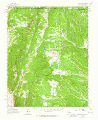
(11)- 1954 Map of Raton, 1963 Print
 1954 Raton1963 Print · USGSNorthern New Mexico's high-country and plains are documented here in the early sixties, showing the region's ranching and mining infrastructure. Trace the legacy of the Maxwell Land Grant, locate remote rural sites like Tafoya School, and follow the Atchison Topeka and Santa Fe Railway through the heart of Raton.3 unique versions available
 - 1958 Map of Raton
 1958 Raton1958 Print · USGSNorthern New Mexico and the Colorado borderlands are mapped here in the late fifties, showcasing a landscape of high peaks and historic land grants. Genealogists and historians can trace families across Picuris Pueblo, find old schoolhouses like Piedra Lumbre School, or follow the Atchison Topeka and Santa Fe rail line.3 unique versions available
 - 1962 Map of Ash Mountain, 1964 Print
 1962 Ash Mountain1964 Print · USGSThe Sangre de Cristo Mountains and the historic Maxwell Land Grant are captured here in the early sixties. Researchers can trace high-altitude ranching and mining history through sites like the Van Lint Mine, Penatlor Ruins, and family-named landmarks like Banning Place.3 unique versions available
 - 1982 Map of Wheeler Peak, 1983 Print
 1982 Wheeler Peak1983 Print · USGSNorthern New Mexico in the early eighties shows a high-altitude landscape of historic mining camps and massive land grants. Researchers can trace the Old Railroad Grade near Elizabethtown or locate remote sites like the French-Henry Mine and Vermejo Park.
 - 1986 Map of Ash Mountain
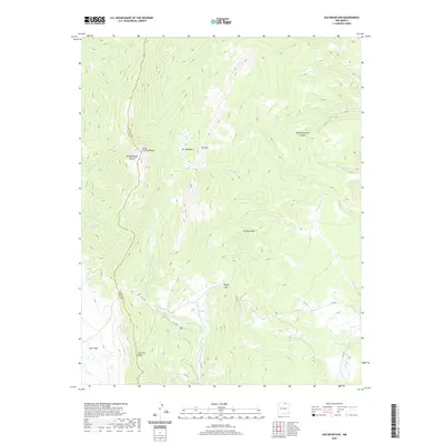
 1986 Ash Mountain1986 Print · USGSNorthern New Mexico's high-country wilderness is captured here in the mid-1980s, detailing the intersection of Taos and Colfax counties. Hikers and historians can trace the paths near Little Costilla Peak, the drainage of Shuree Creek, and the massive The Rock Wall formation.
 - 1995 Map of Ash Mountain, 1998 Print
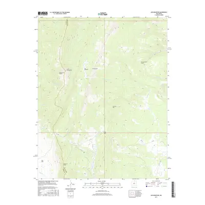
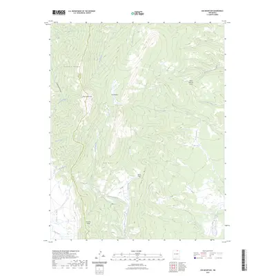
 1995 Ash Mountain1998 Print · USGSThe high Sangre de Cristo Mountains of northern New Mexico are documented here in the mid-1990s as federal management expanded across old land grants. Researchers can locate the historic Mc Crystal Place, the small settlement at Shuree, and family-named landmarks like Harry Bremmer Canyon.
 - 2011 Map of Ash Mountain, 2011 Print
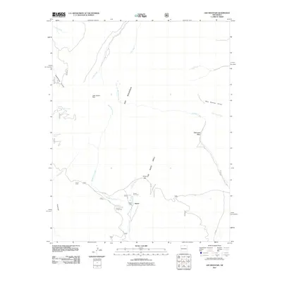 2011 Ash Mountain2011 Print · USGSCovers Shuree, including Taos County, Colfax County, and other nearby areas
 - 2013 Map of Ash Mountain, 2013 Print
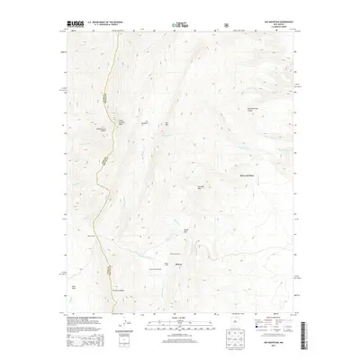 2013 Ash Mountain2013 Print · USGSCovers Shuree, including Taos County, Colfax County, and other nearby areas
 - 2017 Map of Ash Mountain, 2017 Print
 2017 Ash Mountain2017 Print · USGSCovers Shuree, including Taos County, Colfax County, and other nearby areas
 - 2020 Map of Ash Mountain, 2020 Print
 2020 Ash Mountain2020 Print · USGSCovers Shuree, including Taos County, Colfax County, and other nearby areas
 - 2023 Map of Ash Mountain, 2023 Print
 2023 Ash Mountain2023 Print · USGSThe high mountain border of Taos and Colfax counties is surveyed here in the early twenty-first century, showing the intersection of the Culebra and Cimarron ranges. Researchers can trace historic access routes and watersheds through Windy Gap, Valle Vidal, and the drainages of Middle Ponil Creek.
End of results
Showing maps 1-11 of 11
Top cities near Shuree
Frequently asked questions
- What are the different types of historical maps available for Shuree?
- What is the oldest map of Shuree?
- Where can I purchase historical maps of Shuree for my home or office?
- Where can I download high-res historical maps of Shuree?
- Are there historical topographic maps available for Shuree?
- Is there historical aerial imagery available for Shuree?
- Where are historical maps of Shuree sourced from?