Old Maps of Santa Teresa, New Mexico for Metal Detecting
Plan your next treasure hunt with 31 historic maps of Santa Teresa. Find old homesites, ghost towns, trails, and gathering spots that may be lost to time — perfect for identifying promising metal detecting locations.
- Locate forgotten sites: Uncover places like long-lost settlements, abandoned rail lines, or gathering spots.
- Plan better hunts: Use map overlays combined with LiDAR or satellite views to narrow in on historically rich areas.
- Made for detectorists: Thousands of hobbyists use these maps to discover relics, coins, and hidden history.
Use these historic maps to boost your research and find new opportunities beneath the surface of Santa Teresa.
Santa Teresa, NM maps
(31)- 1917 Map of Canutillo, 1957 Print
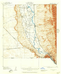 1917 Canutillo1957 Print · USGSThe Rio Grande valley and the international border come to life in this survey from the early twentieth century. Genealogists and researchers can trace the rail-and-river economy through old stations like Strauss, local landmarks like La Vista School, and the industrial Smelter district.
 - 1919 Map of Canutillo
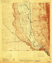 1919 Canutillo1919 Print · USGSThe Rio Grande valley at the Texas and New Mexico border comes to life in this survey from just after the Great War. Genealogists and historians can trace family-named locations and early institutions like La Vista School, the Smelter, and West El Paso PO.3 unique versions available
 - 1953 Map of El Paso
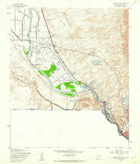
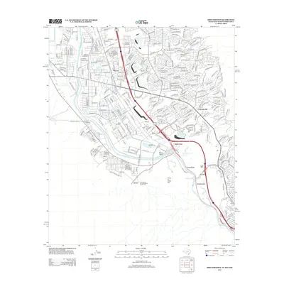
 1953 El Paso1953 Print · USGSEl Paso and the border region are shown here in the early fifties, documenting a landscape of shared river life and rising military presence. Genealogists and historians can trace rail-tied communities like Smeltertown, San Elizario, and the grounds of Fort Bliss.
 - 1955 Map of Smeltertown, 1962 Print
 1955 Smeltertown1962 Print · USGSEl Paso and the borderlands are seen here in the mid-fifties, where industry and education meet the high desert. Researchers can trace the riverfront development of Smeltertown or locate historical sites like La Guna Cem and the University of Texas Western College.5 unique versions available
 - 1955 Map of Strauss, 1962 Print
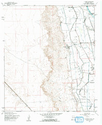
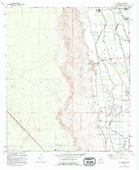
 1955 Strauss1962 Print · USGSThe borderlands of southern New Mexico meet the Texas line in the mid-1950s, centered on the vital rail traffic of the southwest. Genealogists and rail historians can trace the Southern Pacific through Strauss, find the Santa Nina Ch, and follow the Old Railroad Grade near Mastodon.
 - 1955 Map of La Union, 1962 Print
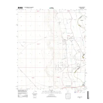
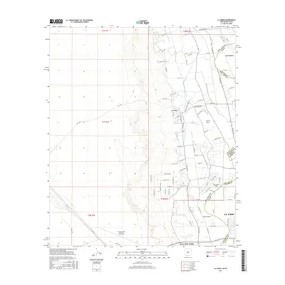
 1955 La Union1962 Print · USGSThe Mesilla Valley landscape comes alive in this mid-fifties study of the irrigated corridor south of Las Cruces. Genealogists and local historians can trace the foundations of La Union, the Refugio Colony, and rural landmarks like St Lukes Ch and Central Sch.2 unique versions available
 - 1959 Map of El Paso, 1968 Print
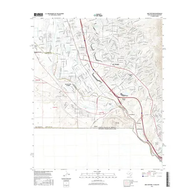
 1959 El Paso1968 Print · USGSEl Paso and the international borderlands come alive in this mid-century survey of the Chihuahuan Desert. Genealogists and historians can trace rail-side settlements like Columbus and Fabens, locate the sprawling Fort Bliss, and explore the geologically unique Kilbourne Hole.2 unique versions available
 - 1964 Map of El Paso
 1964 El Paso1964 Print · USGSThe El Paso and Juarez borderlands are shown in detail during the mid-sixties, from the urban center to the remote volcanic craters of the West Potrillo Mountains. Trace the rail-and-river network through Asarco Smeltertown, the Fort Bliss Military Reservation, and Columbus.
 - 1965 Map of El Paso
 1965 El Paso1965 Print · USGSEl Paso and the Mesilla Valley are shown in the mid-1960s as the region's military and transport infrastructure expanded. Researchers can trace the irrigation network along the Rio Grande, find old border stations like Columbus, and locate Hueco Tanks.
 - 1983 Map of El Paso
 1983 El Paso1983 Print · USGSThe Chihuahuan Desert borderlands come into sharp focus in the early eighties as the binational metro area of El Paso and Ciudad Juarez expands. Genealogists and historians can trace rail lines like the Santa Fe, military grounds at Fort Bliss, and rural valley settlements including Canutillo and Zaragoza.2 unique versions available
 - 1994 Map of Smeltertown
 1994 Smeltertown1994 Print · USGSEl Paso and the international borderlands come alive in the 1990s as industry and education reshape the river valley. Trace the legacy of the Copper Smelter in Smeltertown, locate old family sites near La Calavera, and follow the American Canal.
 - 1994 Map of Strauss
 1994 Strauss1994 Print · USGSThe Chihuahuan Desert meets the international border in the early nineties, revealing a landscape shaped by aviation and rail. Trace the transition from the arid Strauss uplands to the Mesilla Valley via the Southern Pacific and an Old Railroad Grade.
 - 1995 Map of La Union
 1995 La Union1995 Print · USGSThe Mesilla Valley river corridor comes into sharp focus in the mid-1990s as it straddles the border between New Mexico and Texas. Local researchers can trace family landmarks and civic roots at St Lukes Ch, the Cem at La Union, and the Gadsden High Sch campus.
 - 1996 Map of Smeltertown, 2002 Print
 1996 Smeltertown2002 Print · USGSEl Paso and its neighbors in New Mexico and Mexico are shown in detail during the late nineties, showcasing the area's dense urban and industrial infrastructure. Genealogists and local historians can trace the foundations of Smeltertown, locate Memory Gardens Cem, and find local institutions like the University of Texas at El Paso.
 - 1996 Map of La Union, 2002 Print
 1996 La Union2002 Print · USGSThe Rio Grande corridor south of Las Cruces in the mid-1990s shows a landscape defined by intensive Mesilla Valley irrigation and border-region development. Researchers can trace historical land divisions in Refugio Colony Tract No 1 and locate local landmarks like St Lukes Sch and the Gadsden High Sch.
 - 1996 Map of Strauss, 2002 Print
 1996 Strauss2002 Print · USGSSouthern New Mexico meets the Texas and Mexico borders in the mid-nineties, showing a landscape of desert outposts and valley irrigation. Genealogists and historians can trace the Old Railroad Grade and locate sites like Strauss, Lizard, and the Santa Teresa Jr High Sch.
 - 2010 Map of Strauss, 2010 Print
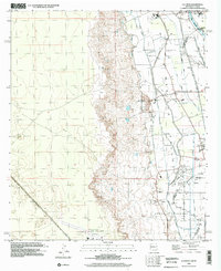
 2010 Strauss2010 Print · USGSCovers Santa Teresa, including El Paso, Sunland Park, and other nearby areas
 - 2010 Map of Smeltertown, 2010 Print
 2010 Smeltertown2010 Print · USGSCovers Santa Teresa, including El Paso, Sunland Park, and other nearby areas
 - 2010 Map of La Union, 2010 Print
 2010 La Union2010 Print · USGSCovers Santa Teresa, including El Paso, Anthony, and other nearby areas
 - 2012 Map of Smeltertown, 2012 Print
 2012 Smeltertown2012 Print · USGSCovers Santa Teresa, including El Paso, Sunland Park, and other nearby areas
 - 2013 Map of La Union, 2013 Print
 2013 La Union2013 Print · USGSCovers Santa Teresa, including El Paso, Anthony, and other nearby areas
 - 2013 Map of Strauss, 2013 Print
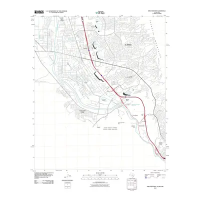
 2013 Strauss2013 Print · USGSCovers Santa Teresa, including El Paso, Sunland Park, and other nearby areas
 - 2016 Map of Smeltertown, 2016 Print
 2016 Smeltertown2016 Print · USGSCovers Santa Teresa, including El Paso, Sunland Park, and other nearby areas
 - 2017 Map of La Union, 2017 Print
 2017 La Union2017 Print · USGSCovers Santa Teresa, including El Paso, Anthony, and other nearby areas
 - 2017 Map of Strauss, 2017 Print
 2017 Strauss2017 Print · USGSCovers Santa Teresa, including El Paso, Sunland Park, and other nearby areas
Showing maps 1-25 of 31
Top cities near Santa Teresa
- El Paso historical maps
- Sunland Park historical maps
- Anthony historical maps
- Anthony, NM historical maps
- Canutillo historical maps
- Anthony historical maps
See more
Top neighborhoods of Santa Teresa
Frequently asked questions
- What are the different types of historical maps available for Santa Teresa?
- What is the oldest map of Santa Teresa?
- Where can I purchase historical maps of Santa Teresa for my home or office?
- Where can I download high-res historical maps of Santa Teresa?
- Are there historical topographic maps available for Santa Teresa?
- Is there historical aerial imagery available for Santa Teresa?
- Where are historical maps of Santa Teresa sourced from?