Old Maps of Espanola, New Mexico for Academic Research
Study the evolution of Espanola with 28 high-resolution historic maps. Whether you're teaching, researching, or modeling changes in land use, these maps provide essential visual documentation of urban, environmental, and geographic change.
- Analyze long-term change: Track patterns in development, transportation, and natural features.
- Ideal for environmental or urban studies: Support academic projects with primary historical map data.
- Use in the classroom or lab: Educators and researchers rely on these maps to bring historical context to life.
These maps are a powerful tool for teaching, research, and visualizing how Espanola has changed over the decades.
Espanola, NM maps
(28)- 1892 Map of Santa Clara
 1892 Santa Clara1892 Print · USGSUpper New Mexico at the end of the nineteenth century reveals a landscape shaped by the Rio Grande and the arrival of the rails. Genealogists and historians can trace traditional settlements like San Ildefonso and Peña Blanca alongside the burgeoning Santa Fé Southern Railway.4 unique versions available
 - 1918 Map of Abiquiu
 1918 Abiquiu1918 Print · USGSUpper Rio Arriba County comes alive in the years following the Great War, showing a network of historic land grants and riverside villages. Researchers can trace the path of the D. and R. G. R. R. or locate ancestral roots in Abiquiu, Vallecitos, and San Juan.
 - 1953 Map of Espanola, 1954 Print
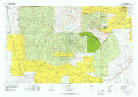
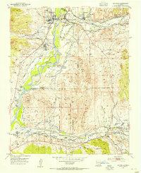 1953 Espanola1954 Print · USGSThe Tewa Basin in the early fifties shows a valley structured by ancient land grants and river-fed irrigation. Researchers can trace ancestral boundaries and local landmarks like Santa Clara Pueblo, the Black Mesa Church, and the McCurdy Sch.3 unique versions available
 - 1953 Map of San Juan Pueblo, 1954 Print
 1953 San Juan Pueblo1954 Print · USGSThe Rio Grande and Chama river valleys in the mid-1950s show a blend of Pueblo life and Spanish colonial heritage. Researchers can trace ancestral lands and mission chapels like Capilla de San Pedro or the historic site of the Old San Juan First Spanish Capitol 1598.4 unique versions available
 - 1953 Map of San Juan Pueblo, 1956 Print
 1953 San Juan Pueblo1956 Print · USGSRio Arriba County life in the mid-fifties is centered on the fertile confluence of the Rio Chama and Rio Grande. Local history researchers can trace ancestral roots through the numerous land grants, old irrigation Ditch lines, and early sites like San Juan Pueblo, Hernandez, and Los Luceros.2 unique versions available
 - 1953 Map of Espanola, 1958 Print
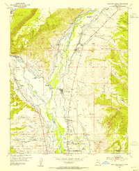
 1953 Espanola1958 Print · USGSNorthern New Mexico in the early fifties shows a landscape of deep canyons and ancestral Pueblo lands along the RIO GRANDE. Genealogists and historians can trace family-named sites like Evans Ranch or locate ancient Cliff Dwellings and the Old Railroad Grade.3 unique versions available
 - 1954 Map of Aztec, 1975 Print
 1954 Aztec1975 Print · USGSNorthern New Mexico and southern Colorado come alive in the mid-1950s, showing the high-country settlements and tribal lands of the San Juan Basin. Genealogists and historians can trace the path of the Denver & Rio Grande Western RR and locate communities like Abiquiu, Park View, and Lumberton.4 unique versions available
 - 1958 Map of Aztec
 1958 Aztec1958 Print · USGSNorthern New Mexico and the southern Colorado border are captured here during the mid-fifties, showing the rugged intersection of national forests and tribal lands. Researchers can trace the Denver and Rio Grande Western rail line and locate remote outposts like Blanco Trading Post or Sargent Ranch.
 - 1958 Map of Albuquerque
 1958 Albuquerque1958 Print · USGSAlbuquerque and the surrounding high desert are captured here during a period of massive federal expansion and postwar growth. Researchers can trace the development of Kirtland Air Force Base, find ancestral homes in Pueblo de Santa Ana, or locate industrial sites like the Jackpile Mine.
 - 1962 Map of Aztec
 1962 Aztec1962 Print · USGSNorthwestern New Mexico in the early sixties showcases a landscape defined by the arrival of the Navajo Reservoir and the high-altitude timber of the Carson National Forest. Trace the path of the Denver & Rio Grande Western RR or locate historic settlements like Tierra Amarilla and Gobernador.
 - 1962 Map of Albuquerque
 1962 Albuquerque1962 Print · USGSAlbuquerque and the surrounding high desert are captured here in the early 1960s during a period of intense mineral and military growth. Genealogists and historians can locate early schools like the Pueblo Pintado School, major industrial sites like the Jackpile Mine, and the sprawling Kirtland Air Force Base.
 - 1963 Map of Albuquerque, 1965 Print
 1963 Albuquerque1965 Print · USGSMid-century New Mexico unfolds across this map, showcasing the intersection of ancient pueblos, modern military bases, and historic mining districts. Trace family roots and local history through the Ortiz Mine, Seven Lakes Trading Post, and Alameda.3 unique versions available
 - 1965 Map of Aztec
 1965 Aztec1965 Print · USGSNorthern New Mexico and southern Colorado come alive in the mid-sixties, from the San Juan Basin to the high Jemez Mountains. Trace the narrow-gauge Denver & Rio Grande Western RR through Monero or locate old outposts like Blanco Trading Post.
 - 1978 Map of Los Alamos
 1978 Los Alamos1978 Print · USGSThe Jemez Mountains and Rio Grande valley come together in the late seventies, showing a land defined by volcanic peaks and ancient pueblos. Trace the footprints of Bandelier National Monument, find the rail line of the Atchison Topeka and Santa Fe, and locate historic settlements like Jemez Pueblo.
 - 1983 Map of Albuquerque, 1984 Print
 1983 Albuquerque1984 Print · USGSCentral New Mexico in the early eighties shows a landscape where ancient pueblos and modern aerospace hubs meet. Trace the routes of the Atchison Topeka and Santa Fe RR or locate landmarks like Kirtland Air Force Base, Madrid, and the Sandia Mountains.
 - 1984 Map of Espanola
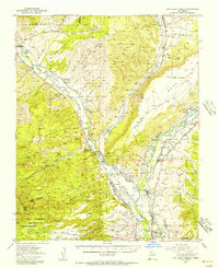
 1984 Espanola1984 Print · USGSIn the mid-1980s, this area of the Rio Grande valley remained a landscape of historic pueblos and vital irrigation ditches. Genealogists and historians can trace the community layouts of Santa Clara Pueblo, La Mesilla, and Jacona alongside the rising landmark of Black Mesa.2 unique versions available
 - 2002 Map of San Juan Pueblo, 2003 Print
 2002 San Juan Pueblo2003 Print · USGSThe confluence of the Rio Grande and Rio Chama at the start of the twenty-first century reveals a landscape shaped by centuries of Spanish and Puebloan history. Researchers can locate the Old San Juan First Spanish Capitol 1598 and explore the irrigation networks of Alcalde and San Juan Pueblo.
 - 2002 Map of Espanola, 2003 Print
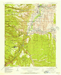
 2002 Espanola2003 Print · USGSNorthern New Mexico's Tewa pueblos and Spanish land grants are mapped here at the start of the millennium. Genealogists can locate family landmarks like the Iglesia de San Antonio de Padua, Santa Clara Pueblo, and the Capilla de Santo Niño de Atocha.
 - 2010 Map of Espanola, 2010 Print
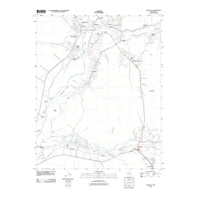 2010 Espanola2010 Print · USGSCovers Espanola, including Española, Santa Cruz, and other nearby areas
 - 2011 Map of San Juan Pueblo, 2011 Print
 2011 San Juan Pueblo2011 Print · USGSCovers Espanola, including Española, El Llano, and other nearby areas
 - 2013 Map of Espanola, 2013 Print
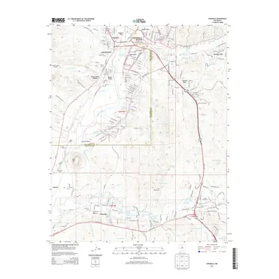 2013 Espanola2013 Print · USGSCovers Espanola, including Española, Santa Cruz, and other nearby areas
 - 2013 Map of San Juan Pueblo, 2013 Print
 2013 San Juan Pueblo2013 Print · USGSCovers Espanola, including Española, El Llano, and other nearby areas
 - 2017 Map of San Juan Pueblo, 2017 Print
 2017 San Juan Pueblo2017 Print · USGSCovers Espanola, including Española, El Llano, and other nearby areas
 - 2017 Map of Espanola, 2017 Print
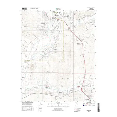 2017 Espanola2017 Print · USGSCovers Espanola, including Española, Santa Cruz, and other nearby areas
 - 2020 Map of San Juan Pueblo, 2020 Print
 2020 San Juan Pueblo2020 Print · USGSCovers Espanola, including Española, El Llano, and other nearby areas
Showing maps 1-25 of 28
Top cities near Espanola
- Los Alamos historical maps
- Española historical maps
- Española historical maps
- White Rock historical maps
- Santa Cruz historical maps
Top neighborhoods of Espanola
- Ranchitos historical maps
- Santo Niño historical maps
- San Pedro historical maps
- Fairview historical maps
- Santo Nino historical maps
- El Guacho historical maps
See more
Frequently asked questions
- What are the different types of historical maps available for Espanola?
- What is the oldest map of Espanola?
- Where can I purchase historical maps of Espanola for my home or office?
- Where can I download high-res historical maps of Espanola?
- Are there historical topographic maps available for Espanola?
- Is there historical aerial imagery available for Espanola?
- Where are historical maps of Espanola sourced from?