Old Maps of White Signal, New Mexico for Academic Research
Study the evolution of White Signal with 13 high-resolution historic maps. Whether you're teaching, researching, or modeling changes in land use, these maps provide essential visual documentation of urban, environmental, and geographic change.
- Analyze long-term change: Track patterns in development, transportation, and natural features.
- Ideal for environmental or urban studies: Support academic projects with primary historical map data.
- Use in the classroom or lab: Educators and researchers rely on these maps to bring historical context to life.
These maps are a powerful tool for teaching, research, and visualizing how White Signal has changed over the decades.
White Signal, NM maps
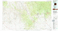
(13)- 1909 Map of Silver City
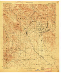 1909 Silver City1909 Print · USGSSilver City and the surrounding mining districts are shown at their industrial peak before the First World War. Researchers can trace early railroad spurs to camps like Santa Rita and Fierro, or locate the expansive Fort Bayard Military Reservation.2 unique versions available
 - 1950 Map of White Signal, 1963 Print
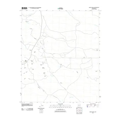
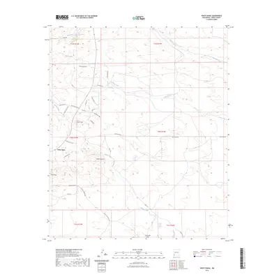
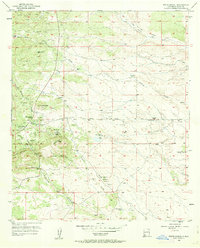 1950 White Signal1963 Print · USGSGrant County ranching and mining history come into focus in this mid-century survey of the New Mexico high country. Genealogists and researchers can locate the White Signal School and 7XV Ranch, or trace the paths to inactive sites like Gold Lake Mine.3 unique versions available
 - 1951 Map of White Signal
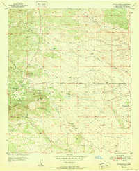 1951 White Signal1951 Print · USGSThe mining and ranching culture of mid-century Grant County is captured here, centered on the settlement of White Signal. Researchers can trace the locations of family-owned operations and landmarks like the 7XV Ranch, White Signal School, and the Apache Trail Mine.
 - 1954 Map of Silver City, 1967 Print
 1954 Silver City1967 Print · USGSSoutheast Arizona and southwest New Mexico meet in this mid-century survey of the high desert and mountain mining districts. Local researchers can trace the rail lines through Lordsburg, the silver operations at Ash Peak Mines, and the limits of Fort Bayard Military Reservation.4 unique versions available
 - 1958 Map of Silver City
 1958 Silver City1958 Print · USGSSouthwestern New Mexico and eastern Arizona appear here in the mid-1950s, a period of intensive mining and rail activity. Trace the routes of the Southern Pacific RR through Lordsburg or locate historic operations at the Chino Mine and Santa Rita.
 - 1962 Map of Silver City
 1962 Silver City1962 Print · USGSThe high desert borderlands of New Mexico and Arizona come alive in this early sixties survey. Genealogists and historians can trace the mining economy through the Chino Mine, follow the rail routes of the Southern Pacific, or locate settlements like Virden and Bayard.
 - 1992 Map of White Signal
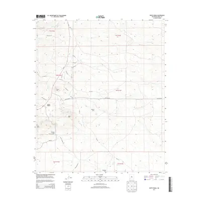
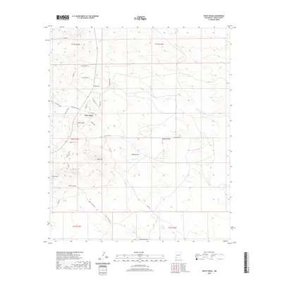
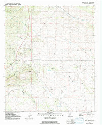 1992 White Signal1992 Print · USGSWhite Signal and the surrounding Burro Mountains are captured here in the early nineties during a period of sustained mining interest. Researchers and genealogists can trace numerous mineral claims like the Gold Lake Mine and Apache Trail Mine or find the remote Grave site near Keese Canyon.
 - 1994 Map of Silver City
 1994 Silver City1994 Print · USGSThe mining heart of Grant County is revealed in the mid-1990s as the massive industrial footprints of the copper industry shaped the landscape. Genealogists and historians can trace the rail lines of the Atchison Topeka and Santa Fe RR or locate landmarks like Fort Bayard State Medical Center and White Signal.
 - 2010 Map of White Signal, 2010 Print
 2010 White Signal2010 Print · USGSCovers White Signal, including Grant County, United States, and other nearby areas
 - 2013 Map of White Signal, 2013 Print
 2013 White Signal2013 Print · USGSCovers White Signal, including Grant County, United States, and other nearby areas
 - 2017 Map of White Signal, 2017 Print
 2017 White Signal2017 Print · USGSCovers White Signal, including Grant County, United States, and other nearby areas
 - 2020 Map of White Signal, 2020 Print
 2020 White Signal2020 Print · USGSCovers White Signal, including Grant County, United States, and other nearby areas
 - 2023 Map of White Signal, 2023 Print
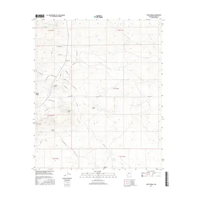
 2023 White Signal2023 Print · USGSGrant County’s high desert landscape is documented here in recent years, centered on the historic crossroads of White Signal. Local historians can trace family-named routes and landmarks like Stone Corral Spring, Tulloch Peak, and Johney Macdonald Rd.
End of results
Showing maps 1-13 of 13
Top cities near White Signal
Frequently asked questions
- What are the different types of historical maps available for White Signal?
- What is the oldest map of White Signal?
- Where can I purchase historical maps of White Signal for my home or office?
- Where can I download high-res historical maps of White Signal?
- Are there historical topographic maps available for White Signal?
- Is there historical aerial imagery available for White Signal?
- Where are historical maps of White Signal sourced from?