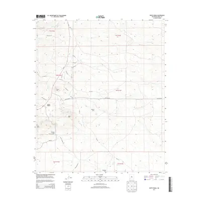
2013 Map of White Signal
USGS Topo · Published 2013About this map
White Signal serves as the primary landmark in this Grant County landscape, positioned near the intersection of several local routes such as White Water Rd and Frank McCaully Rd. The high desert terrain is defined by prominent elevations including Tulloch Peak, Saddle Mtn, and the distinctive Three Sisters. This 2013 survey illustrates a semi-arid environment where water is a critical but seasonal feature, marked by drainage systems like McDonald Draw and the more reliable Stone Corral Spring.
Find a feature on this map
37 named features on this map. Tap any name to fly to it.
Don’t see what you’re looking for? This feature index may not catch every label — zoom into the map to look around manually.
Map Details
Editions of this 2013 White Signal Map
This is the sole edition of this map. No revisions or reprints were ever made.
Other maps of this area

1909 · Silver City
USGS Topo · 1:125,000

1949 · Whitewater
USGS Topo · 1:24,000

1949 · Hurley West
USGS Topo · 1:24,000

1950 · Tyrone
USGS Topo · 1:24,000

1950 · White Signal
USGS Topo · 1:24,000

1950 · Wind Mountain
USGS Topo · 1:24,000

1950 · Burro Peak
USGS Topo · 1:24,000

1951 · White Signal
USGS Topo · 1:24,000

1951 · Big Burro Mountains
USGS Topo · 1:24,000
1951 · Tyrone
USGS Topo · 1:24,000