1900s (20th Century) Maps of Los Alamos County, New Mexico
Explore 16 historic maps of Los Alamos County from the 1900s (20th Century). These maps offer a rare glimpse into what life looked like during the 1900s — showing old roads, neighborhoods, homes, and landmarks that have changed or disappeared over time.
Whether you're researching your family's past, planning a metal detecting trip, or studying how Los Alamos County's landscape evolved across the 1900s, these high-resolution maps are a powerful tool for exploring the history of this region.
- Focus on a specific era: All maps on this page are from the 1900s, giving you a focused view of this time period.
- See what’s changed: Compare century-old streets, trails, and buildings to today's modern landscape using overlays and satellite layers.
- Research with precision: Use these maps for genealogy, historical research, land use analysis, or educational projects.
- View, download, or print: Maps are fully viewable online in high resolution, and can be downloaded or printed for your own records.
Start exploring Los Alamos County's history through authentic maps from the 1900s. This is your window into the past.
Los Alamos County, NM maps
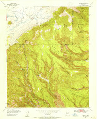
(16)- 1952 Map of White Rock, 1954 Print
 1952 White Rock1954 Print · USGSThe high mesas of Los Alamos and Santa Fe counties are captured here in the early fifties, documenting the remote canyon systems and early utility networks. Genealogists and historians can trace land grant boundaries and find markers of early industry like the Old Railroad Grade and Totavi.3 unique versions available
 - 1952 Map of Valle Toledo, 1954 Print
 1952 Valle Toledo1954 Print · USGSHigh in the Jemez Mountains during the early fifties, this area centers on the private Baca Location No 1 land grant. Genealogists and historians can trace early trails and landmarks like Camp May, the Santa Clara Indian Reservation border, and Cerro Rubio.5 unique versions available
 - 1952 Map of Frijoles, 1954 Print
 1952 Frijoles1954 Print · USGSThe Pajarito Plateau's high mesas and deep canyons are shown in the early fifties, a time when these archaeological landscapes were under federal stewardship. Trace the ancient paths of the Stone Lions Trail to reach the Pueblo of the Stone Lions and the Ceremonial Cave.3 unique versions available
 - 1952 Map of Puye, 1954 Print
 1952 Puye1954 Print · USGSThe Pajarito Plateau in the early fifties reveals a landscape of deep canyons and ancient heritage. Researchers can locate archaeological sites like the Cliff Dwellings at Puye or trace the early industrial footprint of the General Pumice Mine.4 unique versions available
 - 1952 Map of Guaje Mountain, 1954 Print
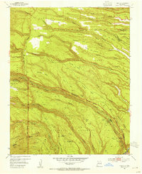
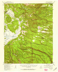
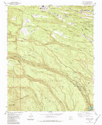
 1952 Guaje Mountain1954 Print · USGSLos Alamos and the surrounding high desert mesas are captured here in the early fifties, documenting a landscape of deep canyons and tribal lands. Researchers can trace the Quemazon Trail, locate ancient Pueblo Ruins, and study the boundaries of the Santa Clara Pueblo Grant.3 unique versions available
 - 1953 Map of Bland, 1954 Print
 1953 Bland1954 Print · USGSSandoval County during the early 1950s reveals a landscape of high-country mining and retreating settlements. Researchers can trace the remnants of the Cochiti Mining District and locate sites like Bland and Tent Rock Ranch.6 unique versions available
 - 1953 Map of Frijoles, 1958 Print
 1953 Frijoles1958 Print · USGSThe Pajarito Plateau was a landscape of deep canyons and volcanic mesas in the years following the war. Genealogists and historians can trace the mining remnants at Bland, ancestral Pueblo Ruins, and early homesteads like the Evans Griffin Place.3 unique versions available
 - 1953 Map of Espanola, 1958 Print
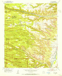
 1953 Espanola1958 Print · USGSNorthern New Mexico in the early fifties shows a landscape of deep canyons and ancestral Pueblo lands along the RIO GRANDE. Genealogists and historians can trace family-named sites like Evans Ranch or locate ancient Cliff Dwellings and the Old Railroad Grade.3 unique versions available
 - 1958 Map of Albuquerque
 1958 Albuquerque1958 Print · USGSAlbuquerque and the surrounding high desert are captured here during a period of massive federal expansion and postwar growth. Researchers can trace the development of Kirtland Air Force Base, find ancestral homes in Pueblo de Santa Ana, or locate industrial sites like the Jackpile Mine.
 - 1962 Map of Albuquerque
 1962 Albuquerque1962 Print · USGSAlbuquerque and the surrounding high desert are captured here in the early 1960s during a period of intense mineral and military growth. Genealogists and historians can locate early schools like the Pueblo Pintado School, major industrial sites like the Jackpile Mine, and the sprawling Kirtland Air Force Base.
 - 1963 Map of Albuquerque, 1965 Print
 1963 Albuquerque1965 Print · USGSMid-century New Mexico unfolds across this map, showcasing the intersection of ancient pueblos, modern military bases, and historic mining districts. Trace family roots and local history through the Ortiz Mine, Seven Lakes Trading Post, and Alameda.3 unique versions available
 - 1978 Map of Los Alamos
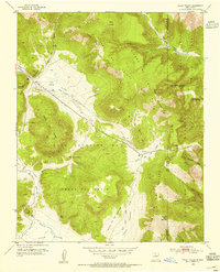
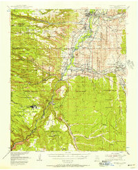
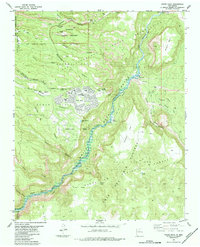
 1978 Los Alamos1978 Print · USGSThe Jemez Mountains and Rio Grande valley come together in the late seventies, showing a land defined by volcanic peaks and ancient pueblos. Trace the footprints of Bandelier National Monument, find the rail line of the Atchison Topeka and Santa Fe, and locate historic settlements like Jemez Pueblo.
 - 1983 Map of Albuquerque, 1984 Print
 1983 Albuquerque1984 Print · USGSCentral New Mexico in the early eighties shows a landscape where ancient pueblos and modern aerospace hubs meet. Trace the routes of the Atchison Topeka and Santa Fe RR or locate landmarks like Kirtland Air Force Base, Madrid, and the Sandia Mountains.
 - 1984 Map of White Rock
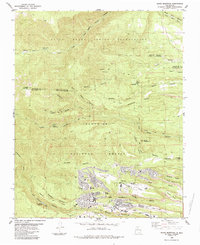
 1984 White Rock1984 Print · USGSLos Alamos County was undergoing significant residential growth in the mid-eighties as modern neighborhoods expanded atop the mesas. Local historians can trace ancestral sites like Tsankawi Ruins and Tshirege Ruins or follow the Old Railroad Grade along the Rio Grande.2 unique versions available
 - 1984 Map of Frijoles
 1984 Frijoles1984 Print · USGSThe Pajarito Plateau during the mid-eighties shows a landscape defined by archaeological heritage and federal research facilities. Researchers can trace ancestral sites like Tyuonyi Ruin and Stone Lions Shrine alongside the growth of Los Alamos.3 unique versions available
 - 1984 Map of Guaje Mountain
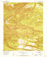
 1984 Guaje Mountain1984 Print · USGSLos Alamos and the surrounding canyonlands appear in the mid-eighties as a complex mix of government research, tribal lands, and mesa-top neighborhoods. Genealogists and historians can trace local development through the Guaje Pines Cem, Barranca Mesa Sch, and the Univ of N Mex (Los Alamos) campus.3 unique versions available
End of results
Showing maps 1-16 of 16
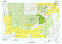
Top cities of Los Alamos County
Frequently asked questions
- What are the different types of historical maps available for Los Alamos County?
- What is the oldest map of Los Alamos County?
- Where can I purchase historical maps of Los Alamos County for my home or office?
- Where can I download high-res historical maps of Los Alamos County?
- Are there historical topographic maps available for Los Alamos County?
- Is there historical aerial imagery available for Los Alamos County?
- Where are historical maps of Los Alamos County sourced from?