2000-2009 Maps of Los Alamos County, New Mexico
Explore 6 historic maps of Los Alamos County from 2000-2009. These maps offer a rare glimpse into what life looked like during the 2000s — showing old roads, neighborhoods, homes, and landmarks that have changed or disappeared over time.
Whether you're researching your family's past, planning a metal detecting trip, or studying how Los Alamos County's landscape evolved across the 2000s, these high-resolution maps are a powerful tool for exploring the history of this region.
- Focus on a specific era: All maps on this page are from the 2000s, giving you a focused view of this time period.
- See what’s changed: Compare century-old streets, trails, and buildings to today's modern landscape using overlays and satellite layers.
- Research with precision: Use these maps for genealogy, historical research, land use analysis, or educational projects.
- View, download, or print: Maps are fully viewable online in high resolution, and can be downloaded or printed for your own records.
Start exploring Los Alamos County's history through authentic maps from the 2000s. This is your window into the past.
Los Alamos County, NM maps
(6)- 2002 Map of Guaje Mountain, 2003 Print
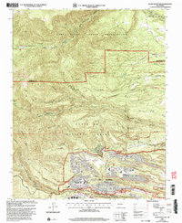 2002 Guaje Mountain2003 Print · USGSLos Alamos and its surrounding mesas are documented here at the turn of the millennium, showing the unique intersection of a world-class laboratory and the New Mexico landscape. Researchers can trace the layout of North Mesa, find the Guaje Pines Cemetery, and locate the Los Alamos National Laboratory.
 - 2002 Map of Bland, 2003 Print
 2002 Bland2003 Print · USGSSandoval County’s mountain landscape is captured here at the turn of the millennium, showing a rugged transition from high caldera rims to deep canyon floors. Genealogists and historians can trace defunct mountain communities and mining sites like Bland, Pines, and the Bruce Place.
 - 2002 Map of White Rock, 2003 Print
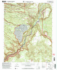 2002 White Rock2003 Print · USGSNorthern New Mexico at the start of the millennium reveals a fascinating intersection of laboratory science, tribal lands, and suburban expansion. Trace the boundaries of the Los Alamos National Laboratory as it neighbors White Rock and the San Ildefonso Indian Reservation.
 - 2002 Map of Puye, 2003 Print
 2002 Puye2003 Print · USGSNew Mexico's high plateaus and ancestral lands are shown in great detail during the early 2000s as the modern lab facilities expanded. Researchers can trace the proximity of Los Alamos National Laboratory to sacred sites like the Puya Cliff Dwellings and the San Ildefonso Pueblo Grant.
 - 2002 Map of Frijoles, 2003 Print
 2002 Frijoles2003 Print · USGSModern scientific infrastructure meets ancient landscapes in the mesas around Los Alamos during the early 2000s. Trace the boundaries of the Los Alamos National Laboratory and the historic Ramon Vigil Grant, or locate the Ceremonial Cave within Bandelier National Monument.
 - 2002 Map of Valle Toledo, 2003 Print
 2002 Valle Toledo2003 Print · USGSThe Jemez Mountains at the turn of the twenty-first century reveal a landscape of vast land grants and volcanic calderas. Researchers can trace the boundaries of the Baca Location No 1 Grant or locate landmarks like Camp May and Cerro Toledo.
End of results
Showing maps 1-6 of 6
Top cities of Los Alamos County
Frequently asked questions
- What are the different types of historical maps available for Los Alamos County?
- What is the oldest map of Los Alamos County?
- Where can I purchase historical maps of Los Alamos County for my home or office?
- Where can I download high-res historical maps of Los Alamos County?
- Are there historical topographic maps available for Los Alamos County?
- Is there historical aerial imagery available for Los Alamos County?
- Where are historical maps of Los Alamos County sourced from?