Old Maps of Arroyo del Agua, New Mexico for Genealogy
Trace your family roots with 13 historic maps of Arroyo del Agua. These high-res maps reveal old neighborhoods, homesites, landmarks, and streets — helping you uncover where your ancestors lived and how the area evolved over time.
- Explore historic neighborhoods: Identify where your relatives may have lived in the 1800s or 1900s.
- Compare maps over time: Trace the changes in streets, buildings, and landmarks for multi-generational research.
- Perfect for genealogy & ancestry research: Used by family historians and researchers to map out lineage and migration.
These maps are an incredible resource for exploring your personal connection to Arroyo del Agua's past.
Arroyo del Agua, NM maps
(13)- 1909 Map of Gallina
 1909 Gallina1909 Print · USGSUpper New Mexico at the end of the territorial era is captured here, showing the remote ranching and mining country along the Continental Divide. Genealogists and historians can locate early homesteads like Hart Ranch, the mining-era Copper City, and ancient Cliff Dwellings.2 unique versions available
 - 1953 Map of Arroyo Del Agua, 1955 Print
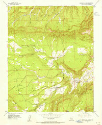 1953 Arroyo Del Agua1955 Print · USGSIn the early fifties, the high mesas and deep arroyos of Rio Arriba County supported a remote network of mountain schools and churches. Genealogists can locate family landmarks like Cordovas Spring or trace the small community at Arroyo del Agua and its Santa Teresa Church.4 unique versions available
 - 1953 Map of Youngsville, 1956 Print
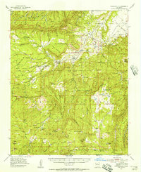 1953 Youngsville1956 Print · USGSNorthern New Mexico in the early fifties was a land of high mesas and remote timber operations near the edge of the forest grants. Genealogists and historians can trace family locations at the C Serrano Cabin, Mesa Poleo School, and Santa Teresa Church.2 unique versions available
 - 1954 Map of Aztec, 1975 Print
 1954 Aztec1975 Print · USGSNorthern New Mexico and southern Colorado come alive in the mid-1950s, showing the high-country settlements and tribal lands of the San Juan Basin. Genealogists and historians can trace the path of the Denver & Rio Grande Western RR and locate communities like Abiquiu, Park View, and Lumberton.4 unique versions available
 - 1958 Map of Aztec
 1958 Aztec1958 Print · USGSNorthern New Mexico and the southern Colorado border are captured here during the mid-fifties, showing the rugged intersection of national forests and tribal lands. Researchers can trace the Denver and Rio Grande Western rail line and locate remote outposts like Blanco Trading Post or Sargent Ranch.
 - 1962 Map of Aztec
 1962 Aztec1962 Print · USGSNorthwestern New Mexico in the early sixties showcases a landscape defined by the arrival of the Navajo Reservoir and the high-altitude timber of the Carson National Forest. Trace the path of the Denver & Rio Grande Western RR or locate historic settlements like Tierra Amarilla and Gobernador.
 - 1965 Map of Aztec
 1965 Aztec1965 Print · USGSNorthern New Mexico and southern Colorado come alive in the mid-sixties, from the San Juan Basin to the high Jemez Mountains. Trace the narrow-gauge Denver & Rio Grande Western RR through Monero or locate old outposts like Blanco Trading Post.
 - 2002 Map of Arroyo Del Agua, 2003 Print
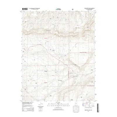
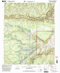 2002 Arroyo Del Agua2003 Print · USGSRio Arriba County at the start of the millennium shows a landscape defined by high mesas and forest service management. Researchers can locate the Santa Teresa Ch, the Coyote Ranger Sta, and water sources like Salitral Spring and Arroyo del Agua.
 - 2011 Map of Arroyo Del Agua, 2011 Print
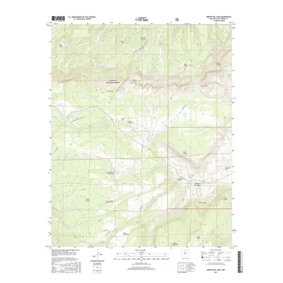
 2011 Arroyo Del Agua2011 Print · USGSCovers Arroyo del Agua, including Santa Teresa, Rio Arriba County, and other nearby areas
 - 2013 Map of Arroyo Del Agua, 2013 Print
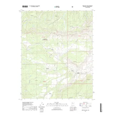
 2013 Arroyo Del Agua2013 Print · USGSCovers Arroyo del Agua, including Santa Teresa, Rio Arriba County, and other nearby areas
 - 2017 Map of Arroyo Del Agua, 2017 Print
 2017 Arroyo Del Agua2017 Print · USGSCovers Arroyo del Agua, including Santa Teresa, Rio Arriba County, and other nearby areas
 - 2020 Map of Arroyo Del Agua, 2020 Print
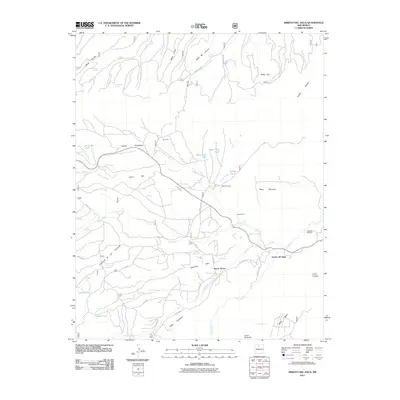
 2020 Arroyo Del Agua2020 Print · USGSCovers Arroyo del Agua, including Santa Teresa, Rio Arriba County, and other nearby areas
 - 2023 Map of Arroyo Del Agua, 2023 Print
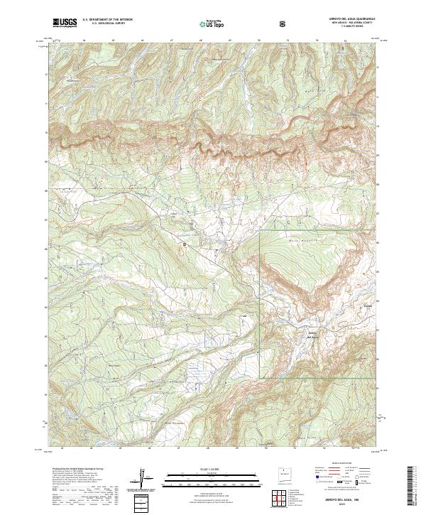 2023 Arroyo Del Agua2023 Print · USGSRio Arriba County’s high mesas and canyon systems are documented here in the early twenty-first century, showing the rural settlements of Arroyo del Agua and Coyote. Genealogists and historians can trace family-named landmarks like Mesa Gurule and Cordovas Spring across the Santa Fe National Forest.
End of results
Showing maps 1-13 of 13
Frequently asked questions
- What are the different types of historical maps available for Arroyo del Agua?
- What is the oldest map of Arroyo del Agua?
- Where can I purchase historical maps of Arroyo del Agua for my home or office?
- Where can I download high-res historical maps of Arroyo del Agua?
- Are there historical topographic maps available for Arroyo del Agua?
- Is there historical aerial imagery available for Arroyo del Agua?
- Where are historical maps of Arroyo del Agua sourced from?