1900s (20th Century) Maps of Farmington, New Mexico
Explore 13 historic maps of Farmington from the 1900s (20th Century). These maps offer a rare glimpse into what life looked like during the 1900s — showing old roads, neighborhoods, homes, and landmarks that have changed or disappeared over time.
Whether you're researching your family's past, planning a metal detecting trip, or studying how Farmington's landscape evolved across the 1900s, these high-resolution maps are a powerful tool for exploring the history of this region.
- Focus on a specific era: All maps on this page are from the 1900s, giving you a focused view of this time period.
- See what’s changed: Compare century-old streets, trails, and buildings to today's modern landscape using overlays and satellite layers.
- Research with precision: Use these maps for genealogy, historical research, land use analysis, or educational projects.
- View, download, or print: Maps are fully viewable online in high resolution, and can be downloaded or printed for your own records.
Start exploring Farmington's history through authentic maps from the 1900s. This is your window into the past.
Farmington, NM maps
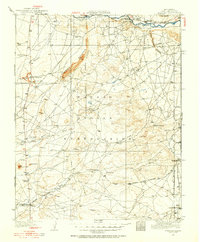
(13)- 1927 Map of Sulphur Spring
 1927 Sulphur Spring1927 Print · USGSSan Juan County was a region of remote outposts and river crossings during the late 1920s. Researchers can trace the early desert road network including the Shiprock Gallup Highway and locate historic hubs like Wheeler Trading Post and Bisti Trading Post.
 - 1928 Map of Kirtland, 1955 Print
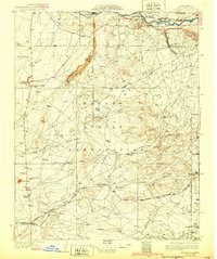
 1928 Kirtland1955 Print · USGSSan Juan County at the close of the 1920s shows a landscape of riverfront farming and remote desert commerce. Genealogists and historians can trace the network of isolated hubs like Wheeler Trading Post, Nava PO, and the early workings of a Coal Mine.
 - 1932 Map of Kirtland
 1932 Kirtland1932 Print · USGSThe Navajo Nation's high desert landscape and the San Juan River valley are documented here in the early thirties. Genealogists and historians can trace essential early hubs like the Wheeler Trading Post, the Oil Pumping Sta near Barber Peak, and the community at Fruitland.
 - 1954 Map of Shiprock
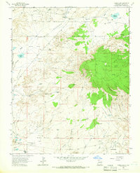
 1954 Shiprock1954 Print · USGSThe Four Corners region in the mid-fifties reveals a vast landscape of tribal lands and desert landmarks. Researchers can trace the mid-century footprints of the Navajo Indian Reservation, identifying remote Trading Posts, the early growth of Farmington, and the iconic spire of Ship Rock.5 unique versions available
 - 1958 Map of Shiprock
 1958 Shiprock1958 Print · USGSThe Four Corners region in the mid-fifties shows a vast network of remote outposts and river settlements. You can locate numerous historic sites like the Emmanuel Mission and several commercial hubs such as Burnham Trading Post and Bisti Trading Post.
 - 1959 Map of Shiprock
 1959 Shiprock1959 Print · USGSThe Four Corners region comes alive in the mid-fifties, showing the high desert outposts and river-valley towns of the Navajo Nation and San Juan County. Genealogists and researchers can locate remote landmarks like the Burnham Trading Post, Two Grey Hills, and the early Helium Plant.
 - 1963 Map of Farmington North, 1965 Print
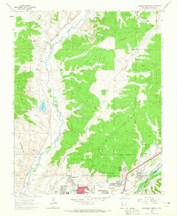 1963 Farmington North1965 Print · USGSFarmington's northern expansion during the early sixties shows the city pushing toward the mesas as the local energy economy took shape. Genealogists and local historians can trace school sites like Ladera del Norte Sch and the Denver and Rio Grande Western rail corridor.2 unique versions available
 - 1963 Map of Flora Vista, 1965 Print
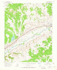 1963 Flora Vista1965 Print · USGSSan Juan County saw significant growth in the early sixties as the Animas River valley balanced agriculture and industry. Genealogists and historians can trace family locations near Flora Vista Cem, Elledge Mill, and the Aztec Ruins.4 unique versions available
 - 1963 Map of Youngs Lake, 1966 Print
 1963 Youngs Lake1966 Print · USGSThe high desert of San Juan County was an active energy frontier in the early 1960s, where industrial development met traditional reservation lands. Trace the footprint of the oil and gas industry at Flare Hill and the Refinery, or locate early recreation spots like Macu Racetrack.3 unique versions available
 - 1965 Map of Farmington South, 1969 Print
 1965 Farmington South1969 Print · USGSMid-century Farmington is shown at a pivotal moment of growth along the Animas River and San Juan River in the 1960s. Researchers can locate local landmarks like Greenlawn Cem, the San Juan Mission, and the Denver and Rio Grande Western rail lines.3 unique versions available
 - 1965 Map of Horn Canyon, 1970 Print
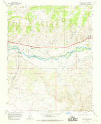 1965 Horn Canyon1970 Print · USGSBloomfield and the San Juan River valley are captured here in the mid-sixties during a period of expanding energy development and water management. Researchers can trace the growth of Desert Hills, locate the Riverside Ch, and find family landmarks like Gallegos Spring.2 unique versions available
 - 1966 Map of Kirtland, 1969 Print
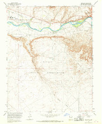 1966 Kirtland1969 Print · USGSSan Juan County comes into focus during the mid-sixties as irrigation and energy production transformed the river valley. Genealogists and historians can locate family landmarks like St Michael Ch, Central High Sch, and the Univ of New Mexico Experimental Farm.2 unique versions available
 - 1980 Map of Farmington, 1981 Print
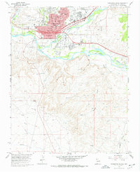
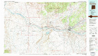 1980 Farmington1981 Print · USGSIn the San Juan Basin during the early 1980s, the energy economy was rapidly transforming the landscape around Farmington and Shiprock. Genealogists and historians can trace the growth of river towns like Kirtland or locate specific sites like the Navajo Mine and Aztec Ruins.2 unique versions available
End of results
Showing maps 1-13 of 13
Top cities near Farmington
- Shiprock Agency historical maps
- Bloomfield historical maps
- Aztec historical maps
- Eastern Navajo Agency historical maps
- Flora Vista historical maps
Frequently asked questions
- What are the different types of historical maps available for Farmington?
- What is the oldest map of Farmington?
- Where can I purchase historical maps of Farmington for my home or office?
- Where can I download high-res historical maps of Farmington?
- Are there historical topographic maps available for Farmington?
- Is there historical aerial imagery available for Farmington?
- Where are historical maps of Farmington sourced from?