Old Maps of Conchas, New Mexico for Genealogy
Trace your family roots with 8 historic maps of Conchas. These high-res maps reveal old neighborhoods, homesites, landmarks, and streets — helping you uncover where your ancestors lived and how the area evolved over time.
- Explore historic neighborhoods: Identify where your relatives may have lived in the 1800s or 1900s.
- Compare maps over time: Trace the changes in streets, buildings, and landmarks for multi-generational research.
- Perfect for genealogy & ancestry research: Used by family historians and researchers to map out lineage and migration.
These maps are an incredible resource for exploring your personal connection to Conchas's past.
Conchas, NM maps
(8)- 1954 Map of Santa Fe, 1963 Print
 1954 Santa Fe1963 Print · USGSNew Mexico's high mountains and eastern plains meet in the mid-fifties, showing a landscape defined by the Sangre de Cristo Mountains and the Pecos River. Trace family roots and local history through San Christobal Church, Sena School, and the historic Las Vegas rail corridor.4 unique versions available
 - 1958 Map of Santa Fe
 1958 Santa Fe1958 Print · USGSThe Sangre De Cristo Mountains meet the high plains in the late 1950s, showing a landscape defined by rail corridors and ranching. Genealogists can trace family-named sites like Upton Ranch or visit the Fort Union (Ruins) and Tuloso School.
 - 1968 Map of Conchas Dam, 1971 Print
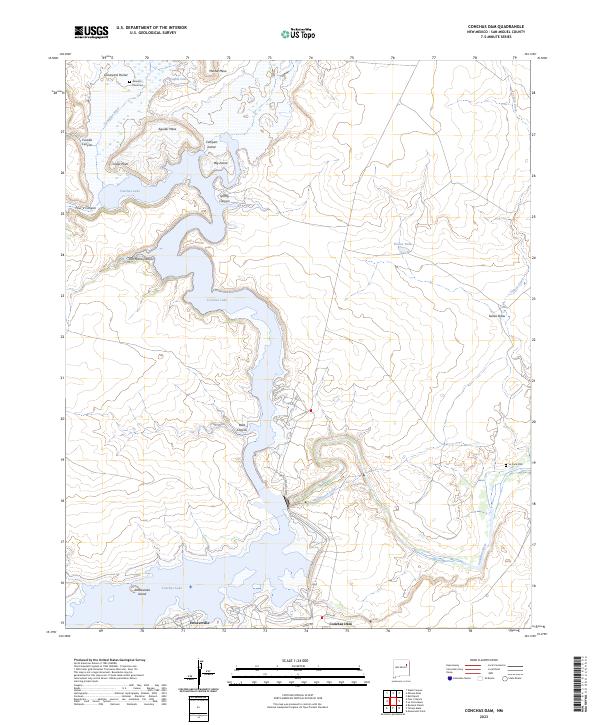
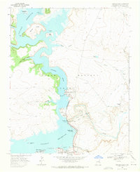 1968 Conchas Dam1971 Print · USGSSan Miguel County underwent a dramatic transformation in the late sixties as the reservoir reshaped the Canadian River valley. Genealogists and historians can trace old landmarks like the Alamosa Plaza Cem, the Pablo Montoya Grant boundary, and the settlement of Hooverville.
 - 2010 Map of Conchas Dam, 2010 Print
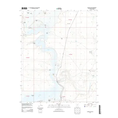
 2010 Conchas Dam2010 Print · USGSCovers Conchas, including Hooverville, San Miguel County, and other nearby areas
 - 2013 Map of Conchas Dam, 2013 Print
 2013 Conchas Dam2013 Print · USGSCovers Conchas, including Hooverville, San Miguel County, and other nearby areas
 - 2017 Map of Conchas Dam, 2017 Print
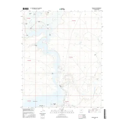 2017 Conchas Dam2017 Print · USGSCovers Conchas, including Hooverville, San Miguel County, and other nearby areas
 - 2020 Map of Conchas Dam, 2020 Print
 2020 Conchas Dam2020 Print · USGSCovers Conchas, including Hooverville, San Miguel County, and other nearby areas
 - 2023 Map of Conchas Dam, 2023 Print
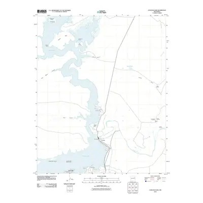
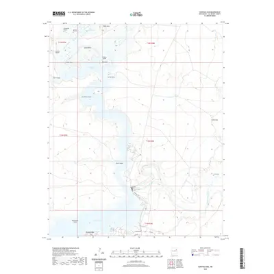
 2023 Conchas Dam2023 Print · USGSConchas Lake and the Canadian River valley are documented in this contemporary survey of San Miguel County. Researchers can identify local landmarks and burial sites like Alamosa Plaza Cem, the Bell Ranch Canal, and the community of Hooverville.
End of results
Showing maps 1-8 of 8
Frequently asked questions
- What are the different types of historical maps available for Conchas?
- What is the oldest map of Conchas?
- Where can I purchase historical maps of Conchas for my home or office?
- Where can I download high-res historical maps of Conchas?
- Are there historical topographic maps available for Conchas?
- Is there historical aerial imagery available for Conchas?
- Where are historical maps of Conchas sourced from?