Old Maps of Williamsville, Amherst for Genealogy
Trace your family roots with 26 historic maps of Williamsville. These high-res maps reveal old neighborhoods, homesites, landmarks, and streets — helping you uncover where your ancestors lived and how the area evolved over time.
- Explore historic neighborhoods: Identify where your relatives may have lived in the 1800s or 1900s.
- Compare maps over time: Trace the changes in streets, buildings, and landmarks for multi-generational research.
- Perfect for genealogy & ancestry research: Used by family historians and researchers to map out lineage and migration.
These maps are an incredible resource for exploring your personal connection to Williamsville's past.
Williamsville, Amherst maps
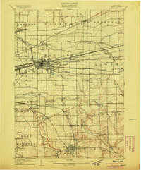
(26)- 1894 Map of Buffalo
 1894 Buffalo1894 Print · USGSBuffalo and its lakefront suburbs are captured at a peak of maritime and rail expansion in the 1890s. Genealogists and local historians can trace the early streets of Kenmore, the path of the Erie Canal, and landmarks like the Fort Erie (Ruins).2 unique versions available
 - 1901 Map of Buffalo
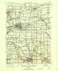
 1901 Buffalo1901 Print · USGSBuffalo was a bustling transportation hub at the dawn of the century, where the Great Lakes met the canal and rail networks. Genealogists can trace family roots in early suburbs like Kenmore or locate ancestral sites near Pine Hill Cemetery and Harlem Station.12 unique versions available
 - 1905 Map of Depew
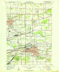
 1905 Depew1905 Print · USGSEastern Erie County at the height of the steam era reveals a complex network of major rail lines and rural hamlets. Genealogists and historians can trace old property lines and rail stations like Looneyville, Grimesville, and the early development of Depew.6 unique versions available
 - 1948 Map of Depew, 1953 Print
 1948 Depew1953 Print · USGSErie County's industrial and civic heart comes into focus during this post-war era of rail and aviation expansion. Researchers can trace ancestral roots at Clarence Fillmore Cemetery or locate old schoolhouses like School No 1 and School No 8 across Harris Hill and Marilla.3 unique versions available
 - 1948 Map of Buffalo, 1958 Print
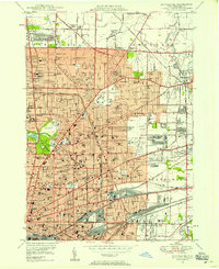
 1948 Buffalo1958 Print · USGSThe Niagara Frontier during the post-war boom years shows the industrial might of the riverfront and the rapid growth of its suburbs. Genealogists and historians can trace neighborhood developments from Brighton Village to Orchard Park, locating landmarks like St Stanislaus Cem and the early Buffalo Airport.
 - 1948 Map of Buffalo NE, 1958 Print
 1948 Buffalo NE1958 Print · USGSBuffalo and its northern reaches are shown in the late 1940s as suburban expansion meets a powerful industrial rail network. Genealogists and historians can trace thousands of individual property blocks and key local landmarks like Offerman Stadium, Forest Lawn Cemetery, and the University of Buffalo.
 - 1950 Map of Lancaster
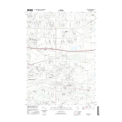
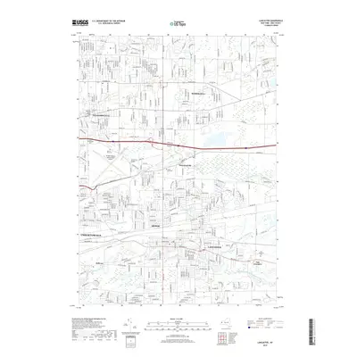
 1950 Lancaster1950 Print · USGSErie County at the mid-century mark shows a landscape of burgeoning suburbs and vital rail corridors. Genealogists and researchers can trace family landmarks like St Marys High School, the Transit Cem, and old district sites like School No 8.
 - 1950 Map of Buffalo NE
 1950 Buffalo NE1950 Print · USGSBuffalo and its northeastern suburbs in the mid-twentieth century show a dense urban fabric of streetcar-era neighborhoods and burgeoning park systems. Genealogists and historians can trace family locations through dozens of numbered schools, large cemeteries like Forest Lawn, and industrial corridors near Sloan and Walden.
 - 1960 Map of Buffalo
 1960 Buffalo1960 Print · USGSWestern New York and the Niagara Peninsula thrive during the mid-twentieth century industrial peak. Genealogists and historians can trace family-named points and early settlements from Dunkirk Light to the Allegany Indian Reservation.
 - 1962 Map of Buffalo, 1980 Print
 1962 Buffalo1980 Print · USGSThe Niagara Frontier and Western New York are captured here in the early sixties, showing the vital industrial and maritime nexus between the U.S. and Canada. Researchers can trace the path of the Welland Canal, locate the Allegany Indian Reservation, or find family sites near Chautauqua Lake.2 unique versions available
 - 1965 Map of Buffalo NE, 1967 Print
 1965 Buffalo NE1967 Print · USGSThe Buffalo suburbs were in full expansion during the mid-sixties as new expressways cut through established neighborhoods. Researchers can trace family sites near Forest Lawn Cemetery, the War Memorial Stadium, or the early campus of the State University at Buffalo.
 - 1965 Map of Lancaster, 1967 Print
 1965 Lancaster1967 Print · USGSErie County's eastern suburbs undergo rapid transformation in the mid-1960s as aviation and highways reshape the land. Researchers can trace family roots through numerous parish sites and cemeteries like the War of 1812 Cem and St Marys Cemetery.
 - 1967 Map of Buffalo
 1967 Buffalo1967 Print · USGSWestern New York and the Lake Erie shoreline are shown here during the mid-1960s industrial peak. Researchers can trace the massive rail networks of the Erie Railroad, locate the Cattaraugus Indian Reservation, or find historic sites like Fort Erie.
 - 1973 Map of Buffalo
 1973 Buffalo1973 Print · USGSWestern New York and Ontario's Golden Horseshoe meet in the early seventies, spanning from the industrial waterfronts of Buffalo to the hills of Allegany State Park. Trace the paths of the Welland Canal and Erie Lackawanna railroad through the lakefront towns of Dunkirk and Port Colborne.
 - 1982 Map of Lancaster, 1983 Print
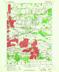
 1982 Lancaster1983 Print · USGSEastern Erie County in the early eighties shows a landscape of suburban growth and institutional heritage. Researchers can trace family sites near Lancaster Rural Cem, follow the Conrail rail lines, or locate the County Home and Infirmary.
 - 1984 Map of Buffalo, 1985 Print
 1984 Buffalo1985 Print · USGSWestern New York's industrial and transport hubs are in full view during the mid-eighties, from the Lake Erie waterfront to the Genesee Valley. Researchers can trace the legacy of the Erie Canal, find ancestral sites like Mount Calvary Cem, or locate the Attica Correctional Facility.2 unique versions available
 - 2010 Map of Buffalo NE, 2010 Print
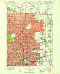
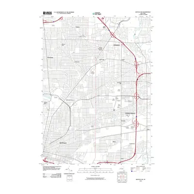 2010 Buffalo NE2010 Print · USGSCovers Williamsville, including Buffalo, Amherst, and other nearby areas
 - 2010 Map of Lancaster, 2010 Print
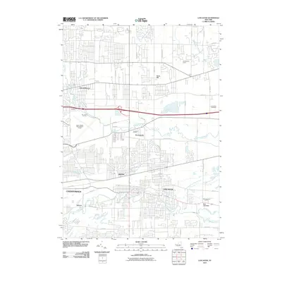 2010 Lancaster2010 Print · USGSCovers Williamsville, including Amherst, Cheektowaga, and other nearby areas
 - 2013 Map of Lancaster, 2013 Print
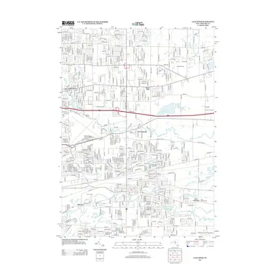 2013 Lancaster2013 Print · USGSCovers Williamsville, including Amherst, Cheektowaga, and other nearby areas
 - 2013 Map of Buffalo NE, 2013 Print
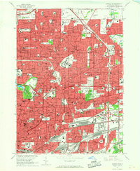
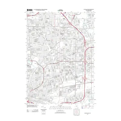 2013 Buffalo NE2013 Print · USGSCovers Williamsville, including Buffalo, Amherst, and other nearby areas
 - 2016 Map of Lancaster, 2016 Print
 2016 Lancaster2016 Print · USGSCovers Williamsville, including Amherst, Cheektowaga, and other nearby areas
 - 2016 Map of Buffalo NE, 2016 Print
 2016 Buffalo NE2016 Print · USGSCovers Williamsville, including Buffalo, Amherst, and other nearby areas
 - 2019 Map of Buffalo NE, 2019 Print
 2019 Buffalo NE2019 Print · USGSCovers Williamsville, including Buffalo, Amherst, and other nearby areas
 - 2019 Map of Lancaster, 2019 Print
 2019 Lancaster2019 Print · USGSCovers Williamsville, including Amherst, Cheektowaga, and other nearby areas
 - 2023 Map of Lancaster, 2023 Print
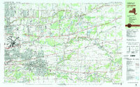
 2023 Lancaster2023 Print · USGSErie County's eastern suburbs and the busy aviation hub of Buffalo appear in this contemporary look at the evolving landscape. Genealogists and historians can locate several burial grounds including Transit Rural Cem and the War of 1812 Cem near Bowmansville.
Showing maps 1-25 of 26
Top cities near Williamsville
- Buffalo historical maps
- Amherst historical maps
- Cheektowaga historical maps
- Tonawanda historical maps
- Hamburg historical maps
- Niagara Falls historical maps
See more
Frequently asked questions
- What are the different types of historical maps available for Williamsville?
- What is the oldest map of Williamsville?
- Where can I purchase historical maps of Williamsville for my home or office?
- Where can I download high-res historical maps of Williamsville?
- Are there historical topographic maps available for Williamsville?
- Is there historical aerial imagery available for Williamsville?
- Where are historical maps of Williamsville sourced from?