Old Maps of Grand Island, New York for Metal Detecting
Plan your next treasure hunt with 54 historic maps of Grand Island. Find old homesites, ghost towns, trails, and gathering spots that may be lost to time — perfect for identifying promising metal detecting locations.
- Locate forgotten sites: Uncover places like long-lost settlements, abandoned rail lines, or gathering spots.
- Plan better hunts: Use map overlays combined with LiDAR or satellite views to narrow in on historically rich areas.
- Made for detectorists: Thousands of hobbyists use these maps to discover relics, coins, and hidden history.
Use these historic maps to boost your research and find new opportunities beneath the surface of Grand Island.
Grand Island, NY maps
(54)- 1894 Map of Buffalo
 1894 Buffalo1894 Print · USGSBuffalo and its lakefront suburbs are captured at a peak of maritime and rail expansion in the 1890s. Genealogists and local historians can trace the early streets of Kenmore, the path of the Erie Canal, and landmarks like the Fort Erie (Ruins).2 unique versions available
 - 1894 Map of Niagara Falls
 1894 Niagara Falls1894 Print · USGSThe Niagara frontier in the early 1890s shows a landscape of strategic forts and burgeoning rail power. Trace the international border from Fort Niagara past the Brock Monument to the rail hubs at Suspension Bridge.
 - 1896 Map of Niagara Falls
 1896 Niagara Falls1896 Print · USGSThe Niagara frontier at the close of the nineteenth century was a landscape of international boundaries and massive engineering. Trace the complex rail networks through Suspension Bridge or the historic fortifications at Fort Niagara and Fort Massassauga.2 unique versions available
 - 1897 Map of Tonawanda
 1897 Tonawanda1897 Print · USGSNiagara and Erie counties thrived at the close of the nineteenth century as vital corridors of commerce. Genealogists and historians can trace the early rail networks through Pekin or locate riverside landmarks like Sour Spring Grove and the Erie Canal.
 - 1899 Map of Niagara
 1899 Niagara1899 Print · USGSThe Niagara Frontier is mapped here in the late nineteenth century as a bustling corridor of trade and transport. Researchers can trace the path of the Erie Canal through Lockport or locate early rural settlements like Ransomville and the Tuscarora Indian Reservation.6 unique versions available
 - 1900 Map of Tonawanda
 1900 Tonawanda1900 Print · USGSNiagara County and northern Erie County are shown at the turn of the century as the Erie Canal and heavy rail lines drove the growth of the North Tonawanda lumber and shipping hub. Genealogists can trace family footprints in outlying hamlets like Bergholtz, Ransomville, and Martinsville.
 - 1900 Map of Niagara Falls, 1961 Print
 1900 Niagara Falls1961 Print · USGSThe Niagara frontier at the turn of the century shows an intense convergence of industrial power and military history along the international border. Trace the rail-and-river economy through the Suspension Bridge and Michigan Central R. R. or locate old landmarks like Fort Niagara and the Whirlpool.4 unique versions available
 - 1901 Map of Buffalo
 1901 Buffalo1901 Print · USGSBuffalo was a bustling transportation hub at the dawn of the century, where the Great Lakes met the canal and rail networks. Genealogists can trace family roots in early suburbs like Kenmore or locate ancestral sites near Pine Hill Cemetery and Harlem Station.12 unique versions available
 - 1901 Map of Niagara Falls
 1901 Niagara Falls1901 Print · USGSThe Niagara frontier at the dawn of the twentieth century is captured here in striking detail, from the river's mouth to the falls. Trace the dense rail networks of the Niagara Falls area or locate Fort Niagara and the Brock Monument.11 unique versions available
 - 1901 Map of Tonawanda
 1901 Tonawanda1901 Print · USGSAt the turn of the century, the Niagara Frontier was a powerhouse of canal and rail transit. Genealogists can trace family footprints in settlements like Sanborn, Martinsville, and Bergholtz, or follow the original path of the ERIE CANAL through Tonawanda.7 unique versions available
 - 1948 Map of Tonawanda, 1953 Print
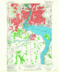
 1948 Tonawanda1953 Print · USGSNiagara and Erie counties are shown here just after the war, where the Niagara River meets the historic Erie Canal. Genealogists and local historians can trace the early layout of North Tonawanda or locate family sites at Molyneaux Corners and Colonial Village.3 unique versions available
 - 1948 Map of Tonawanda West, 1958 Print
 1948 Tonawanda West1958 Print · USGSThe industrial and riverfront character of the Niagara frontier is on full display during the postwar era. Genealogists and historians can trace rail networks like the New York Central RR and locate local landmarks such as Bishop Duffy High Sch or the Holy Ghost Cem (Church).2 unique versions available
 - 1948 Map of Buffalo, 1958 Print
 1948 Buffalo1958 Print · USGSThe Niagara Frontier during the post-war boom years shows the industrial might of the riverfront and the rapid growth of its suburbs. Genealogists and historians can trace neighborhood developments from Brighton Village to Orchard Park, locating landmarks like St Stanislaus Cem and the early Buffalo Airport.
 - 1949 Map of Niagara Falls
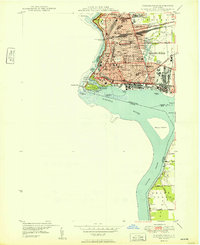 1949 Niagara Falls1949 Print · USGSNiagara Falls at the close of the 1940s showcases a dense urban grid and international border long before modern redevelopment. Genealogists can trace family neighborhoods through sites like Oakwood Cem and Gaskill High Sch.
 - 1950 Map of Buffalo NW
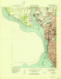 1950 Buffalo NW1950 Print · USGSThe Niagara River and Grand Island are shown in detail during the early fifties, capturing Buffalo's northern expansion. Genealogists and historians can locate dozens of local institutions like Lafayette High Sch, Mt Olivet Cem, and Bell Airport.2 unique versions available
 - 1950 Map of Tonawanda West
 1950 Tonawanda West1950 Print · USGSNiagara Falls and North Tonawanda are captured during a period of major post-war industrial and suburban growth. Researchers can trace the development of Cayuga Island, find local schools like Gratwick Sch, and locate family plots at White Haven Cem.
 - 1952 Map of Toronto, 1954 Print
 1952 Toronto1954 Print · USGSLake Ontario and the international border define this mid-century landscape of rapid industrial and suburban growth. Researchers can trace the vital shipping and rail corridors of the era, from the Welland Canal to the New York Central Railroad.
 - 1954 Map of Tonawanda West
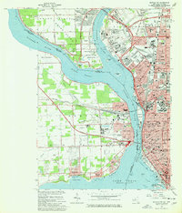
 1954 Tonawanda West1954 Print · USGSThe Niagara River corridor and Grand Island are captured during a mid-century period of industrial and suburban growth. Researchers can locate family landmarks like St Johnsburg, Holy Ghost Cem, and Bishop Duffy High Sch.
 - 1960 Map of Buffalo
 1960 Buffalo1960 Print · USGSWestern New York and the Niagara Peninsula thrive during the mid-twentieth century industrial peak. Genealogists and historians can trace family-named points and early settlements from Dunkirk Light to the Allegany Indian Reservation.
 - 1962 Map of Buffalo, 1980 Print
 1962 Buffalo1980 Print · USGSThe Niagara Frontier and Western New York are captured here in the early sixties, showing the vital industrial and maritime nexus between the U.S. and Canada. Researchers can trace the path of the Welland Canal, locate the Allegany Indian Reservation, or find family sites near Chautauqua Lake.2 unique versions available
 - 1962 Map of Toronto, 1982 Print
 1962 Toronto1982 Print · USGSThe Golden Horseshoe and the Niagara Frontier meet in this early 1960s study of a growing international border region. Trace the path of the Welland Canal and locate land marks like the Scarborough Bluffs and Tuscarora Indian Reservation.
 - 1965 Map of Toronto
 1965 Toronto1965 Print · USGSThe Golden Horseshoe and Niagara Frontier are shown in detail during the early sixties, highlighting the international shipping and transit networks. Trace the path of the Erie Canal, the Welland Canal, and rail lines connecting Toronto and Niagara Falls.2 unique versions available
 - 1965 Map of Tonawanda West, 1967 Print
 1965 Tonawanda West1967 Print · USGSNiagara and Erie counties are captured here in the mid-sixties, a period of heavy industrial activity and Cold War aviation expansion. Researchers can trace family sites like Holy Ghost Cem or explore the massive layout of the Niagara Falls Air Force Base and the riverfront Buckhorn Island State Park.
 - 1965 Map of Buffalo NW, 1967 Print
 1965 Buffalo NW1967 Print · USGSThe Niagara frontier in the mid-sixties shows the industrial and suburban growth of BUFFALO and Fort Erie at their international junction. Genealogists and historians can trace neighborhood landmarks from Mt Olivet Cemetery to the Buffalo Seminary.2 unique versions available
 - 1965 Map of Niagara Falls, 1968 Print
 1965 Niagara Falls1968 Print · USGSThe Niagara frontier in the mid-sixties shows a landscape of world-famous cataracts and a thriving urban industrial core. Researchers can trace the neighborhood footprints of Stamford Centre and Chippawa or locate local landmarks like Oakwood Cem and Holy Trinity Sch.
Showing maps 1-25 of 54
Top cities near Grand Island
- Buffalo historical maps
- Amherst historical maps
- Cheektowaga historical maps
- Tonawanda historical maps
- Hamburg historical maps
- Niagara Falls historical maps
See more
Top neighborhoods of Grand Island
- Edgewater historical maps
- Sheenwater historical maps
- Sandy Beach historical maps
- Oakfield historical maps
- Sour Spring Grove historical maps
- Grandyle Village historical maps
Frequently asked questions
- What are the different types of historical maps available for Grand Island?
- What is the oldest map of Grand Island?
- Where can I purchase historical maps of Grand Island for my home or office?
- Where can I download high-res historical maps of Grand Island?
- Are there historical topographic maps available for Grand Island?
- Is there historical aerial imagery available for Grand Island?
- Where are historical maps of Grand Island sourced from?