Old Maps of Newcomb, New York for Academic Research
Study the evolution of Newcomb with 112 high-resolution historic maps. Whether you're teaching, researching, or modeling changes in land use, these maps provide essential visual documentation of urban, environmental, and geographic change.
- Analyze long-term change: Track patterns in development, transportation, and natural features.
- Ideal for environmental or urban studies: Support academic projects with primary historical map data.
- Use in the classroom or lab: Educators and researchers rely on these maps to bring historical context to life.
These maps are a powerful tool for teaching, research, and visualizing how Newcomb has changed over the decades.
Newcomb, NY maps
(112)- 1895 Map of Mt. Marcy
 1895 Mt. Marcy1895 Print · USGSThe Adirondack High Peaks are captured here in the late nineteenth century, showing early mountain outposts and wilderness boundaries. Trace the trails from Adirondack Lodge and Keene Valley to summits like Mt. Marcy and Mt. Skylight.2 unique versions available
 - 1897 Map of Schroon Lake
 1897 Schroon Lake1897 Print · USGSAdirondack mountain life in the late nineteenth century centers on the busy waters of Schroon Lake and the surrounding wilderness. Researchers can trace early settlements like Olmstedville and Irishtown or locate the historic Steamboat Route and remote landmarks like Lester Dam.10 unique versions available
 - 1898 Map of Newcomb
 1898 Newcomb1898 Print · USGSThe Adirondack wilderness around the upper Hudson River is captured here in the late nineteenth century. Genealogists and historians can trace early settlements and sporting outposts like Aiden Lair, the Northwoods Club, and Tahawus.
 - 1901 Map of Newcomb
 1901 Newcomb1901 Print · USGSThe Adirondack high country near the turn of the century is defined by the headwaters of the Hudson River and the small outposts of the New York interior. Genealogists and historians can trace the early footprint of the Northwoods Club, the settlement at Newcomb, and the remote station at Aiden Lair.9 unique versions available
 - 1902 Map of Mt. Marcy
 1902 Mt. Marcy1902 Print · USGSThe High Peaks of the Adirondacks are meticulously charted in the early 1900s, showing the early infrastructure for mountain tourism. Trace historical routes to Mt. Marcy from Adirondack Lodge or locate the old valley settlements of Keene Valley and Beede.10 unique versions available
 - 1903 Map of Blue Mountain
 1903 Blue Mountain1903 Print · USGSThe Adirondack wilderness in the early 1900s centered on the waterways of Hamilton County. Trace the early tourism routes including the Steamboat Route through Blue Mountain Lake and historical stops like Forest House.11 unique versions available
 - 1904 Map of Santanoni
 1904 Santanoni1904 Print · USGSThe Adirondack High Peaks are shown in the early twentieth century, an era of private sporting clubs and heavy iron mining. Trace early trails and remote outposts like Mac Intyre Ironworks, Camp Santanoni, and the Tahawus Club.10 unique versions available
 - 1904 Map of Long Lake
 1904 Long Lake1904 Print · USGSThe Adirondack wilderness of the early 1900s is shown here as a landscape of logging camps and lakeside retreats. Trace the Steamboat Route on Long Lake to Island House, or locate old rail junctions near Faust and Coreys P.O.10 unique versions available
 - 1948 Map of Ogdensburg, 1973 Print
 1948 Ogdensburg1973 Print · USGSThe international border along the St Lawrence River comes to life in the late 1940s, showing the vital rail and water connections between New York and Ontario. Researchers can trace the grounds of St Lawrence University, the massive Camp Drum military reservation, and the historic Rideau River and Canal.2 unique versions available
 - 1950 Map of Glens Falls
 1950 Glens Falls1950 Print · USGSThe Adirondacks and the Green Mountains meet in this mid-century survey of the New York and Vermont borderlands. Researchers can trace the industrial rail corridors of the Rutland RR and Delaware & Hudson RR connecting Glens Falls, Rutland, and the shores of Lake George.
 - 1950 Map of Lake Champlain
 1950 Lake Champlain1950 Print · USGSThe Lake Champlain valley and its surrounding peaks are captured in detail during the late 1940s, showing the vital rail and road connections between New York and Vermont. Researchers can trace the routes of the Central Vermont Railway or locate old industrial centers like Mineville and Witherbee.2 unique versions available
 - 1950 Map of Utica, 1951 Print
 1950 Utica1951 Print · USGSCentral New York in the post-war era showcases the industrial Mohawk Valley and the pristine Adirondack interior. Researchers can trace transportation networks like the New York Central Railroad and find early Cold War sites such as Griffiss Air Force Base.
 - 1951 Map of Ogdensburg
 1951 Ogdensburg1951 Print · USGSThe St. Lawrence frontier and the North Country are captured here during the post-war era, from the river ports to the high Adirondacks. Genealogists and historians can trace the rail-and-river economy through Ogdensburg, the Rutland rail lines, and Potsdam.
 - 1953 Map of Ogdensburg
 1953 Ogdensburg1953 Print · USGSThe North Country and St. Lawrence Valley are shown here in the early fifties, just as the region’s rail-and-river economy remained in full swing. Genealogists and historians can trace family-named corners and rural hubs along the Rutland railroad or locate heritage sites near Ogdensburg, Potsdam, and the St Regis Indian Reservation.
 - 1953 Map of Schroon Lake, 1956 Print
 1953 Schroon Lake1956 Print · USGSSchroon Lake and the surrounding Adirondack high peaks are captured here in the early fifties before major highway expansion. Genealogists and local historians can trace family-named sites and vanished mountain hamlets like Irishtown, Olmstedville, and St Marys Ch.4 unique versions available
 - 1953 Map of Santanoni, 1957 Print
 1953 Santanoni1957 Print · USGSThe High Peaks of Essex County are documented in the early 1950s, showing a landscape defined by deep wilderness and early industrial outposts. Researchers can trace the Northville Placid Trail or locate the Old MacIntyre Furnace and the settlement at Tahawus.5 unique versions available
 - 1953 Map of Mount Marcy, 1957 Print
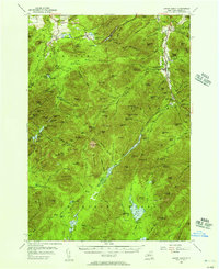 1953 Mount Marcy1957 Print · USGSThe High Peaks region in the mid-fifties shows a landscape of deep wilderness crossed by an extensive network of footpaths and early recreation sites. You can trace the Old Military Road, find the Norton Cem, or locate the Olympic Bobsled Run.5 unique versions available
 - 1954 Map of Newcomb, 1957 Print
 1954 Newcomb1957 Print · USGSThe High Peaks wilderness of Essex and Hamilton Counties is captured here in the mid-1950s, centered on the settlement of Newcomb. Researchers can trace the Old Military Road, locate the Tahawus Club, and identify mid-century retreats like Camp Che-na-wah and Aiden Lair.5 unique versions available
 - 1954 Map of Blue Mountain, 1957 Print
 1954 Blue Mountain1957 Print · USGSIn the mid-1950s, this Adirondack landscape centers on the growing recreational hubs of Long Lake and Blue Mountain Lake. Genealogists and hikers can trace the Northville-Lake Placid Trail past the Long Lake Cem and the remote Forest House.6 unique versions available
 - 1955 Map of Long Lake, 1957 Print
 1955 Long Lake1957 Print · USGSThe Adirondack lake country comes alive in the mid-1950s, showing the intersection of village life and deep wilderness. Trace local history through landmarks like the Veterans Hospital, the settlement at Coreys, and the St Alphonsus Ch.6 unique versions available
 - 1956 Map of Glens Falls, 1968 Print
 1956 Glens Falls1968 Print · USGSUpper New York and the Vermont mountains are captured here in the mid-fifties, showing the rugged rail-and-river network of the Northeast. Researchers can trace the paths of the Delaware and Hudson RR and Rutland RR as they wind through valley towns like Poultney and Whitehall.3 unique versions available
 - 1957 Map of Utica
 1957 Utica1957 Print · USGSCentral New York and the Adirondack foothills are captured here in the mid-fifties, showing a landscape defined by the Mohawk River corridor and the growing highway system. Genealogists and researchers can trace the rail lines of the New York Central and locate communities from Lowville to Gloversville.
 - 1958 Map of Lake Champlain
 1958 Lake Champlain1958 Print · USGSThe Champlain Valley and surrounding high peaks are captured here in the late fifties, showcasing the cross-border region from the Adirondacks to the Green Mountains. Researchers can trace historic rail routes like the Rutland Railway or locate old valley settlements such as Keeseville and Vergennes.2 unique versions available
 - 1959 Map of Glens Falls
 1959 Glens Falls1959 Print · USGSUpper New York and Vermont are captured here during the late 1950s, a period of transition for these mountain communities. Researchers can trace the legacy of the region's river-and-rail economy through landmarks like Lake George, Saratoga Springs, and Killington Peak.2 unique versions available
 - 1961 Map of Ogdensburg
 1961 Ogdensburg1961 Print · USGSThe St. Lawrence valley and the Adirondack high country meet in this early sixties survey during a peak era for rail and river commerce. Genealogists and historians can trace the paths of the New York Central railroad through remote settlements like Wanakena, Conifer, and Piercefield.
Showing maps 1-25 of 112
Top cities near Newcomb
- North Elba historical maps
- Harrietstown historical maps
- Chester historical maps
- Schroon historical maps
- Indian Lake historical maps
- Keene historical maps
See more
Frequently asked questions
- What are the different types of historical maps available for Newcomb?
- What is the oldest map of Newcomb?
- Where can I purchase historical maps of Newcomb for my home or office?
- Where can I download high-res historical maps of Newcomb?
- Are there historical topographic maps available for Newcomb?
- Is there historical aerial imagery available for Newcomb?
- Where are historical maps of Newcomb sourced from?