Old Maps of Westport, New York for Academic Research
Study the evolution of Westport with 60 high-resolution historic maps. Whether you're teaching, researching, or modeling changes in land use, these maps provide essential visual documentation of urban, environmental, and geographic change.
- Analyze long-term change: Track patterns in development, transportation, and natural features.
- Ideal for environmental or urban studies: Support academic projects with primary historical map data.
- Use in the classroom or lab: Educators and researchers rely on these maps to bring historical context to life.
These maps are a powerful tool for teaching, research, and visualizing how Westport has changed over the decades.
Westport, NY maps
(60)- 1894 Map of Elizabethtown
 1894 Elizabethtown1894 Print · USGSThe Adirondack high country of Essex County is captured here in the 1890s, showcasing a landscape defined by mountain peaks and the iron industry. Trace the early rail lines of the L. C. & M. R. R. into Mineville or locate vanished sites like Euba Mills and New Russia.2 unique versions available
 - 1894 Map of Port Henry
 1894 Port Henry1894 Print · USGSLake Champlain was a bustling corridor of steamships and rail lines during the 1890s, bridging the gap between New York and Vermont. Historians can trace the strategic layout of Crown Point, locate the French Fort Ruins, and explore industrial sites like Wadhams Mills.
 - 1895 Map of Willsboro
 1895 Willsboro1895 Print · USGSLake Champlain and its late 19th-century transport networks are detailed here, showing the era when ferries and steamships linked New York and Vermont. Genealogists and historians can trace old homesteads and landings near Keeseville, the McNeil Ferry, and the tracks of the Central Vermont R. R.7 unique versions available
 - 1895 Map of Elizabethtown
 1895 Elizabethtown1895 Print · USGSEssex County in the 1890s is shown here as a landscape of timber, iron ore, and river-valley hamlets. Genealogists and historians can trace the early rail corridor of the L.C. & M. R.R. or locate family sites in Mineville, New Russia, and Moriah Center.
 - 1898 Map of Port Henry
 1898 Port Henry1898 Print · USGSLake Champlain and its historic shores are captured in the late nineteenth century as steam and rail networks connected these borderlands. Researchers can locate the French Fort Ruins, trace the Central Vermont line, and explore old industrial sites like Wadhams Mills.10 unique versions available
 - 1901 Map of Elizabethtown
 1901 Elizabethtown1901 Print · USGSEssex County's high peaks and mining districts are captured here at the turn of the century, when the valley roads and mountain notches were the primary arteries of travel. Genealogists and historians can trace old community life in Elizabethtown, the industrial roots of Mineville, and the remote logging and mill sites at Euba Mills.9 unique versions available
 - 1941 Map of Willsboro
 1941 Willsboro1941 Print · USGSLake Champlain's shores in New York and Vermont are captured here just before the war, showing a landscape defined by lakefront landings and busy railroads. Trace the routes of the Delaware and Hudson and find local landmarks like Craterclub, Whallonsburg, and St Josephs Ch.2 unique versions available
 - 1943 Map of Willsboro
 1943 Willsboro1943 Print · USGSThe Lake Champlain shoreline in the early 1940s reveals a landscape of mountain-backed villages and vital cross-lake rail connections. Genealogists and researchers can trace local landmarks like St Josephs Ch, Lakeview Cem, and the path of the Delaware and Hudson railroad.3 unique versions available
 - 1945 Map of Port Henry, 1958 Print
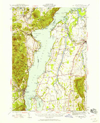 1945 Port Henry1958 Print · USGSMid-century life along the Vermont and New York border is centered on the waters of Lake Champlain and its historic defenses. Researchers can trace the ruins of Fort Crown Point or locate family roots at Gage Cemetery and Smith School.5 unique versions available
 - 1947 Map of Port Henry
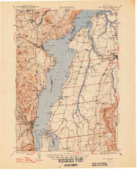 1947 Port Henry1947 Print · USGSLake Champlain sits at the heart of this late 1940s survey of the New York and Vermont borderlands. Genealogists and local historians can trace legacy sites like the Fort St Frederic Ruins, the Rutland RR corridor, and a high density of country schools including Crane Sch and Smith Sch.2 unique versions available
 - 1950 Map of Lake Champlain
 1950 Lake Champlain1950 Print · USGSThe Lake Champlain valley and its surrounding peaks are captured in detail during the late 1940s, showing the vital rail and road connections between New York and Vermont. Researchers can trace the routes of the Central Vermont Railway or locate old industrial centers like Mineville and Witherbee.2 unique versions available
 - 1955 Map of Elizabethtown, 1957 Print
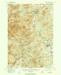 1955 Elizabethtown1957 Print · USGSThe Adirondack iron mining district and the high peaks of Essex County are captured here in the mid-fifties. Researchers can trace the industrial footprint of the Fisher Hill Iron Mine and the mining communities of Witherbee and Mineville alongside the wilderness of Giant Mtn.5 unique versions available
 - 1956 Map of Willsboro, 1958 Print
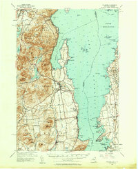 1956 Willsboro1958 Print · USGSLake Champlain and the eastern Adirondacks come alive in the mid-1950s, showing the intricate shoreline from New York to Vermont. Genealogists can trace family roots through sites like Whallon Bay Sch, Boardman Cem, and the Lady of Hope Shrine.4 unique versions available
 - 1958 Map of Lake Champlain
 1958 Lake Champlain1958 Print · USGSThe Champlain Valley and surrounding high peaks are captured here in the late fifties, showcasing the cross-border region from the Adirondacks to the Green Mountains. Researchers can trace historic rail routes like the Rutland Railway or locate old valley settlements such as Keeseville and Vergennes.2 unique versions available
 - 1962 Map of Lake Champlain, 1975 Print
 1962 Lake Champlain1975 Print · USGSLake Champlain and the high peaks of the Adirondacks and Green Mountains are captured here during the mid-twentieth century. Researchers can trace the industrial legacy of the Lyon Mountain Mine and the rail corridors of the Central Vermont RR and Delaware & Hudson RR.3 unique versions available
 - 1978 Map of Witherbee, 1979 Print
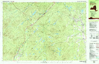 1978 Witherbee1979 Print · USGSMining and mountain life in the eastern Adirondacks intersect during the late seventies, showing the industrial pulse of these upland towns. Genealogists and hikers can trace the Lake Champlain and Moriah Railroad, find the SS Peter and Paul Cem, and locate the Belfry Mtn Lookout Tower.
 - 1978 Map of Elizabethtown, 1979 Print
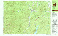 1978 Elizabethtown1979 Print · USGSElizabethtown and the Bouquet River valley are captured in the late seventies as the Adirondack Northway reshaped regional travel. Genealogists and historians can locate the Black River Cem, the Central School, and the Court House at the heart of this mountain community.2 unique versions available
 - 1980 Map of Willsboro
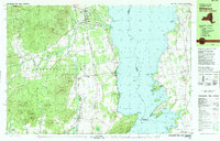 1980 Willsboro1980 Print · USGSThe Lake Champlain shoreline at the edge of the Adirondacks was a bustling corridor of rail and water transport in the late twentieth century. Researchers can trace the Delaware and Hudson line between Willsboro and Essex, or locate family sites like Brookfield Cem and St Josephs Ch.
 - 1980 Map of Westport, 1981 Print
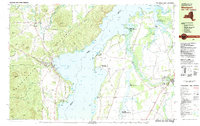 1980 Westport1981 Print · USGSLake Champlain divides the New York Adirondacks from the Vermont plains in the early eighties, showing a landscape defined by water and rail. Researchers can trace family sites at Riverside Cem and Prospect Cem, or locate landmarks like Camp Dudley and the Delaware and Hudson railroad.3 unique versions available
 - 1980 Map of Port Henry, 1981 Print
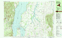 1980 Port Henry1981 Print · USGSLake Champlain's narrows were a hub of activity in the late twentieth century, balancing heavy industry with significant colonial heritage. Genealogists and historians can trace Fort St Frederic Ruins, family cemeteries like Spear Cem, and the path of the Delaware and Hudson railroad.
 - 1986 Map of Lake Champlain South
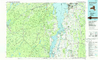 1986 Lake Champlain South1986 Print · USGSIn the mid-1980s, the shores of Lake Champlain linked the Adirondack high peaks with the Vermont valley. Genealogists and researchers can trace the rail lines of the Delaware & Hudson RR or locate historic settlements like Mineville and Au Sable Forks.2 unique versions available
 - 1999 Map of Witherbee, 2000 Print
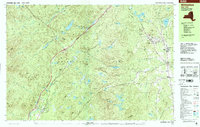 1999 Witherbee2000 Print · USGSThe Adirondack mining district at the close of the twentieth century shows a landscape shaped by iron and industry. Researchers can trace the Lake Champlain and Moriah Railroad as it connects Witherbee and Mineville near the Belfry Mtn Lookout Tower.
 - 1999 Map of Willsboro, 2000 Print
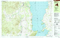 1999 Willsboro2000 Print · USGSSettled along the shores of Lake Champlain at the close of the twentieth century, this area features historic villages and mountain peaks. Genealogists can trace family names at Boardman Cem and Barber Cem or locate the Covered Bridge and St Philip Ch.
 - 1999 Map of Westport, 2000 Print
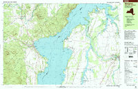 1999 Westport2000 Print · USGSLake Champlain and the Adirondack foothills met in the final years of the millennium, showing a landscape shaped by recreation and river drainage. Researchers can find lakeside landmarks like Camp Dudley, family burial sites at Riverside Cem, and the winding course of the Boquet River.
 - 2010 Map of Elizabethtown, 2010 Print
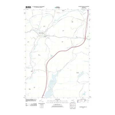 2010 Elizabethtown2010 Print · USGSElizabethtown and the river valleys of the High Peaks region are documented here in the early twenty-first century. Researchers can trace land use through the Adirondack Park, locating the Black River Cemetery and settlements at Pleasant Valley and New Russia.
Showing maps 1-25 of 60
Top cities near Westport
- South Burlington historical maps
- Shelburne historical maps
- Moriah historical maps
- Charlotte historical maps
- Ferrisburgh historical maps
- Vergennes historical maps
See more
Top neighborhoods of Westport
Frequently asked questions
- What are the different types of historical maps available for Westport?
- What is the oldest map of Westport?
- Where can I purchase historical maps of Westport for my home or office?
- Where can I download high-res historical maps of Westport?
- Are there historical topographic maps available for Westport?
- Is there historical aerial imagery available for Westport?
- Where are historical maps of Westport sourced from?