Old Maps of Bangor, New York for Academic Research
Study the evolution of Bangor with 34 high-resolution historic maps. Whether you're teaching, researching, or modeling changes in land use, these maps provide essential visual documentation of urban, environmental, and geographic change.
- Analyze long-term change: Track patterns in development, transportation, and natural features.
- Ideal for environmental or urban studies: Support academic projects with primary historical map data.
- Use in the classroom or lab: Educators and researchers rely on these maps to bring historical context to life.
These maps are a powerful tool for teaching, research, and visualizing how Bangor has changed over the decades.
Bangor, NY maps
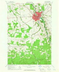
(34)- 1915 Map of Malone, 1957 Print
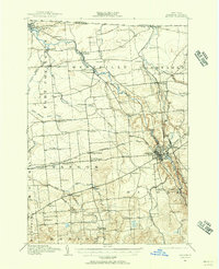 1915 Malone1957 Print · USGSFranklin County at the onset of the Great War reveals a landscape defined by industrial rail junctions and a dense network of district schools. Genealogists can trace family roots through numerous rural school sites and landmarks like the County Almshouse, Malone Junction, and Fort Covington.2 unique versions available
 - 1917 Map of Malone
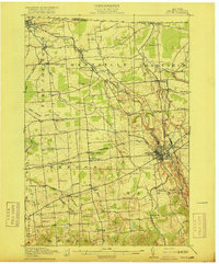 1917 Malone1917 Print · USGSNorthern New York's borderlands are captured here during the height of the steam-rail era, centered on the busy junction at Malone. Genealogists and local historians can trace family locations near dozens of rural schoolhouses or along the Rutland RR and Salmon River.5 unique versions available
 - 1948 Map of Ogdensburg, 1973 Print
 1948 Ogdensburg1973 Print · USGSThe international border along the St Lawrence River comes to life in the late 1940s, showing the vital rail and water connections between New York and Ontario. Researchers can trace the grounds of St Lawrence University, the massive Camp Drum military reservation, and the historic Rideau River and Canal.2 unique versions available
 - 1951 Map of Ogdensburg
 1951 Ogdensburg1951 Print · USGSThe St. Lawrence frontier and the North Country are captured here during the post-war era, from the river ports to the high Adirondacks. Genealogists and historians can trace the rail-and-river economy through Ogdensburg, the Rutland rail lines, and Potsdam.
 - 1953 Map of Ogdensburg
 1953 Ogdensburg1953 Print · USGSThe North Country and St. Lawrence Valley are shown here in the early fifties, just as the region’s rail-and-river economy remained in full swing. Genealogists and historians can trace family-named corners and rural hubs along the Rutland railroad or locate heritage sites near Ogdensburg, Potsdam, and the St Regis Indian Reservation.
 - 1961 Map of Ogdensburg
 1961 Ogdensburg1961 Print · USGSThe St. Lawrence valley and the Adirondack high country meet in this early sixties survey during a peak era for rail and river commerce. Genealogists and historians can trace the paths of the New York Central railroad through remote settlements like Wanakena, Conifer, and Piercefield.
 - 1964 Map of Ft. Covington, 1965 Print
 1964 Ft. Covington1965 Print · USGSNear the international border in the mid-1960s, this area of Franklin County shows a landscape of river-bend settlements and rural townships. Researchers can trace family roots through numerous burial sites like Elmwood Cem and Coal Hill Cem, or locate old homesteads near Cooks Corners.2 unique versions available
 - 1964 Map of Constable, 1966 Print
 1964 Constable1966 Print · USGSFranklin County's international borderlands are captured here in the mid-1960s, showing the rural landscape around the US Customs Port of Entry. Genealogists can trace local roots at Pine Grove Cem and the St Francis of Assisi Cem near the village of Constable.2 unique versions available
 - 1964 Map of Malone, 1966 Print
 1964 Malone1966 Print · USGSMalone and the Salmon River valley are captured in the mid-1960s during a period of steady growth in Franklin County. Genealogists and local historians can trace family locations along Wheeler Road, visit the Dimmick Cem, or locate the St Josephs Ursuline Academy.4 unique versions available
 - 1964 Map of Bangor, 1966 Print
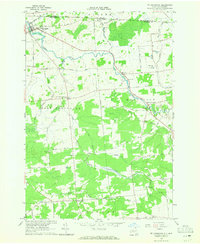
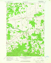 1964 Bangor1966 Print · USGSNorthern New York's agricultural heartland is documented here in the mid-1960s, showing a landscape of small hamlets and family-named backroads. Genealogists and local historians can trace the foundations of Skerry, Brandon Center, and East Dickinson alongside burial grounds like Brandon Cem.2 unique versions available
 - 1985 Map of Massena
 1985 Massena1985 Print · USGSNorthern New York at the mid-eighties shows a landscape of river-driven industry and high mountain wilderness along the Canadian border. Researchers can trace the legacy of iron working and milling in Brasher Iron Works or follow the Raquette River through Massena and Potsdam.
 - 1993 Map of Fort Covington, 1995 Print
 1993 Fort Covington1995 Print · USGSFranklin County's northern borderlands are shown here in the 1990s as the river-fed communities of Ft Covington and Westville continue their long history. Genealogists can trace family sites at Maple Hill Cem, Wylie Cem, and along Cushman Road.
 - 1993 Map of Constable, 1995 Print
 1993 Constable1995 Print · USGSThe northern border of Franklin County meets Quebec in the 1990s, centered on the cross-border community of Trout River. Genealogists and local historians can trace family locations along Taylor Road and visit documented sites like Pine Grove Cem and St Francis Of Assisi Cem.
 - 1994 Map of Massena
 1994 Massena1994 Print · USGSThe St. Lawrence River valley and northern Adirondacks meet in the mid-1990s, revealing a landscape of international shipping, rail corridors, and dense state forests. Genealogists and historians can trace the foundations of Massena, the St Regis Indian Reservation, and small hamlets like Brasher Iron Works.
 - 2010 Map of Malone, 2010 Print
 2010 Malone2010 Print · USGSCovers Bangor, including Malone, Malone, and other nearby areas
 - 2010 Map of Bangor, 2010 Print
 2010 Bangor2010 Print · USGSCovers Bangor, including Moira, Dickinson, and other nearby areas
 - 2010 Map of Fort Covington, 2010 Print
 2010 Fort Covington2010 Print · USGSCovers Bangor, including Moira, Westville, and other nearby areas
 - 2010 Map of Constable, 2010 Print
 2010 Constable2010 Print · USGSCovers Bangor, including Malone, Westville, and other nearby areas
 - 2013 Map of Bangor, 2013 Print
 2013 Bangor2013 Print · USGSCovers Bangor, including Moira, Dickinson, and other nearby areas
 - 2013 Map of Malone, 2013 Print
 2013 Malone2013 Print · USGSCovers Bangor, including Malone, Malone, and other nearby areas
 - 2013 Map of Fort Covington, 2013 Print
 2013 Fort Covington2013 Print · USGSCovers Bangor, including Moira, Westville, and other nearby areas
 - 2013 Map of Constable, 2013 Print
 2013 Constable2013 Print · USGSCovers Bangor, including Malone, Westville, and other nearby areas
 - 2016 Map of Bangor, 2016 Print
 2016 Bangor2016 Print · USGSCovers Bangor, including Moira, Dickinson, and other nearby areas
 - 2016 Map of Constable, 2016 Print
 2016 Constable2016 Print · USGSCovers Bangor, including Malone, Westville, and other nearby areas
 - 2016 Map of Fort Covington, 2016 Print
 2016 Fort Covington2016 Print · USGSCovers Bangor, including Moira, Westville, and other nearby areas
Showing maps 1-25 of 34
Top cities near Bangor
- Malone historical maps
- Malone historical maps
- Moira historical maps
- Brasher historical maps
- Westville historical maps
- Lawrence historical maps
See more
Top neighborhoods of Bangor
Frequently asked questions
- What are the different types of historical maps available for Bangor?
- What is the oldest map of Bangor?
- Where can I purchase historical maps of Bangor for my home or office?
- Where can I download high-res historical maps of Bangor?
- Are there historical topographic maps available for Bangor?
- Is there historical aerial imagery available for Bangor?
- Where are historical maps of Bangor sourced from?