Old Maps of Tully, New York for Hiking & Exploration
Hike through history with 21 historic maps of Tully. Explore old trails, ghost towns, and forgotten backroads — perfect for outdoor adventurers and local explorers.
- Rediscover forgotten places: Map out old mining camps, roads, and footpaths that no longer exist on modern maps.
- Layer with modern tools: Combine with LiDAR or satellite views to plan hikes through historical terrain.
- Made for exploration: Popular among hikers, overlanders, and local history lovers.
Use these maps to find adventure and explore the hidden past of Tully.
Tully, NY maps
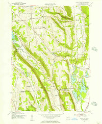
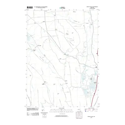
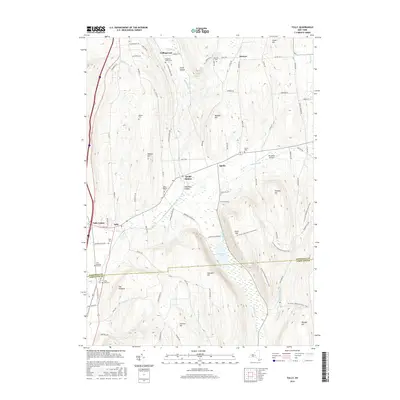
(21)- 1900 Map of Tully
 1900 Tully1900 Print · USGSIn the hills south of Syracuse during the late 1890s, this area supported a network of dairy farms and rail-dependent hamlets. Genealogists can locate long-lost rural communities like Maple Grove (Case P.O.), the Onondaga Indian Reservation, and the resort grounds at Assembly Park.9 unique versions available
 - 1943 Map of Otisco Valley
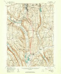
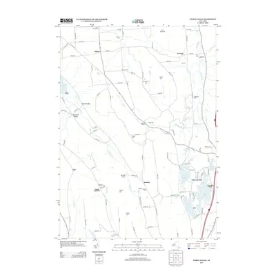
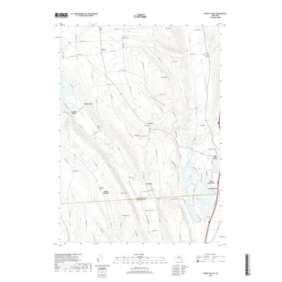
 1943 Otisco Valley1943 Print · USGSCentral New York's glacial lake country is captured here during the early 1940s, showing the rural communities of the Tully and Otisco valleys. Genealogists can locate family burial grounds like St Patricks Cem and tracing old school districts and Salt Wells.
 - 1943 Map of Tully, 1953 Print
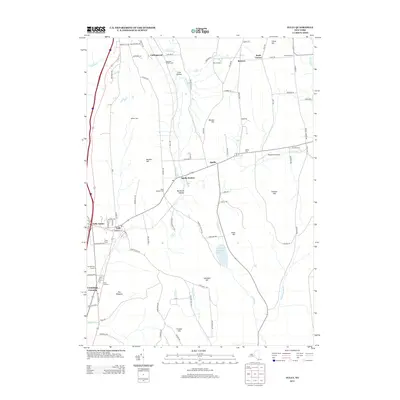
 1943 Tully1953 Print · USGSThe Onondaga and Cortland County borderlands are seen here in the early 1940s, showing a landscape of upland ridges and rail-connected valley towns. Trace local ancestry through the STATE COLLEGE EXPERIMENTAL STATION, numerous rural schools, and sites like St Leos Cem and Apulia Station.
 - 1950 Map of Elmira
 1950 Elmira1950 Print · USGSThe Finger Lakes region thrived in the late 1940s as a hub of industry and transport. Trace family roots and vanished landmarks near Seneca Lake or explore the rail lines of the Erie RR and the sprawling Seneca Ordnance Depot.2 unique versions available
 - 1955 Map of Otisco Valley, 1956 Print
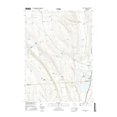
 1955 Otisco Valley1956 Print · USGSOnondaga and Cortland Counties appear here in the mid-fifties, showing a landscape of glacial lakes and upland farms. You can trace family roots at The West Cem and Hillsdale Cem, or locate mid-century landmarks like Camp Hoover and Assembly Park.4 unique versions available
 - 1955 Map of Tully, 1956 Print
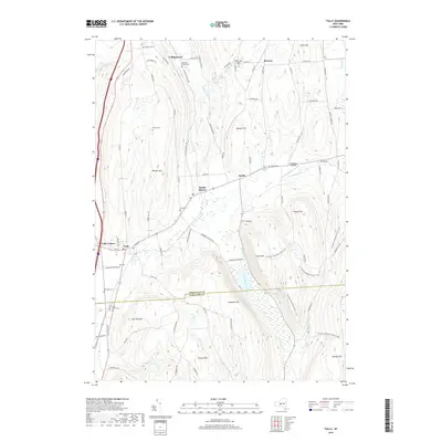
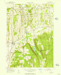 1955 Tully1956 Print · USGSIn the mid-fifties, the Tully Valley was a blend of concentrated village life and sprawling state forestry lands. Genealogists and historians can trace the Delaware Lackawanna and Western tracks through Apulia Station or find local landmarks like St Leo Ch and Meeker Cem.4 unique versions available
 - 1955 Map of Tully, 1961 Print
 1955 Tully1961 Print · USGSCentral New York at the dawn of the interstate era reveals a landscape of glacial lakes and historic upland hamlets. Genealogists can trace family sites at Pioneer Cem or St Patrick Cem, while identifying rail stops like Apulia Station.2 unique versions available
 - 1958 Map of Elmira
 1958 Elmira1958 Print · USGSThe New York Finger Lakes during the late fifties reveal a complex landscape of glacial geology and industrial growth. Researchers can trace historic transport corridors like the Erie Canal and Erie RR, or locate institutional landmarks like Cornell University.2 unique versions available
 - 1962 Map of Elmira, 1969 Print
 1962 Elmira1969 Print · USGSThe Finger Lakes region and Southern Tier are captured here during a period of industrial maturity and highway expansion. Researchers can trace the path of the Erie Canal, the footprint of the Seneca Army Depot, and legacy rail lines through Elmira and Ithaca.4 unique versions available
 - 1965 Map of Elmira
 1965 Elmira1965 Print · USGSThe Finger Lakes and Southern Tier regions are captured in the mid-sixties, showcasing a landscape of deep glacial valleys and heavy rail infrastructure. Trace old railroad corridors like the Pennsylvania RR or visit landmarks like Letchworth State Park and the Seneca Army Depot.
 - 1986 Map of Auburn
 1986 Auburn1986 Print · USGSThe Finger Lakes region in the mid-eighties shows a landscape of deep glacial waters and significant military sites. Trace the layout of the Seneca Army Depot, find the campus of Wells College, and follow the historic Lehigh Valley RR lines.2 unique versions available
 - 2010 Map of Tully, 2010 Print
 2010 Tully2010 Print · USGSCovers Tully, including Pompey, LaFayette, and other nearby areas
 - 2010 Map of Otisco Valley, 2010 Print
 2010 Otisco Valley2010 Print · USGSCovers Tully, including LaFayette, Otisco, and other nearby areas
 - 2013 Map of Tully, 2013 Print
 2013 Tully2013 Print · USGSCovers Tully, including Pompey, LaFayette, and other nearby areas
 - 2013 Map of Otisco Valley, 2013 Print
 2013 Otisco Valley2013 Print · USGSCovers Tully, including LaFayette, Otisco, and other nearby areas
 - 2016 Map of Otisco Valley, 2016 Print
 2016 Otisco Valley2016 Print · USGSCovers Tully, including LaFayette, Otisco, and other nearby areas
 - 2016 Map of Tully, 2016 Print
 2016 Tully2016 Print · USGSCovers Tully, including Pompey, LaFayette, and other nearby areas
 - 2019 Map of Tully, 2019 Print
 2019 Tully2019 Print · USGSCovers Tully, including Pompey, LaFayette, and other nearby areas
 - 2019 Map of Otisco Valley, 2019 Print
 2019 Otisco Valley2019 Print · USGSCovers Tully, including LaFayette, Otisco, and other nearby areas
 - 2023 Map of Tully, 2023 Print
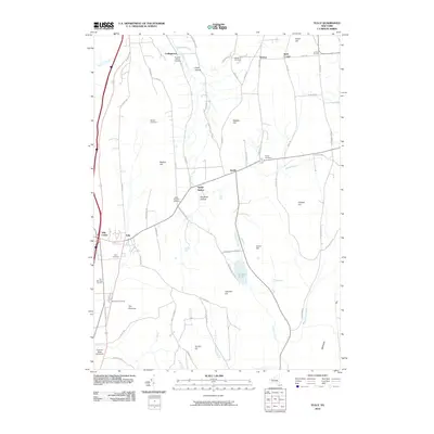
 2023 Tully2023 Print · USGSThe Tully and Apulia valley region is captured here in the early twenty-first century, showing the enduring rural character of southern Onondaga County. Researchers can trace historic burial sites like Saint Leo's Cem and Miles Cem or explore the drainage of Labrador Creek and Fabius Brook.
 - 2023 Map of Otisco Valley, 2023 Print
 2023 Otisco Valley2023 Print · USGSThe hill country of central New York south of Syracuse is captured here in modern detail. Researchers can locate numerous family-history sites like The West Cem and Spafford Hollow Cem near the shores of Otisco Lake.
End of results
Showing maps 1-21 of 21
Top cities near Tully
- Syracuse historical maps
- Manlius historical maps
- De Witt historical maps
- DeWitt historical maps
- Camillus historical maps
- Onondaga historical maps
See more
Top neighborhoods of Tully
- Vesper historical maps
- Tully Center historical maps
- Bromley historical maps
- Assembly Park historical maps
- Tully Lake Park historical maps
- Tully historical maps
Frequently asked questions
- What are the different types of historical maps available for Tully?
- What is the oldest map of Tully?
- Where can I purchase historical maps of Tully for my home or office?
- Where can I download high-res historical maps of Tully?
- Are there historical topographic maps available for Tully?
- Is there historical aerial imagery available for Tully?
- Where are historical maps of Tully sourced from?