Old Maps of Mapletown, Hoosick
Explore 17 old maps of Mapletown, spanning from 1897 to today. These high-resolution historic maps reveal how streets, neighborhoods, landmarks, and natural features evolved over time — perfect for genealogy, metal detecting, research, and local history exploration.
What you can do with these maps:
- See how Mapletown changed over time: Compare historical maps to modern-day views to trace roads, homesites, rail lines & more.
- View detailed metadata: Each map includes creators, publishers, year, scale, and archive source.
- Overlay maps with satellite & LiDAR: Visualize the past alongside modern tools to explore terrain & human change.
- Trusted historical sources: Maps sourced from the USGS, Library of Congress, and other archives.
- Access maps your way: View online, download high-res files, or order prints for personal or research use.
Start exploring old maps of Mapletown to uncover forgotten places, hidden landmarks, and the deep history beneath your feet.
Mapletown, Hoosick maps
(17)- 1897 Map of Hoosick
 1897 Hoosick1897 Print · USGSThe Hoosic River valley and Taconic foothills thrive at the peak of the rail era in the late nineteenth century. Genealogists and historians can trace the specific layouts of Hoosick Falls, Boyntonville, and the remote hamlets of Sodom and Factory Hollow.10 unique versions available
 - 1900 Map of Taconic
 1900 Taconic1900 Print · USGSThe tri-state border region of the Taconic Mountains thrived at the turn of the century as a hub of rail travel and valley industry. Genealogists and historians can trace the early footprints of Hoosick Falls, Bennington, and the winding path of the Rutland R.R.4 unique versions available
 - 1943 Map of Hoosick Falls, 1958 Print
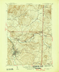
 1943 Hoosick Falls1958 Print · USGSThe New York and Vermont borderlands come alive in this mid-century survey of the Hoosic and Walloomsac valleys. Trace the busy rail junctions of the Boston and Maine and locate historic sites like Bennington Battlefield Park and Sodom.4 unique versions available
 - 1946 Map of Hoosick Falls
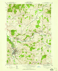
 1946 Hoosick Falls1946 Print · USGSRensselaer County and the Vermont border are captured here just after the war, showing a landscape shaped by river valleys and early rail lines. Researchers can trace ancestral locations from Hoosick Falls to rural spots like Sodom, School No 5, and the St Marys Cem.2 unique versions available
 - 1948 Map of Albany, 1951 Print
 1948 Albany1951 Print · USGSThe Hudson and Connecticut River valleys are captured here in the late 1940s, showing the vital rail and water corridors of the Northeast. You can trace the Boston and Maine tracks past Mt Greylock or locate early settlements like Great Barrington and Bennington.
 - 1956 Map of Albany, 1968 Print
 1956 Albany1968 Print · USGSThe industrial heart of the Northeast is revealed in the mid-1950s, from the Hudson Valley to the Connecticut River. Researchers can trace the legacy of the Quabbin Reservoir, locate Westover Air Force Base, or follow the Rutland RR through the Green Mountains.2 unique versions available
 - 1957 Map of Albany
 1957 Albany1957 Print · USGSThe Tri-State region and Connecticut River Valley are captured here during a period of significant postwar growth and infrastructure expansion. Genealogists and historians can trace the rail-and-river economy through landmarks like the Boston and Maine railroad, Quabbin Reservoir, and Westover Air Force Base.
 - 1959 Map of Albany
 1959 Albany1959 Print · USGSThe Hudson and Connecticut River valleys are captured here during the late fifties, showing the region's dense rail networks and massive water projects. Researchers can trace the New York State Thruway or locate local landmarks like Mt Greylock and the Quabbin Reservoir.
 - 1962 Map of Albany
 1962 Albany1962 Print · USGSThe Hudson and Connecticut River valleys meet the Green Mountains and Berkshires in this mid-century overview of the Northeast. Genealogists and historians can trace the industrial hearts of Albany and Springfield or locate features like Quabbin Reservoir and Westover Air Force Base.
 - 1986 Map of Albany
 1986 Albany1986 Print · USGSThe Capital District and the tri-state highlands come into focus during the mid-eighties as urban growth meets the edge of the Green Mountains. Researchers can trace historic industrial sites and landmarks like the Watervliet Arsenal, the Bennington Battle Monument, and the grounds of Rensselaer Polytechnic Institute.
 - 1989 Map of Albany
 1989 Albany1989 Print · USGSThe tri-state intersection of New York, Vermont, and Massachusetts comes alive in the late 1980s, centered on the historic river confluence of the Capital District. Researchers can trace the extensive rail lines of the D & H RR and explore high peaks like Mount Greylock or the reaches of the Tomhannock Reservoir.2 unique versions available
 - 1995 Map of Hoosick Falls, 2000 Print
 1995 Hoosick Falls2000 Print · USGSThe Rensselaer County borderlands come alive in the mid-nineties as small settlements and rail junctions follow the winding river valleys into Vermont. Researchers can trace family sites from St Marys Ch to rural outposts like Post Corners and Center White Creek.
 - 2011 Map of Hoosick Falls, 2011 Print
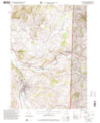
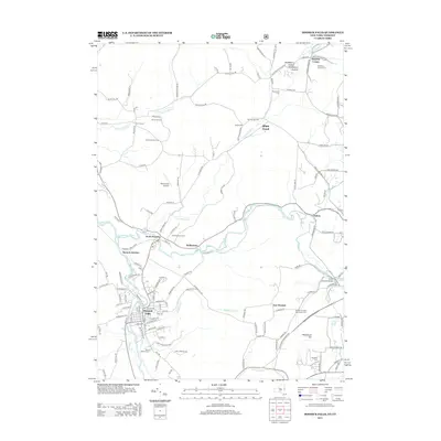
 2011 Hoosick Falls2011 Print · USGSCovers Mapletown, including Bennington, Hoosick, and other nearby areas
 - 2013 Map of Hoosick Falls, 2013 Print
 2013 Hoosick Falls2013 Print · USGSCovers Mapletown, including Bennington, Hoosick, and other nearby areas
 - 2016 Map of Hoosick Falls, 2016 Print
 2016 Hoosick Falls2016 Print · USGSCovers Mapletown, including Bennington, Hoosick, and other nearby areas
 - 2019 Map of Hoosick Falls, 2019 Print
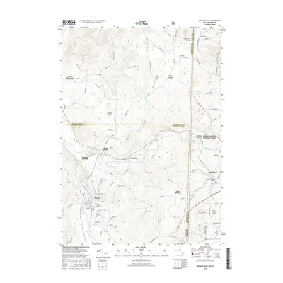
 2019 Hoosick Falls2019 Print · USGSCovers Mapletown, including Bennington, Hoosick, and other nearby areas
 - 2023 Map of Hoosick Falls, 2023 Print
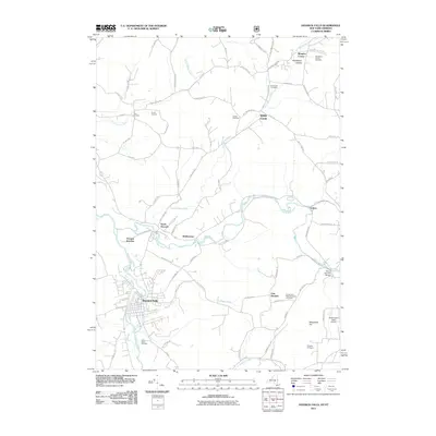
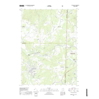
 2023 Hoosick Falls2023 Print · USGSThe New York and Vermont border country comes alive in this survey of the river valleys north of Hoosick Falls. Genealogists can trace family names at Maple Grove Cem or Kingsley Cem while following the path of the Pan Am Southern rail line.
End of results
Showing maps 1-17 of 17
Top cities near Mapletown
- North Adams historical maps
- Brunswick historical maps
- Bennington historical maps
- Sand Lake historical maps
- Adams historical maps
- Williamstown historical maps
See more
Frequently asked questions
- What are the different types of historical maps available for Mapletown?
- What is the oldest map of Mapletown?
- Where can I purchase historical maps of Mapletown for my home or office?
- Where can I download high-res historical maps of Mapletown?
- Are there historical topographic maps available for Mapletown?
- Is there historical aerial imagery available for Mapletown?
- Where are historical maps of Mapletown sourced from?