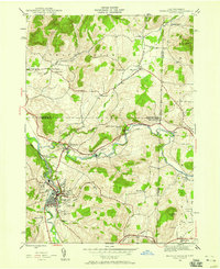
1943 Map of Hoosick Falls
USGS Topo · Published 1958About this map
Hoosick Falls serves as the industrial and social hub of this borderland region during the 1940s, situated where the Hoosic River meets Woods Brook. The landscape is defined by its strategic transportation corridors, including the Boston and Maine and Rutland railroads, which intersect at Hoosick Junction. In the northern portion of the map, the agrarian character of White Creek is punctuated by numerous rural schoolhouses and small family settlements like Center White Creek and Post Corners. A significant portion of the eastern terrain reflects Revolutionary War heritage at Bennington Battlefield Park, located along the Walloomsac River near the tiny hamlet of Sodom. Genealogists will find several burial grounds, such as Quaker Cem and St Marys Cem, alongside landmarks of mid-century life like the Hoosick Falls Country Club and Bennington Airport.
Find a feature on this map
44 named features on this map. Tap any name to fly to it.
Don’t see what you’re looking for? This feature index may not catch every label — zoom into the map to look around manually.
Map Details
Editions of this 1943 Hoosick Falls Map
4 editions found
Other maps of this area

1894 · Equinox
USGS Topo · 1:62,500

1895 · Cambridge
USGS Topo · 1:62,500

1896 · Equinox
USGS Topo · 1:62,500

1897 · Hoosick
USGS Topo · 1:62,500

1898 · Cambridge
USGS Topo · 1:62,500

1898 · Bennington
USGS Topo · 1:62,500

1900 · Taconic
USGS Topo · 1:125,000

1900 · Equinox
USGS Topo · 1:62,500

1901 · Cambridge
USGS Topo · 1:62,500

1903 · Mettawee
USGS Topo · 1:125,000