Old Maps of Pittstown, New York for Genealogy
Trace your family roots with 43 historic maps of Pittstown. These high-res maps reveal old neighborhoods, homesites, landmarks, and streets — helping you uncover where your ancestors lived and how the area evolved over time.
- Explore historic neighborhoods: Identify where your relatives may have lived in the 1800s or 1900s.
- Compare maps over time: Trace the changes in streets, buildings, and landmarks for multi-generational research.
- Perfect for genealogy & ancestry research: Used by family historians and researchers to map out lineage and migration.
These maps are an incredible resource for exploring your personal connection to Pittstown's past.
Pittstown, NY maps
(43)- 1893 Map of Cohoes
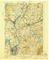
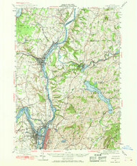
 1893 Cohoes1893 Print · USGSThe upper Hudson Valley and its industrial corridor come alive in the 1890s, from the streets of Cohoes to the Bemis Heights Battle Ground. Trace the original paths of the Erie Canal and Champlain Canal through Waterford and Mechanicsville.
 - 1895 Map of Cohoes
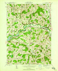
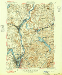
 1895 Cohoes1895 Print · USGSThe Hudson and Mohawk river valleys at the end of the nineteenth century reveal a landscape shaped by canal trade and burgeoning rail lines. Genealogists and local historians can trace the early layouts of Cohoes, Mechanicville, and the historic Battle Ground at Bemis Heights.
 - 1897 Map of Hoosick
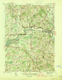
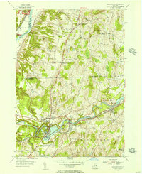
 1897 Hoosick1897 Print · USGSThe Hoosic River valley and Taconic foothills thrive at the peak of the rail era in the late nineteenth century. Genealogists and historians can trace the specific layouts of Hoosick Falls, Boyntonville, and the remote hamlets of Sodom and Factory Hollow.10 unique versions available
 - 1898 Map of Cohoes
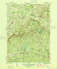
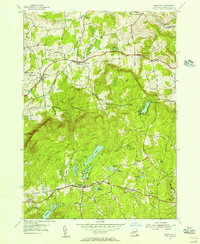
 1898 Cohoes1898 Print · USGSUpper Hudson Valley industry and transport are captured here at the end of the nineteenth century, from the confluence of the Mohawk to the hills of Pittstown. Trace the historic path of the Champlain Canal and the storied Battle Ground near Stillwater.8 unique versions available
 - 1900 Map of Taconic
 1900 Taconic1900 Print · USGSThe tri-state border region of the Taconic Mountains thrived at the turn of the century as a hub of rail travel and valley industry. Genealogists and historians can trace the early footprints of Hoosick Falls, Bennington, and the winding path of the Rutland R.R.4 unique versions available
 - 1929 Map of Cohoes
 1929 Cohoes1929 Print · USGSThe industrial and revolutionary history of the Hudson Valley is clear in this late twenties survey of the river's confluence. Researchers can trace early rail stops at Stillwater Center Sta, explore the Saratoga Battlefield, or locate rural schoolhouses from School No 4 to School No 13.4 unique versions available
 - 1944 Map of Eagle Bridge, 1958 Print
 1944 Eagle Bridge1958 Print · USGSThe Hoosic River valley during the mid-1940s reveals a landscape defined by riverside rail corridors and upland farming hamlets. Genealogists can trace family roots through Woodside Cem, rural schoolhouses, and small settlements like Buskirk and West Hoosick.3 unique versions available
 - 1946 Map of Eagle Bridge
 1946 Eagle Bridge1946 Print · USGSThe Hoosic River valley in the years following the war was a hub of small-town rail commerce and rural life. Genealogists and local historians can trace family roots through the clusters at Eagle Bridge, West Hoosick, and Center White Creek, or locate old landmarks like Woodside Cem and School No 2.2 unique versions available
 - 1946 Map of Grafton
 1946 Grafton1946 Print · USGSRensselaer County’s lake-strewn plateau is captured here in the mid-1940s, showing the early development of rural settlements and seasonal camps. Genealogists can locate family landmarks like the Warren Cem or trace old school districts such as Groveside Sch and Cobb Sch.2 unique versions available
 - 1947 Map of Cohoes, 1968 Print
 1947 Cohoes1968 Print · USGSThe Hudson and Mohawk river valleys converge here in the mid-1940s, revealing a dense network of canals and early industrial railroads. Researchers can trace the Champlain Canal (Abandoned), find old rural schoolhouses, and locate landmarks like the Fire Lookout Tower and Cohoes Falls.
 - 1948 Map of Albany, 1951 Print
 1948 Albany1951 Print · USGSThe Hudson and Connecticut River valleys are captured here in the late 1940s, showing the vital rail and water corridors of the Northeast. You can trace the Boston and Maine tracks past Mt Greylock or locate early settlements like Great Barrington and Bennington.
 - 1949 Map of Cohoes
 1949 Cohoes1949 Print · USGSThe Hudson and Mohawk river valleys meet in the late 1940s at the industrial nexus of Cohoes and Troy. Local historians can trace early transport routes along the Champlain Canal, find family names near Bemis Heights, or locate old landmarks like the Fire Lookout Tower.2 unique versions available
 - 1950 Map of Eagle Bridge, 1951 Print
 1950 Eagle Bridge1951 Print · USGSPost-war Upstate New York comes to life along the Hoosic River valley at the Washington and Rensselaer county line. Trace family roots through rural hamlets like Eagle Bridge, Buskirk, and West Hoosick, or locate old landmarks like School No 4 and Woodside Cem.
 - 1954 Map of Schaghticoke, 1956 Print
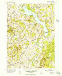
 1954 Schaghticoke1956 Print · USGSIn the mid-1950s, the Hoosic River valley hummed with industry and agriculture as rail lines connected thriving villages. Genealogists and historians can trace family ties at the Little Red Schoolhouse, St Johns Ch, and Elmwood Cemetery.4 unique versions available
 - 1954 Map of Grafton, 1956 Print
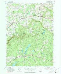
 1954 Grafton1956 Print · USGSRensselaer County’s high plateau and glacial lake country are captured here in the mid-1950s. Researchers can trace the rural legacy of the region through small hamlets like Boyntonville and local landmarks such as St Georges Ch and Cobb Sch.3 unique versions available
 - 1954 Map of Tomhannock, 1956 Print
 1954 Tomhannock1956 Print · USGSRensselaer County in the mid-1950s shows a landscape shaped by the massive Tomhannock Reservoir and established rural townships. Genealogists and local historians can trace old school districts like School No 5, family cemeteries such as Maplewood Cem, and the path of the Boston and Maine railroad.2 unique versions available
 - 1956 Map of Albany, 1968 Print
 1956 Albany1968 Print · USGSThe industrial heart of the Northeast is revealed in the mid-1950s, from the Hudson Valley to the Connecticut River. Researchers can trace the legacy of the Quabbin Reservoir, locate Westover Air Force Base, or follow the Rutland RR through the Green Mountains.2 unique versions available
 - 1957 Map of Albany
 1957 Albany1957 Print · USGSThe Tri-State region and Connecticut River Valley are captured here during a period of significant postwar growth and infrastructure expansion. Genealogists and historians can trace the rail-and-river economy through landmarks like the Boston and Maine railroad, Quabbin Reservoir, and Westover Air Force Base.
 - 1959 Map of Albany
 1959 Albany1959 Print · USGSThe Hudson and Connecticut River valleys are captured here during the late fifties, showing the region's dense rail networks and massive water projects. Researchers can trace the New York State Thruway or locate local landmarks like Mt Greylock and the Quabbin Reservoir.
 - 1962 Map of Albany
 1962 Albany1962 Print · USGSThe Hudson and Connecticut River valleys meet the Green Mountains and Berkshires in this mid-century overview of the Northeast. Genealogists and historians can trace the industrial hearts of Albany and Springfield or locate features like Quabbin Reservoir and Westover Air Force Base.
 - 1978 Map of Grafton, 1983 Print
 1978 Grafton1983 Print · USGSRensselaer County's upland townships are captured here in the late 1970s, showing a landscape of managed forests and high-elevation glacial ponds. Researchers can trace rural school locations like Cobb Sch and Groveside Sch or explore old settlements at Potter Hill and Factory Hollow.
 - 1986 Map of Albany
 1986 Albany1986 Print · USGSThe Capital District and the tri-state highlands come into focus during the mid-eighties as urban growth meets the edge of the Green Mountains. Researchers can trace historic industrial sites and landmarks like the Watervliet Arsenal, the Bennington Battle Monument, and the grounds of Rensselaer Polytechnic Institute.
 - 1989 Map of Albany
 1989 Albany1989 Print · USGSThe tri-state intersection of New York, Vermont, and Massachusetts comes alive in the late 1980s, centered on the historic river confluence of the Capital District. Researchers can trace the extensive rail lines of the D & H RR and explore high peaks like Mount Greylock or the reaches of the Tomhannock Reservoir.2 unique versions available
 - 2010 Map of Schaghticoke, 2010 Print
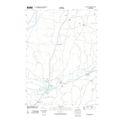 2010 Schaghticoke2010 Print · USGSCovers Pittstown, including Stillwater, Schaghticoke, and other nearby areas
 - 2010 Map of Eagle Bridge, 2010 Print
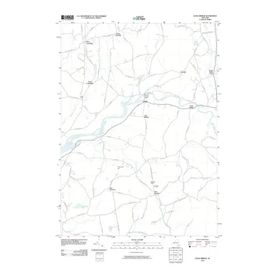 2010 Eagle Bridge2010 Print · USGSCovers Pittstown, including Schaghticoke, Hoosick, and other nearby areas
Showing maps 1-25 of 43
Top cities near Pittstown
- Albany historical maps
- Colonie historical maps
- Troy historical maps
- Saratoga Springs historical maps
- Halfmoon historical maps
- Cohoes historical maps
See more
Top neighborhoods of Pittstown
- Lincolnville historical maps
- Raymertown historical maps
- Tomhannock historical maps
- Factory Hollow historical maps
- Johnsonville historical maps
- Millertown historical maps
See more
Frequently asked questions
- What are the different types of historical maps available for Pittstown?
- What is the oldest map of Pittstown?
- Where can I purchase historical maps of Pittstown for my home or office?
- Where can I download high-res historical maps of Pittstown?
- Are there historical topographic maps available for Pittstown?
- Is there historical aerial imagery available for Pittstown?
- Where are historical maps of Pittstown sourced from?