Old Maps of Colton, New York for Genealogy
Trace your family roots with 98 historic maps of Colton. These high-res maps reveal old neighborhoods, homesites, landmarks, and streets — helping you uncover where your ancestors lived and how the area evolved over time.
- Explore historic neighborhoods: Identify where your relatives may have lived in the 1800s or 1900s.
- Compare maps over time: Trace the changes in streets, buildings, and landmarks for multi-generational research.
- Perfect for genealogy & ancestry research: Used by family historians and researchers to map out lineage and migration.
These maps are an incredible resource for exploring your personal connection to Colton's past.
Colton, NY maps
(98)- 1907 Map of Tupper Lake
 1907 Tupper Lake1907 Print · USGSThe Adirondack wilderness at the turn of the century shows a landscape defined by new rail lines and remote sporting clubs. Researchers can trace the early rail stops at Piercefield Sta and Childwold Sta or locate the isolated Sabattis P O and Ushers Farm.8 unique versions available
 - 1908 Map of Potsdam
 1908 Potsdam1908 Print · USGSSt. Lawrence County is captured here in the early twentieth century as a vibrant landscape of river-powered industry and dispersed school districts. Researchers can trace the original N. Y. C. and H. R. R. R. through Norwood or locate historic rural landmarks like Browns Bridge and Old Forge School.7 unique versions available
 - 1919 Map of Cranberry Lake, 1959 Print
 1919 Cranberry Lake1959 Print · USGSThe northern Adirondack wilderness is captured here just after the Great War, showing a landscape defined by timber, mining, and the winding Oswegatchie River. Trace the early development of Benson Mines, the State Ranger School, and the remote landing at Wanakena.3 unique versions available
 - 1920 Map of Childwold, 1954 Print
 1920 Childwold1954 Print · USGSIn the Adirondack interior during the early 1920s, this area showcases a network of timber camps and early sporting clubs. Researchers can trace the riverfront development of Hollywood and Childwold, or locate landmarks like the Shur-leff Hotel and Kildare.2 unique versions available
 - 1921 Map of Cranberry Lake
 1921 Cranberry Lake1921 Print · USGSIn the early 1920s, this area of the Adirondacks was a nexus of wilderness and industry, from the waters of Cranberry Lake to the iron operations at Benson Mines. Researchers can trace the early grounds of the State Ranger School and follow the New York Central RR through Wanakena.7 unique versions available
 - 1921 Map of Childwold
 1921 Childwold1921 Print · USGSThe Adirondack wilderness in the early twenties was a landscape of remote sporting clubs and isolated river outposts. Genealogists and historians can trace old homesteads and landmarks like the Shurtleff Hotel, Childwold School, and the long-vanished community of Hollywood.
 - 1921 Map of Stark, 1956 Print
 1921 Stark1956 Print · USGSSt. Lawrence County in the early twenties shows a landscape shaped by logging and the Adirondack wilderness. Researchers can trace the path of the Lumber RR, locate early rural sites like Glendale Mill and Cold Brook School, or find the secluded Stillwater Club.2 unique versions available
 - 1922 Map of Childwold
 1922 Childwold1922 Print · USGSThe St. Lawrence County wilderness in the early twenties is a landscape of isolated camps and early Adirondack outposts. Local historians can locate vanished sites like the Shurtleff Hotel or trace the early foundations of Childwold and Hollywood near the Jordan River.4 unique versions available
 - 1923 Map of Stark
 1923 Stark1923 Print · USGSSt. Lawrence County was a landscape of remote lumbering outposts and river-fed settlements in the early 1920s. Genealogists and historians can trace old homesteads at Sellecks Cors, follow the path of the Lumber RR, and locate the Irish Settlement.4 unique versions available
 - 1931 Map of Cranberry Lake
 1931 Cranberry Lake1931 Print · USGSThe Adirondack wilderness around Cranberry Lake is captured here in the early thirties, showcasing a landscape of logging, mining, and remote rail travel. Genealogists and historians can trace the industrial footprints of Benson Mines, the State Ranger School, and the New York Central line.
 - 1940 Map of Stark
 1940 Stark1940 Print · USGSSt. Lawrence County was a landscape of remote logging camps and private sporting clubs during the interwar years. Genealogists can locate family outposts like Sellecks Cors or trace the early rural education system at Littlejohn School and Cold Brook School.
 - 1942 Map of Long Bow, 1958 Print
 1942 Long Bow1958 Print · USGSSt. Lawrence County’s timbered foothills appear in detail during the early 1940s as the Raquette River flows toward the St. Lawrence. Researchers can locate remote schoolhouses like School No 6 and trace the original path of the Russell Turnpike Rd past Pickettsville.
 - 1943 Map of Colton
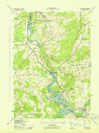 1943 Colton1943 Print · USGSSt. Lawrence County is shown during the early 1940s as its river-driven economy and rural school districts remained the heart of local life. Genealogists can trace family locations near Riverside Cem or find the numerous numbered schoolhouses serving Hannawa Falls and West Parishville.2 unique versions available
 - 1943 Map of Long Bow
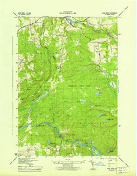 1943 Long Bow1943 Print · USGSThe northern Adirondack foothills during the early 1940s reveal a landscape of river-driven industry and remote mountain schools. Researchers can trace the paths of the historic Russell Turnpike and locate several rural schoolhouses like School No. 11 and School No. 13.
 - 1948 Map of Ogdensburg, 1973 Print
 1948 Ogdensburg1973 Print · USGSThe international border along the St Lawrence River comes to life in the late 1940s, showing the vital rail and water connections between New York and Ontario. Researchers can trace the grounds of St Lawrence University, the massive Camp Drum military reservation, and the historic Rideau River and Canal.2 unique versions available
 - 1951 Map of Ogdensburg
 1951 Ogdensburg1951 Print · USGSThe St. Lawrence frontier and the North Country are captured here during the post-war era, from the river ports to the high Adirondacks. Genealogists and historians can trace the rail-and-river economy through Ogdensburg, the Rutland rail lines, and Potsdam.
 - 1953 Map of Ogdensburg
 1953 Ogdensburg1953 Print · USGSThe North Country and St. Lawrence Valley are shown here in the early fifties, just as the region’s rail-and-river economy remained in full swing. Genealogists and historians can trace family-named corners and rural hubs along the Rutland railroad or locate heritage sites near Ogdensburg, Potsdam, and the St Regis Indian Reservation.
 - 1954 Map of Tupper Lake, 1957 Print
 1954 Tupper Lake1957 Print · USGSThe northern Adirondacks in the mid-1950s centered on the logging and rail corridor through Piercefield and Conifer. Researchers can trace the New York Central line to remote stops like Childwold Sta and Sabattis or locate the St Paul Cem.4 unique versions available
 - 1961 Map of Ogdensburg
 1961 Ogdensburg1961 Print · USGSThe St. Lawrence valley and the Adirondack high country meet in this early sixties survey during a peak era for rail and river commerce. Genealogists and historians can trace the paths of the New York Central railroad through remote settlements like Wanakena, Conifer, and Piercefield.
 - 1964 Map of Rainbow Falls, 1966 Print
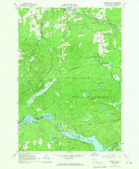 1964 Rainbow Falls1966 Print · USGSThe Raquette River corridor in St. Lawrence County shows a landscape defined by hydroelectric power and mid-century recreation in the mid-1960s. Researchers can trace the development of the Five Falls and Rainbow Falls reservoirs or locate local landmarks like the Boy Scout Camp and the settlement of Pickettville.3 unique versions available
 - 1964 Map of Colton, 1966 Print
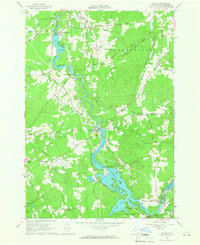 1964 Colton1966 Print · USGSSt. Lawrence County was defined by its hydroelectric river valley in the mid-1960s. Researchers can trace the civic foundations of the area through family landmarks like Vebber Corners, old burial grounds such as Riverside Cem, and the St Patrick Ch at Colton.2 unique versions available
 - 1968 Map of Wolf Mountain, 1971 Print
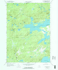 1968 Wolf Mountain1971 Print · USGSThe Adirondack wilderness in the late sixties is defined by a vast network of glacial ponds and state-managed timberlands. Researchers can trace the Penn Central rail line past Robinwood or locate the Partlow Milldam and Lookout Tower on Cat Mtn.2 unique versions available
 - 1968 Map of Childwold, 1971 Print
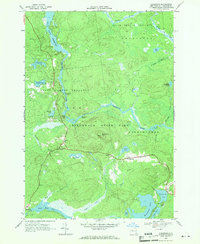 1968 Childwold1971 Print · USGSThe Raquette River wilderness in the late sixties reveals a network of remote hamlets and scout camps. Trace the developments at Childwold, identify family burial sites at the Cem near Sevey Corners, and locate the Lookout Tower on Moosehead Mtn.
 - 1968 Map of Cranberry Lake, 1971 Print
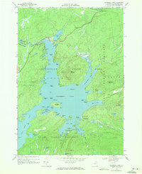 1968 Cranberry Lake1971 Print · USGSCranberry Lake and the surrounding Adirondack wilderness are captured here in the late sixties, showing the intricate shoreline and interior islands. Researchers can find remote landmarks like the Cranberry Lake Biological Station, Joe Indian Island, and the Cranberry Lake Cem.2 unique versions available
 - 1968 Map of Stark, 1971 Print
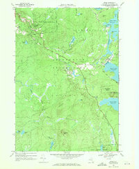 1968 Stark1971 Print · USGSThe Raquette River highlands in the late 1960s reveal a landscape of hydroelectric power and deep woods recreation. Researchers can locate the Irish Settlement, trace the flooded banks of Blake Falls Reservoir, and find family landmarks like Whispering Pines Camp or the Granshue Club.
Showing maps 1-25 of 98
Top cities near Colton
- Pierrepont historical maps
- Parishville historical maps
- Fine historical maps
- Hopkinton historical maps
- Waverly historical maps
- Long Lake historical maps
See more
Top neighborhoods of Colton
- Irish Settlement historical maps
- Stark historical maps
- Sevey historical maps
- Brandy Brook historical maps
- Shurtleff historical maps
- South Colton historical maps
See more
Frequently asked questions
- What are the different types of historical maps available for Colton?
- What is the oldest map of Colton?
- Where can I purchase historical maps of Colton for my home or office?
- Where can I download high-res historical maps of Colton?
- Are there historical topographic maps available for Colton?
- Is there historical aerial imagery available for Colton?
- Where are historical maps of Colton sourced from?