1960s Maps of Parishville, New York
Explore 7 historic maps of Parishville from the 1960s. These maps offer a rare glimpse into what life looked like during the 1960s — showing old roads, neighborhoods, homes, and landmarks that have changed or disappeared over time.
Whether you're researching your family's past, planning a metal detecting trip, or studying how Parishville's landscape evolved across the 1960s, these high-resolution maps are a powerful tool for exploring the history of this region.
- Focus on a specific era: All maps on this page are from the 1960s, giving you a focused view of this time period.
- See what’s changed: Compare century-old streets, trails, and buildings to today's modern landscape using overlays and satellite layers.
- Research with precision: Use these maps for genealogy, historical research, land use analysis, or educational projects.
- View, download, or print: Maps are fully viewable online in high resolution, and can be downloaded or printed for your own records.
Start exploring Parishville's history through authentic maps from the 1960s. This is your window into the past.
Parishville, NY maps
(7)- 1961 Map of Ogdensburg
 1961 Ogdensburg1961 Print · USGSThe St. Lawrence valley and the Adirondack high country meet in this early sixties survey during a peak era for rail and river commerce. Genealogists and historians can trace the paths of the New York Central railroad through remote settlements like Wanakena, Conifer, and Piercefield.
 - 1964 Map of Rainbow Falls, 1966 Print
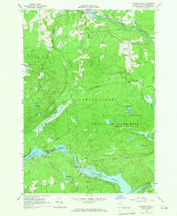 1964 Rainbow Falls1966 Print · USGSThe Raquette River corridor in St. Lawrence County shows a landscape defined by hydroelectric power and mid-century recreation in the mid-1960s. Researchers can trace the development of the Five Falls and Rainbow Falls reservoirs or locate local landmarks like the Boy Scout Camp and the settlement of Pickettville.3 unique versions available
 - 1964 Map of Sylvan Falls, 1966 Print
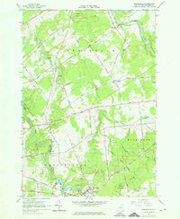
 1964 Sylvan Falls1966 Print · USGSThe Adirondack foothills in the mid-1960s reveal a landscape of managed forests and river power. Local researchers can trace the West Branch St Regis River past Sylvan Falls to the Cough Cem and Blake Falls Reservoir.
 - 1964 Map of Parishville, 1966 Print
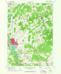
 1964 Parishville1966 Print · USGSSt. Lawrence County in the mid-1960s is defined by its hydroelectric power along the river and deep-rooted rural hamlets. Genealogists and local historians can trace family locations near Parishville, Fairview Cem, and the Allen Falls Reservoir.3 unique versions available
 - 1964 Map of Potsdam, 1966 Print
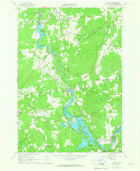
 1964 Potsdam1966 Print · USGSSt. Lawrence County is captured during a period of academic and industrial growth in the mid-sixties. Researchers can trace the footprints of Clarkson College, locate family plots in Bayside Cem, and follow the New York Central Railroad through Norwood.3 unique versions available
 - 1964 Map of Colton, 1966 Print
 1964 Colton1966 Print · USGSSt. Lawrence County was defined by its hydroelectric river valley in the mid-1960s. Researchers can trace the civic foundations of the area through family landmarks like Vebber Corners, old burial grounds such as Riverside Cem, and the St Patrick Ch at Colton.2 unique versions available
 - 1968 Map of Stark, 1971 Print
 1968 Stark1971 Print · USGSThe Raquette River highlands in the late 1960s reveal a landscape of hydroelectric power and deep woods recreation. Researchers can locate the Irish Settlement, trace the flooded banks of Blake Falls Reservoir, and find family landmarks like Whispering Pines Camp or the Granshue Club.
End of results
Showing maps 1-7 of 7
Top cities near Parishville
- Potsdam historical maps
- Canton historical maps
- Potsdam historical maps
- Norfolk historical maps
- Stockholm historical maps
- Moira historical maps
See more
Top neighborhoods of Parishville
- Willisville historical maps
- High Flats historical maps
- Pickettville historical maps
- West Parishville historical maps
- Parishville Center historical maps
- Sinclair Corner historical maps
See more
Frequently asked questions
- What are the different types of historical maps available for Parishville?
- What is the oldest map of Parishville?
- Where can I purchase historical maps of Parishville for my home or office?
- Where can I download high-res historical maps of Parishville?
- Are there historical topographic maps available for Parishville?
- Is there historical aerial imagery available for Parishville?
- Where are historical maps of Parishville sourced from?