Old Maps of Parishville, Parishville for Metal Detecting
Plan your next treasure hunt with 22 historic maps of Parishville. Find old homesites, ghost towns, trails, and gathering spots that may be lost to time — perfect for identifying promising metal detecting locations.
- Locate forgotten sites: Uncover places like long-lost settlements, abandoned rail lines, or gathering spots.
- Plan better hunts: Use map overlays combined with LiDAR or satellite views to narrow in on historically rich areas.
- Made for detectorists: Thousands of hobbyists use these maps to discover relics, coins, and hidden history.
Use these historic maps to boost your research and find new opportunities beneath the surface of Parishville.
Parishville, Parishville maps
(22)- 1908 Map of Potsdam
 1908 Potsdam1908 Print · USGSSt. Lawrence County is captured here in the early twentieth century as a vibrant landscape of river-powered industry and dispersed school districts. Researchers can trace the original N. Y. C. and H. R. R. R. through Norwood or locate historic rural landmarks like Browns Bridge and Old Forge School.7 unique versions available
 - 1942 Map of Long Bow, 1958 Print
 1942 Long Bow1958 Print · USGSSt. Lawrence County’s timbered foothills appear in detail during the early 1940s as the Raquette River flows toward the St. Lawrence. Researchers can locate remote schoolhouses like School No 6 and trace the original path of the Russell Turnpike Rd past Pickettsville.
 - 1943 Map of Parishville
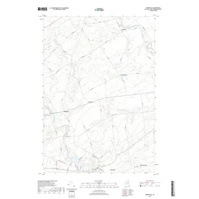
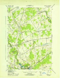 1943 Parishville1943 Print · USGSSt. Lawrence County during the early years of the war reveals a landscape of river-powered hamlets and numerous rural school districts. Researchers can trace family origins across the townships of Stockholm and Hopkinton or locate sites like Fairview Cem and Allens Falls Reservoir.2 unique versions available
 - 1943 Map of Long Bow
 1943 Long Bow1943 Print · USGSThe northern Adirondack foothills during the early 1940s reveal a landscape of river-driven industry and remote mountain schools. Researchers can trace the paths of the historic Russell Turnpike and locate several rural schoolhouses like School No. 11 and School No. 13.
 - 1948 Map of Ogdensburg, 1973 Print
 1948 Ogdensburg1973 Print · USGSThe international border along the St Lawrence River comes to life in the late 1940s, showing the vital rail and water connections between New York and Ontario. Researchers can trace the grounds of St Lawrence University, the massive Camp Drum military reservation, and the historic Rideau River and Canal.2 unique versions available
 - 1951 Map of Ogdensburg
 1951 Ogdensburg1951 Print · USGSThe St. Lawrence frontier and the North Country are captured here during the post-war era, from the river ports to the high Adirondacks. Genealogists and historians can trace the rail-and-river economy through Ogdensburg, the Rutland rail lines, and Potsdam.
 - 1953 Map of Ogdensburg
 1953 Ogdensburg1953 Print · USGSThe North Country and St. Lawrence Valley are shown here in the early fifties, just as the region’s rail-and-river economy remained in full swing. Genealogists and historians can trace family-named corners and rural hubs along the Rutland railroad or locate heritage sites near Ogdensburg, Potsdam, and the St Regis Indian Reservation.
 - 1961 Map of Ogdensburg
 1961 Ogdensburg1961 Print · USGSThe St. Lawrence valley and the Adirondack high country meet in this early sixties survey during a peak era for rail and river commerce. Genealogists and historians can trace the paths of the New York Central railroad through remote settlements like Wanakena, Conifer, and Piercefield.
 - 1964 Map of Rainbow Falls, 1966 Print
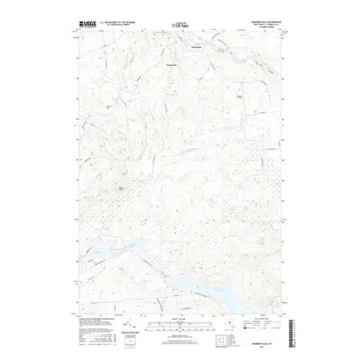
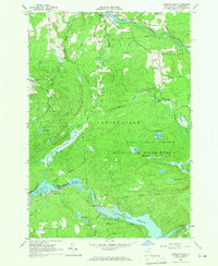 1964 Rainbow Falls1966 Print · USGSThe Raquette River corridor in St. Lawrence County shows a landscape defined by hydroelectric power and mid-century recreation in the mid-1960s. Researchers can trace the development of the Five Falls and Rainbow Falls reservoirs or locate local landmarks like the Boy Scout Camp and the settlement of Pickettville.3 unique versions available
 - 1964 Map of Parishville, 1966 Print
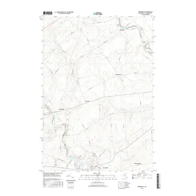
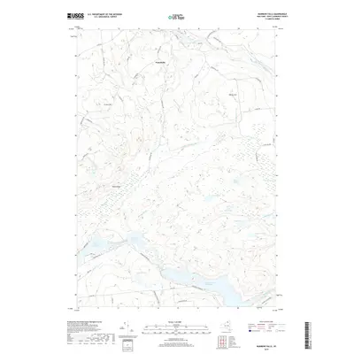
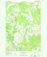 1964 Parishville1966 Print · USGSSt. Lawrence County in the mid-1960s is defined by its hydroelectric power along the river and deep-rooted rural hamlets. Genealogists and local historians can trace family locations near Parishville, Fairview Cem, and the Allen Falls Reservoir.3 unique versions available
 - 1985 Map of Massena
 1985 Massena1985 Print · USGSNorthern New York at the mid-eighties shows a landscape of river-driven industry and high mountain wilderness along the Canadian border. Researchers can trace the legacy of iron working and milling in Brasher Iron Works or follow the Raquette River through Massena and Potsdam.
 - 1994 Map of Massena
 1994 Massena1994 Print · USGSThe St. Lawrence River valley and northern Adirondacks meet in the mid-1990s, revealing a landscape of international shipping, rail corridors, and dense state forests. Genealogists and historians can trace the foundations of Massena, the St Regis Indian Reservation, and small hamlets like Brasher Iron Works.
 - 2010 Map of Rainbow Falls, 2010 Print
 2010 Rainbow Falls2010 Print · USGSCovers Parishville, including Colton, Hopkinton, and other nearby areas
 - 2010 Map of Parishville, 2010 Print
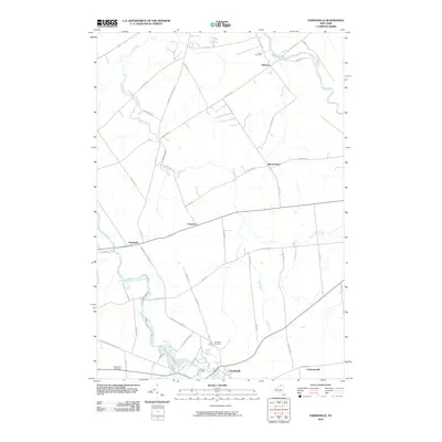 2010 Parishville2010 Print · USGSCovers Parishville, including Stockholm, Hopkinton, and other nearby areas
 - 2013 Map of Parishville, 2013 Print
 2013 Parishville2013 Print · USGSCovers Parishville, including Stockholm, Hopkinton, and other nearby areas
 - 2013 Map of Rainbow Falls, 2013 Print
 2013 Rainbow Falls2013 Print · USGSCovers Parishville, including Colton, Hopkinton, and other nearby areas
 - 2016 Map of Parishville, 2016 Print
 2016 Parishville2016 Print · USGSCovers Parishville, including Stockholm, Hopkinton, and other nearby areas
 - 2016 Map of Rainbow Falls, 2016 Print
 2016 Rainbow Falls2016 Print · USGSCovers Parishville, including Colton, Hopkinton, and other nearby areas
 - 2019 Map of Parishville, 2019 Print
 2019 Parishville2019 Print · USGSCovers Parishville, including Stockholm, Hopkinton, and other nearby areas
 - 2019 Map of Rainbow Falls, 2019 Print
 2019 Rainbow Falls2019 Print · USGSCovers Parishville, including Colton, Hopkinton, and other nearby areas
 - 2023 Map of Parishville, 2023 Print
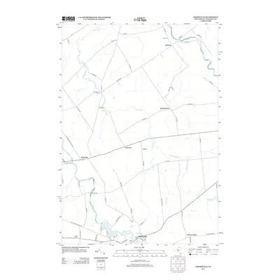
 2023 Parishville2023 Print · USGSSt. Lawrence County in the 2020s remains a landscape of river-fed hamlets and quiet northern woods. Genealogists can trace family footprints at Hillcrest Cem and Fairview Cem, or locate landmarks like Allen Falls and Catherineville.
 - 2023 Map of Rainbow Falls, 2023 Print
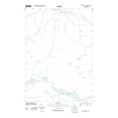
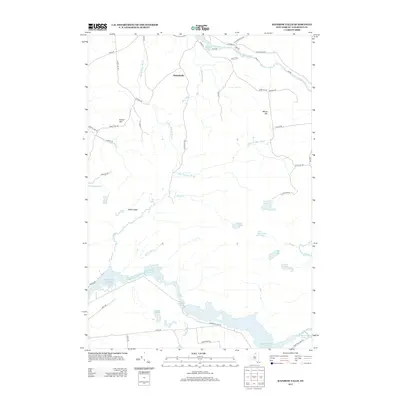
 2023 Rainbow Falls2023 Print · USGSIn this modern record of St. Lawrence County, the Raquette River corridor is defined by a chain of major reservoirs and the Adirondack Park Preserve. Researchers can trace old routes like Pickettville Rd and find secluded landmarks like Morgan Rapids or Hawk Ledge.
End of results
Showing maps 1-22 of 22
Top cities near Parishville
- Potsdam historical maps
- Potsdam historical maps
- Norfolk historical maps
- Stockholm historical maps
- Louisville historical maps
- Moira historical maps
See more
Frequently asked questions
- What are the different types of historical maps available for Parishville?
- What is the oldest map of Parishville?
- Where can I purchase historical maps of Parishville for my home or office?
- Where can I download high-res historical maps of Parishville?
- Are there historical topographic maps available for Parishville?
- Is there historical aerial imagery available for Parishville?
- Where are historical maps of Parishville sourced from?