Old Maps of Fort Edward, New York for Hiking & Exploration
Hike through history with 28 historic maps of Fort Edward. Explore old trails, ghost towns, and forgotten backroads — perfect for outdoor adventurers and local explorers.
- Rediscover forgotten places: Map out old mining camps, roads, and footpaths that no longer exist on modern maps.
- Layer with modern tools: Combine with LiDAR or satellite views to plan hikes through historical terrain.
- Made for exploration: Popular among hikers, overlanders, and local history lovers.
Use these maps to find adventure and explore the hidden past of Fort Edward.
Fort Edward, NY maps
(28)- 1895 Map of Glens Falls, 1955 Print
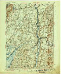
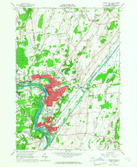
 1895 Glens Falls1955 Print · USGSThe Hudson River corridor and the southern tip of Lake George are seen here in the late nineteenth century. Researchers can trace military history at the Fort William Henry Ruins or find old industry at Griswolds Mills and Feeder Dam.
 - 1897 Map of Glens Falls
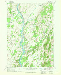
 1897 Glens Falls1897 Print · USGSThe upper Hudson River valley and the southern shores of Lake George are captured here during the late Victorian industrial era. Genealogists and historians can trace old homesteads and landmarks like the Fort Wm. Henry Ruins, Griswolds Mills, and the Delaware and Hudson RR corridor.9 unique versions available
 - 1900 Map of Schuylerville
 1900 Schuylerville1900 Print · USGSUpper Hudson Valley life at the close of the nineteenth century centers on the busy canal and river corridor. Researchers can trace the Champlain Canal through Schuylerville and Fort Miller, or locate family sites near the Saratoga Battle Field and Gansevoort.7 unique versions available
 - 1935 Map of Fort Miller
 1935 Fort Miller1935 Print · USGSThe Hudson River and its engineering works dominate this mid-1930s landscape along the border of Washington and Saratoga counties. Genealogists can locate family landmarks like Ellis Farm or trace ancestors through Fort Miller Cem and the numerous rural schoolhouses such as Argyle Sch.
 - 1938 Map of Glens Falls
 1938 Glens Falls1938 Print · USGSUpper Hudson Valley and Lake George history comes alive in this survey of a developing industrial and resort corridor. Researchers can locate colonial military sites like Fort George Ruins, early industry at Griswolds Mills, and the path of the Cable RR.
 - 1940 Map of Schuylerville
 1940 Schuylerville1940 Print · USGSSaratoga and Washington Counties are shown here just before the mid-century, defined by the industrial river towns and the grounds of the Saratoga Battlefield. Genealogists can trace family names at Clarks Corners or Quaker Springs and locate early 20th-century landmarks like the Saratoga Battle Monument.3 unique versions available
 - 1947 Map of Glens Falls
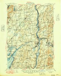
 1947 Glens Falls1947 Print · USGSThe upper Hudson Valley and the southern gateway to the Adirondacks are captured here during a period of robust industrial and rail growth. Researchers can trace historic fortifications like Fort George Ruins and identify old milling sites such as Pattens Mills and Griswolds Mills.
 - 1947 Map of Schuylerville, 1958 Print
 1947 Schuylerville1958 Print · USGSUpper Hudson Valley life and Revolutionary War heritage meet in the late 1940s. Trace the path of the Champlain Canal and find local landmarks like the Saratoga Battle Monument and the Fernwood Trout Hatchery.3 unique versions available
 - 1949 Map of Schuylerville
 1949 Schuylerville1949 Print · USGSUpper Hudson Valley life in the late nineteen-forties centers on the river and its canal, shortly after the national park was established. Genealogists and historians can trace family locations near Victory Mills, old rural burial grounds like Griswold Cem, and the Fernwood Trout Hatchery.
 - 1950 Map of Glens Falls
 1950 Glens Falls1950 Print · USGSThe Adirondacks and the Green Mountains meet in this mid-century survey of the New York and Vermont borderlands. Researchers can trace the industrial rail corridors of the Rutland RR and Delaware & Hudson RR connecting Glens Falls, Rutland, and the shores of Lake George.
 - 1955 Map of Glens Falls, 1958 Print
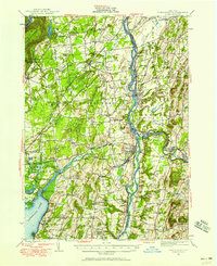
 1955 Glens Falls1958 Print · USGSThe Hudson River valley and the southern gateway to the Adirondacks are captured here in the mid-fifties. Genealogists and local historians can trace family plots at Union Cem, locate the Mud Street Sch, and explore the grounds of Fort William Henry.4 unique versions available
 - 1956 Map of Glens Falls, 1968 Print
 1956 Glens Falls1968 Print · USGSUpper New York and the Vermont mountains are captured here in the mid-fifties, showing the rugged rail-and-river network of the Northeast. Researchers can trace the paths of the Delaware and Hudson RR and Rutland RR as they wind through valley towns like Poultney and Whitehall.3 unique versions available
 - 1959 Map of Glens Falls
 1959 Glens Falls1959 Print · USGSUpper New York and Vermont are captured here during the late 1950s, a period of transition for these mountain communities. Researchers can trace the legacy of the region's river-and-rail economy through landmarks like Lake George, Saratoga Springs, and Killington Peak.2 unique versions available
 - 1964 Map of Glens Falls
 1964 Glens Falls1964 Print · USGSThe tri-state borderlands of New York, Vermont, and New Hampshire appear here in the mid-1960s. Researchers can trace the rail routes of the Rutland RR and find historic sites like Ticonderoga and Saratoga National Historical Park.
 - 1966 Map of Hudson Falls, 1968 Print
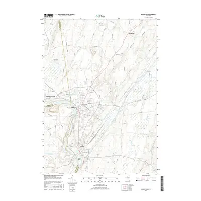
 1966 Hudson Falls1968 Print · USGSThe industrial riverfronts of Washington County are seen here in the mid-sixties as they grew around the historic locks and falls. Researchers can trace the path of the Champlain Canal, locate family plots in Union Cemetery, and see the early footprint of Adirondack Community College.3 unique versions available
 - 1967 Map of Ft Miller, 1970 Print
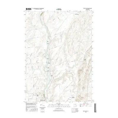
 1967 Ft Miller1970 Print · USGSThe Hudson River valley north of Schuylerville comes into focus in the late 1960s, showing a landscape shaped by river transport and upland farming. Researchers can trace the path of the Champlain Canal or locate family homesteads along Gavettes Road and Hunter Road.2 unique versions available
 - 1986 Map of Glens Falls
 1986 Glens Falls1986 Print · USGSThe Upper Hudson Valley and Vermont borderlands come together in this mid-eighties survey of industrial river towns and mountain retreats. Genealogists and historians can trace the rail lines of the Delaware and Hudson Railway or locate landmarks like the Mount McGregor Correctional Facility and Saratoga Spa State Park.2 unique versions available
 - 1989 Map of Glens Falls
 1989 Glens Falls1989 Print · USGSThe Upper Hudson Valley and the Vermont borderlands are captured here during the late eighties, showing a landscape of river-town industry and mountain recreation. Researchers can trace the Champlain Canal, the Delaware and Hudson RR, and historic sites like Saratoga National Historical Park.
 - 2010 Map of Fort Miller, 2010 Print
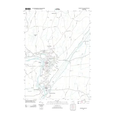
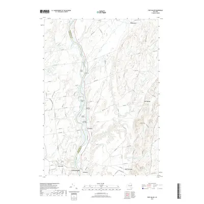
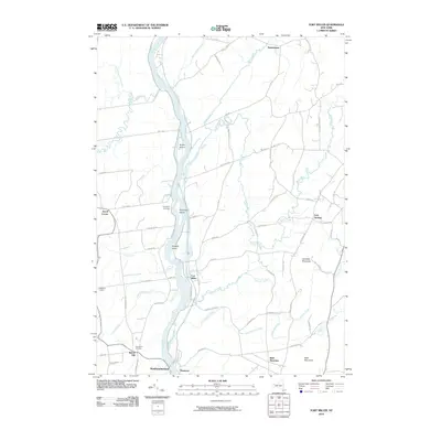 2010 Fort Miller2010 Print · USGSCovers Fort Edward, including Moreau, Northumberland, and other nearby areas
 - 2010 Map of Hudson Falls, 2010 Print
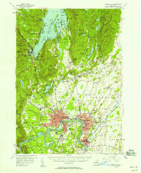
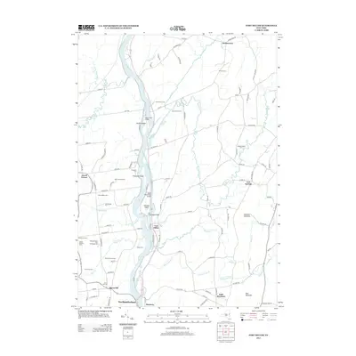
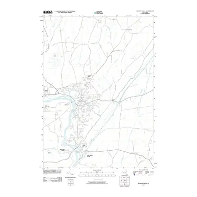 2010 Hudson Falls2010 Print · USGSCovers Fort Edward, including Queensbury, Moreau, and other nearby areas
 - 2013 Map of Hudson Falls, 2013 Print
 2013 Hudson Falls2013 Print · USGSCovers Fort Edward, including Queensbury, Moreau, and other nearby areas
 - 2013 Map of Fort Miller, 2013 Print
 2013 Fort Miller2013 Print · USGSCovers Fort Edward, including Moreau, Northumberland, and other nearby areas
 - 2016 Map of Fort Miller, 2016 Print
 2016 Fort Miller2016 Print · USGSCovers Fort Edward, including Moreau, Northumberland, and other nearby areas
 - 2016 Map of Hudson Falls, 2016 Print
 2016 Hudson Falls2016 Print · USGSCovers Fort Edward, including Queensbury, Moreau, and other nearby areas
 - 2019 Map of Fort Miller, 2019 Print
 2019 Fort Miller2019 Print · USGSCovers Fort Edward, including Moreau, Northumberland, and other nearby areas
Showing maps 1-25 of 28
Top cities near Fort Edward
- Queensbury historical maps
- Saratoga Springs historical maps
- Wilton historical maps
- Malta historical maps
- Moreau historical maps
- Glens Falls historical maps
See more
Top neighborhoods of Fort Edward
Frequently asked questions
- What are the different types of historical maps available for Fort Edward?
- What is the oldest map of Fort Edward?
- Where can I purchase historical maps of Fort Edward for my home or office?
- Where can I download high-res historical maps of Fort Edward?
- Are there historical topographic maps available for Fort Edward?
- Is there historical aerial imagery available for Fort Edward?
- Where are historical maps of Fort Edward sourced from?