Old Maps of Oak Island, North Carolina for Hiking & Exploration
Hike through history with 23 historic maps of Oak Island. Explore old trails, ghost towns, and forgotten backroads — perfect for outdoor adventurers and local explorers.
- Rediscover forgotten places: Map out old mining camps, roads, and footpaths that no longer exist on modern maps.
- Layer with modern tools: Combine with LiDAR or satellite views to plan hikes through historical terrain.
- Made for exploration: Popular among hikers, overlanders, and local history lovers.
Use these maps to find adventure and explore the hidden past of Oak Island.
Oak Island, NC maps
(23)- 1943 Map of Lockwoods Folly, 1962 Print
 1943 Lockwoods Folly1962 Print · USGSCoastal Brunswick County is shown here during the early 1940s, when the shoreline was defined by quiet landings and maritime forest. Genealogists and historians can trace family-named landmarks and old settlements like Varnum Town, Dixon Chapel, and Holden Beach.
 - 1944 Map of Lockwoods Folly
 1944 Lockwoods Folly1944 Print · USGSThe Brunswick County coast during the 1940s reveals a landscape of tidal marshes and quiet river landings before the era of modern development. Trace the maritime history of Varnum Town and follow family-named landmarks like Gores Ldg and the uniquely named Half Hell Road.
 - 1946 Map of Southport
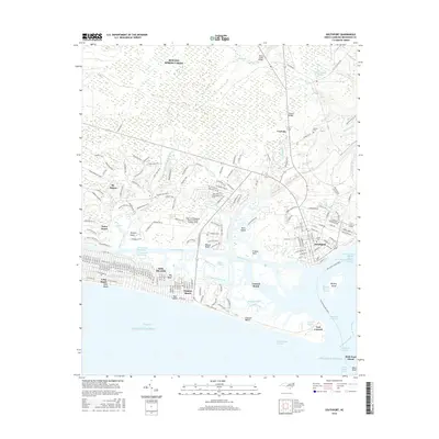
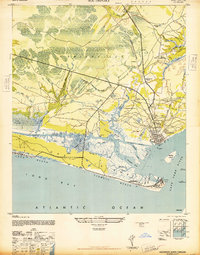 1946 Southport1946 Print · USGSImmediately following the war, this coastal area shows the intersection of maritime defense and river-based commerce. Researchers can trace family landmarks and civic sites like the Brunswick Co Home, Browns Ch, and the grounds of Fort Caswell.
 - 1949 Map of Georgetown, 1953 Print
 1949 Georgetown1953 Print · USGSThe South Carolina coast and North Carolina borderlands appear here in the mid-century, prior to the major modern development of the Grand Strand. Genealogists and historians can trace the rail networks of the Seaboard Air Line Railroad and locate coastal landmarks from Fort Caswell to McClellanville.
 - 1967 Map of Georgetown
 1967 Georgetown1967 Print · USGSThe South Carolina Lowcountry and Grand Strand meet in the late sixties, showcasing a coastal landscape transitioning from river-based industry to seaside tourism. Researchers can trace the Intracoastal Waterway past Georgetown or locate historical sites like Fort Fisher and Murrells Inlet.
 - 1969 Map of Southport
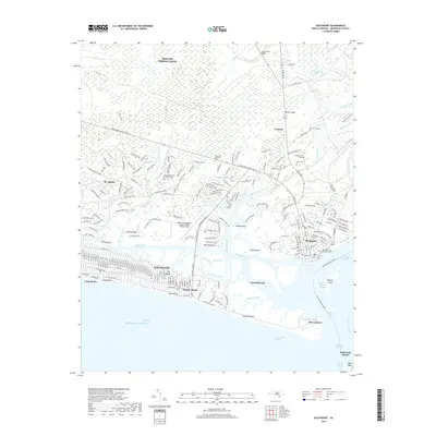
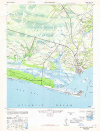 1969 Southport1969 Print · USGSThe mouth of the Cape Fear River and the surrounding marshes are captured here during a period of transition for coastal North Carolina. Genealogists and historians can locate family landmarks such as Browns Ch, the Brunswick Co Home, and the grounds of Fort Caswell.
 - 1974 Map of Georgetown, 1978 Print
 1974 Georgetown1978 Print · USGSThe Carolina coast and Pee Dee region are shown here in the mid-seventies, just as the Grand Strand was maturing into a premier destination. Researchers can trace the inland rail corridors of the Seaboard Coast Line Railroad or explore the coastal reaches of the Cape Romain National Wildlife Refuge and Myrtle Beach State Park.2 unique versions available
 - 1980 Map of Lockwoods Folly, 1985 Print
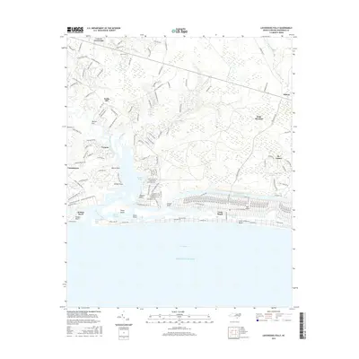
 1980 Lockwoods Folly1985 Print · USGSCoastal Brunswick County comes into focus in this early 1980s aerial survey, revealing the intersection of timberland, swamp, and sea. Genealogists and historians can trace the rural layouts of Varnum Town and Lennon Crossroads along the banks of the Lockwoods Folly River.
 - 1980 Map of Southport, 1985 Print
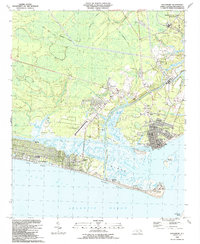
 1980 Southport1985 Print · USGSThe Brunswick County coast comes into focus in the early eighties, showing the transition from historic river ports to growing beach communities. Genealogists and historians can trace the foundations of Yaupon Beach, the fortifications at Fort Caswell, and the waterfront at Southport.
 - 1986 Map of Myrtle Beach
 1986 Myrtle Beach1986 Print · USGSThe Grand Strand and Brunswick County coast are captured in the mid-eighties before the late-century development boom. Researchers can trace the footprint of the Myrtle Beach Air Force Base and old coastal settlements like Atlantic Beach and Socastee.
 - 1990 Map of Myrtle Beach
 1990 Myrtle Beach1990 Print · USGSThe Grand Strand and the North Carolina borderlands are captured here in the decade before the base closure. Genealogists and historians can trace the development of Myrtle Beach and North Myrtle Beach alongside rural landmarks like Star Bluff Crossroads and Fort Caswell.
 - 1990 Map of Southport, 1991 Print
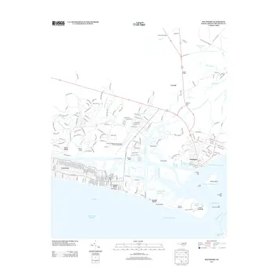
 1990 Southport1991 Print · USGSThe Brunswick County coast in the late eighties shows a dynamic mix of military heritage and beach community growth. Researchers can trace the development of Southport and Long Beach or locate family landmarks like St Peters Ch and Bethel Cem.
 - 1990 Map of Lockwoods Folly, 1991 Print
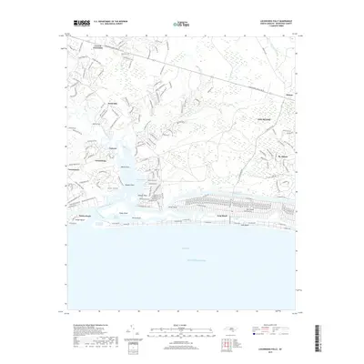
 1990 Lockwoods Folly1991 Print · USGSCoastal Brunswick County is captured in the late twentieth century as traditional river life met the rising tide of beach development. Trace the history of older communities like Varnamtown or search for family roots near Zion Hill Ch and Mercer Landing.
 - 2010 Map of Lockwoods Folly, 2010 Print
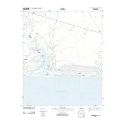 2010 Lockwoods Folly2010 Print · USGSCovers Oak Island, including Holden Beach, Varnamtown, and other nearby areas
 - 2010 Map of Southport, 2010 Print
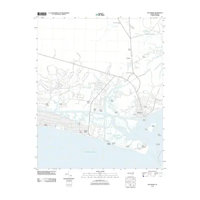 2010 Southport2010 Print · USGSCovers Oak Island, including Boiling Spring Lakes, Southport, and other nearby areas
 - 2013 Map of Lockwoods Folly, 2013 Print
 2013 Lockwoods Folly2013 Print · USGSCovers Oak Island, including Holden Beach, Varnamtown, and other nearby areas
 - 2013 Map of Southport, 2013 Print
 2013 Southport2013 Print · USGSCovers Oak Island, including Boiling Spring Lakes, Southport, and other nearby areas
 - 2016 Map of Southport, 2016 Print
 2016 Southport2016 Print · USGSCovers Oak Island, including Boiling Spring Lakes, Southport, and other nearby areas
 - 2016 Map of Lockwoods Folly, 2016 Print
 2016 Lockwoods Folly2016 Print · USGSCovers Oak Island, including Holden Beach, Varnamtown, and other nearby areas
 - 2019 Map of Southport, 2019 Print
 2019 Southport2019 Print · USGSCovers Oak Island, including Boiling Spring Lakes, Southport, and other nearby areas
 - 2019 Map of Lockwoods Folly, 2019 Print
 2019 Lockwoods Folly2019 Print · USGSCovers Oak Island, including Holden Beach, Varnamtown, and other nearby areas
 - 2022 Map of Southport, 2022 Print
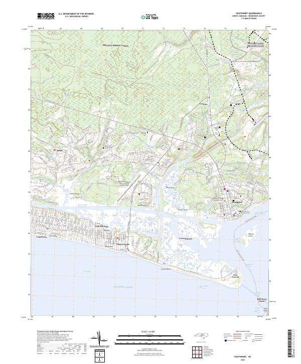 2022 Southport2022 Print · USGSCoastal Brunswick County comes into focus in this contemporary study of the Cape Fear estuary and its barrier islands. Researchers can trace family history through the Old Smithville Burying Ground and explore the grounds of Fort Caswell.
 - 2022 Map of Lockwoods Folly, 2022 Print
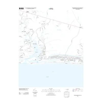
 2022 Lockwoods Folly2022 Print · USGSThe Brunswick County coast comes into sharp focus in this recent survey, showcasing the established beach communities and river settlements. Trace the residential growth of Oak Island and Holden Beach or locate inland landmarks like Lennon Crossroads and Mercers Mill Pond.
End of results
Showing maps 1-23 of 23
Top cities near Oak Island
- Boiling Spring Lakes historical maps
- Southport historical maps
- Shallotte historical maps
- Holden Beach historical maps
- Varnamtown historical maps
- Caswell Beach historical maps
See more
Top neighborhoods of Oak Island
Frequently asked questions
- What are the different types of historical maps available for Oak Island?
- What is the oldest map of Oak Island?
- Where can I purchase historical maps of Oak Island for my home or office?
- Where can I download high-res historical maps of Oak Island?
- Are there historical topographic maps available for Oak Island?
- Is there historical aerial imagery available for Oak Island?
- Where are historical maps of Oak Island sourced from?