1900s (20th Century) Maps of Buncombe County, North Carolina
Explore 95 historic maps of Buncombe County from the 1900s (20th Century). These maps offer a rare glimpse into what life looked like during the 1900s — showing old roads, neighborhoods, homes, and landmarks that have changed or disappeared over time.
Whether you're researching your family's past, planning a metal detecting trip, or studying how Buncombe County's landscape evolved across the 1900s, these high-resolution maps are a powerful tool for exploring the history of this region.
- Focus on a specific era: All maps on this page are from the 1900s, giving you a focused view of this time period.
- See what’s changed: Compare century-old streets, trails, and buildings to today's modern landscape using overlays and satellite layers.
- Research with precision: Use these maps for genealogy, historical research, land use analysis, or educational projects.
- View, download, or print: Maps are fully viewable online in high resolution, and can be downloaded or printed for your own records.
Start exploring Buncombe County's history through authentic maps from the 1900s. This is your window into the past.
Buncombe County, NC maps
(95)- 1900 Map of Mount Mitchell, 1963 Print
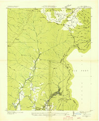
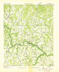
 1900 Mount Mitchell1963 Print · USGSWestern North Carolina at the turn of the century shows a landscape of high peaks and isolated river settlements before the arrival of modern highways. Genealogists and mountain historians can trace early homesteads along the Cane River or follow the Southern RR through Old Fort and Black Mountain.3 unique versions available
 - 1901 Map of Asheville
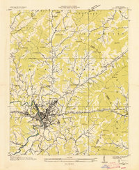
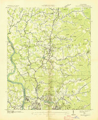
 1901 Asheville1901 Print · USGSWestern North Carolina at the turn of the century shows a mountain landscape adapting to the arrival of major railroads. Genealogists and historians can trace family-named peaks and early communities like Mars Hill, Hot Springs, and the estates at Biltmore.9 unique versions available
 - 1902 Map of Mount Mitchell, 1937 Print
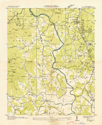
 1902 Mount Mitchell1937 Print · USGSThe high peaks of Western North Carolina are captured here at the start of the twentieth century, showing the rail and river corridors that shaped the region. Trace early settlements like Burnsville, Montreat, and the winding Southern Railway.3 unique versions available
 - 1905 Map of Pisgah, 1956 Print
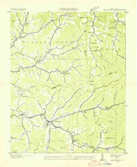
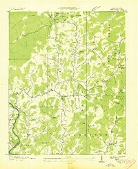
 1905 Pisgah1956 Print · USGSThe North Carolina high country around the turn of the century reveals a land of timber tracts and emerging mountain retreats. Genealogists and hikers can trace early routes to Buck Spring Lodge, follow the Southern RR tracks, and locate vanished settlements like Angeline and Calhoun.
 - 1906 Map of Pisgah, 1934 Print
 1906 Pisgah1934 Print · USGSThe Blue Ridge highlands at the turn of the century reveal a landscape of mountain river valleys and early timber frontiers. Genealogists and historians can trace family-named bridges and crossings like Graham Bridge or locate vanished settlements such as Grange and Retreat.2 unique versions available
 - 1907 Map of Saluda
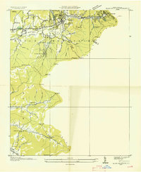
 1907 Saluda1907 Print · USGSNorth Carolina's mountain frontier meets the South Carolina foothills in this 1900s survey of the Blue Ridge. Genealogists and researchers can trace the early rail network through Saluda and locate old landmarks like Rockcliff PO and Pleasant Grove Church.3 unique versions available
 - 1935 Map of Cruso
 1935 Cruso1935 Print · USGSHigh in the Blue Ridge during the mid-thirties, the East Fork Pigeon River valley reveals a landscape of isolated mountain settlements and forest. Genealogists and hikers can trace old homesteads near Cruso, locate the Quinn Cem, and follow the original path of State Highway No 284.
 - 1935 Map of Montreat
 1935 Montreat1935 Print · USGSMontreat and the surrounding Black Mountains are shown here in the mid-1930s, documenting the area's religious centers and early park development. Genealogists and hikers can trace the Toll Road up to Clingmans Peak or locate old community landmarks like Brookside Sch and Homers Chapel.
 - 1935 Map of Canton
 1935 Canton1935 Print · USGSCanton and the surrounding Blue Ridge foothills are captured in detail during the mid-1930s as the railroad and river economy flourished. Genealogists can locate family landmarks like Roberson School, Piney Grove Church, and the settlement at Turnpike.
 - 1935 Map of Black Brothers
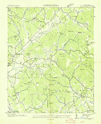
 1935 Black Brothers1935 Print · USGSThe high peaks of the Black Mountains dominate this mid-1930s survey of Yancey County. Local historians can trace the steep Aerial Tramway and old transport routes like the Toll Road connecting Pensacola to high-altitude landmarks like Camp Alice.
 - 1935 Map of Batcave
 1935 Batcave1935 Print · USGSThe Henderson County highlands come into focus in the mid-1930s as mountain communities like Edneyville organized around small rural hubs. Local researchers can trace family roots through landmarks like Edneyville Cem or search for old homesteads near Blue Ridge Ch and Raven Rock.
 - 1935 Map of Black Mountain
 1935 Black Mountain1935 Print · USGSBuncombe County in the mid-1930s reveals a landscape shaped by mountain transit and social institutions. Genealogists can locate family landmarks like Tabernacle Ch, Pleasant Grove Sch, and the remote Mountain Orphanage along the rail-and-river corridor.
 - 1935 Map of Barnardsville
 1935 Barnardsville1935 Print · USGSBarnardsville and the surrounding Blue Ridge foothills are captured in the mid-1930s before modern development altered these mountain hollows. Researchers can trace family roots through numerous burial sites like Whitaker Cem and locate vanished centers of community like Just PO and Sodom.
 - 1935 Map of Craggy Pinnacle
 1935 Craggy Pinnacle1935 Print · USGSThe high ridges of Buncombe County are captured here in the mid-1930s, showing a transition from remote mountain homesteads to early forestry and recreational sites. Genealogists can trace family names at Beetree Cem and Huey Cem, or locate landmarks like Camp Sequoyah and Union Valley Ch.
 - 1936 Map of Marshall
 1936 Marshall1936 Print · USGSMadison County's river-driven economy is on full display in the mid-1930s, centered on the tight bends of the French Broad River. Researchers can trace old mountain schools and community hubs like Madison Seminary, Redmon Dam, and the Old Station Cem.
 - 1936 Map of Sandymush
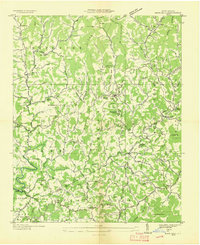
 1936 Sandymush1936 Print · USGSBuncombe and Madison Counties are captured in the mid-1930s as high-country communities transitioned toward modern road systems. Researchers can trace family roots through numerous mountain houses and rural landmarks like Sandymush Brick Ch, Gentrys Mill, and Lusk Chapel.
 - 1936 Map of Enka
 1936 Enka1936 Print · USGSMid-1930s Buncombe County comes into focus as the Hominy Creek valley begins its industrial transformation. Genealogists and local historians can trace the foundations of Enka, Candler, and vanished landmarks like the Pisgah Industrial Institute and Lake Ashnoca.
 - 1936 Map of Weaverville
 1936 Weaverville1936 Print · USGSBuncombe County in the mid-1930s shows a landscape of mountain settlements and river industry between Weaverville and Asheville. Genealogists and researchers can locate family landmarks like Garrison Cemetery and historic rural hubs such as Britten Cove School and Clarks Chapel.
 - 1936 Map of Skyland
 1936 Skyland1936 Print · USGSWestern North Carolina during the mid-thirties reveals a landscape of high ridges and developing river valleys. Genealogists and historians can trace local community roots through landmarks like Arden School, CCC Camp No 5, and Brickton Ch.
 - 1936 Map of Hepco
 1936 Hepco1936 Print · USGSHaywood and Madison counties are captured here in the mid-1930s, showing a landscape of high ridges and rural valley communities. Genealogists can trace family roots through landmarks like James Chapel Sch, Belmont Ch, and the settlement of Hepco near the Hepco Dam.
 - 1936 Map of Fruitland
 1936 Fruitland1936 Print · USGSThe Blue Ridge foothills of Henderson and Buncombe Counties come alive in the mid-1930s. Genealogists can trace family roots through the Fruitland Institute, Mountain Sanitarium, and rural sites like Tweed Chapel or Patty Chapel.
 - 1936 Map of Mars Hill
 1936 Mars Hill1936 Print · USGSMadison and Buncombe counties meet in this mid-1930s survey of the Blue Ridge foothills during a period of infrastructure expansion. Researchers can locate dozens of country landmarks like CCC Camp Joe, the Abandoned Power Dam, and Old Bull Creek Ch.
 - 1936 Map of Leicester
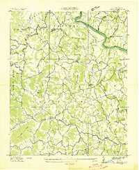 1936 Leicester1936 Print · USGSLeicester and the surrounding Buncombe County townships appear here during the mid-1930s, showing a landscape of mountain farming and river-bound industry. Genealogists can locate family landmarks like Gudger Chapel, Sluder Cem, and the Alexander School.
 - 1936 Map of Dunsmore Mountain
 1936 Dunsmore Mountain1936 Print · USGSThe Pisgah National Forest region comes alive in the mid-1930s, showing a landscape of remote mountain churches and early forest management. Genealogists can trace family landmarks like Kelly Cem, Stony Fork Sch, and the high-elevation Buck Spring Lodge.
 - 1936 Map of Asheville
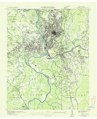 1936 Asheville1936 Print · USGSAsheville and its surrounding mountain townships are captured in detail during the mid-1930s as the city expanded along the river valleys. Researchers can trace historic family burial sites at Violet Hill Cem, locate the early grounds of Eliada Orphans Home, or explore the rail-dependent corridor of Murphy Junction.
Showing maps 1-25 of 95
Top cities of Buncombe County
- Asheville historical maps
- Black Mountain historical maps
- Swannanoa historical maps
- Woodfin historical maps
- Weaverville historical maps
- Biltmore Forest historical maps
See more
Frequently asked questions
- What are the different types of historical maps available for Buncombe County?
- What is the oldest map of Buncombe County?
- Where can I purchase historical maps of Buncombe County for my home or office?
- Where can I download high-res historical maps of Buncombe County?
- Are there historical topographic maps available for Buncombe County?
- Is there historical aerial imagery available for Buncombe County?
- Where are historical maps of Buncombe County sourced from?