Old Maps of Catawba County, North Carolina for Hiking & Exploration
Hike through history with 112 historic maps of Catawba County. Explore old trails, ghost towns, and forgotten backroads — perfect for outdoor adventurers and local explorers.
- Rediscover forgotten places: Map out old mining camps, roads, and footpaths that no longer exist on modern maps.
- Layer with modern tools: Combine with LiDAR or satellite views to plan hikes through historical terrain.
- Made for exploration: Popular among hikers, overlanders, and local history lovers.
Use these maps to find adventure and explore the hidden past of Catawba County.
Catawba County, NC maps
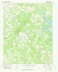
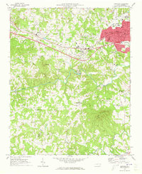
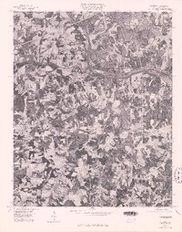
(112)- 1893 Map of Statesville, 1934 Print
 1893 Statesville1934 Print · USGSThe North Carolina Piedmont in the late nineteenth century was a landscape of river-powered industry and rail-connected crossroads. Researchers can trace ancestral locations through dozens of named mills like Ketchies Mill and historic crossings like Cornelius Ferry or Beattie Ford.2 unique versions available
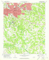
 - 1895 Map of Hickory
 1895 Hickory1895 Print · USGSThe North Carolina foothills come alive in the late nineteenth century as the rail lines reached Hickory and Newton. Genealogists can trace family roots through numerous country landmarks like Tuttle's Store, Emmanuel Church, and Cloninger's Mill.5 unique versions available
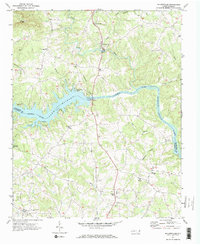
 - 1905 Map of Morganton, 1941 Print
 1905 Morganton1941 Print · USGSThe foothills and high peaks of the Blue Ridge come alive in the early twentieth century, centered on the growing towns of Morganton and Lenoir. Genealogists and historians can trace the early rail corridor of the Southern Railway and locate vanished landmarks like Arneys Store and Rutherford College.2 unique versions available
 - 1953 Map of Charlotte, 1968 Print
 1953 Charlotte1968 Print · USGSThe North Carolina Piedmont and South Carolina borderlands are shown in detail during a period of significant growth and reservoir development. Trace the rail corridors of the Southern Railway or find family roots in towns like China Grove, Misenheimer, and Lincolnton.3 unique versions available
 - 1954 Map of Charlotte
 1954 Charlotte1954 Print · USGSThe North Carolina Piedmont in the mid-1950s shows a region of rapid growth and industrial expansion centered around Charlotte. Trace the era's infrastructure through the Southern railroad lines and locate significant landmarks like the Charlotte Naval Ammunition Depot and Lake Norman.2 unique versions available
 - 1956 Map of Casar, 1958 Print
 1956 Casar1958 Print · USGSThe rural foothills of the South Mountains come alive in this mid-fifties study of the Cleveland and Lincoln county line. Genealogists and local historians can trace family land around Casar, Ramsey, and Shoups Ford or locate several country churches like Carpenters Grove Ch.2 unique versions available
 - 1960 Map of Charlotte
 1960 Charlotte1960 Print · USGSMid-century North Carolina and South Carolina meet in this 1960 survey of the Piedmont's industrial and textile heartland. Trace the growth of Charlotte alongside historic landmarks like Kings Mountain National Military Park and the Charlotte Naval Ammunition Depot.2 unique versions available
 - 1962 Map of Charlotte
 1962 Charlotte1962 Print · USGSThe North Carolina Piedmont in the early sixties showcases a landscape transformed by massive reservoirs and industrial growth. Researchers can trace the development of Lake Norman, locate the Charlotte Naval Ammunition Depot, or find family landmarks like Wesley Chapel and Brown & Norcott Mills.
 - 1969 Map of Troutman, 1972 Print
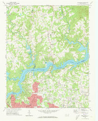
 1969 Troutman1972 Print · USGSIredell County is seen here in the late sixties as the rising waters of Lake Norman reshaped the Catawba River valley. Genealogists and local historians can trace the foundations of Troutman and Barium Springs, or locate rural landmarks like Pine Grove Cem and the Home for Children.
 - 1970 Map of Banoak, 1972 Print
 1970 Banoak1972 Print · USGSCatawba and Lincoln counties are shown here in the early seventies, a landscape of rolling Piedmont ridges and family farms. Researchers can trace local heritage through dozens of country landmarks like Cat Square, Hulls Crossroads, and the North Brook Sch No 3.
 - 1970 Map of Maiden, 1972 Print
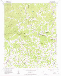
 1970 Maiden1972 Print · USGSMaiden and its surrounding Catawba County countryside appear in the early seventies as a thriving rail-centered community. Genealogists and local historians can trace family roots through numerous landmarks like Ivey Memorial Ch, Pumpkin Center, and the Providence Mill.2 unique versions available
 - 1970 Map of Lake Norman North, 1972 Print
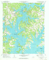 1970 Lake Norman North1972 Print · USGSThe northern reaches of Lake Norman are shown just years after the reservoir's creation, where you can trace the flooded Catawba River valley. Genealogists will find Webbs Chapel, Motto Grove Church, and the Brawley School.3 unique versions available
 - 1970 Map of Bethlehem, 1973 Print
 1970 Bethlehem1973 Print · USGSThe northern edge of Hickory and the waters of Lake Hickory come into sharp focus during this period of 1970s growth. Researchers can trace the development of lakeside communities like Bethlehem or locate family landmarks such as Isaac Creek Ch and Bentley Cem.
 - 1970 Map of Newton, 1973 Print
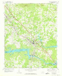
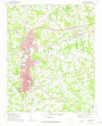 1970 Newton1973 Print · USGSCatawba County's industrial and civic heart comes into focus during the early seventies as expansion connects the rail-side communities. Genealogists and historians can trace numerous rural landmarks, from Old St Pauls Ch and Eastview Cem to the halls of Newton-Conover High Sch.
 - 1970 Map of Catawba, 1973 Print
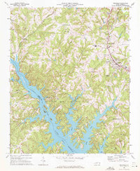
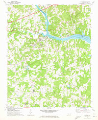 1970 Catawba1973 Print · USGSThe Catawba River valley in the early seventies shows the early years of Lake Norman and the rural communities of Iredell and Catawba counties. Genealogy and local history researchers can locate the Bunker Hill Covered Bridge, Murrays Mill, and the Catawba Rosenwald Sch.
 - 1970 Map of Denver, 1973 Print
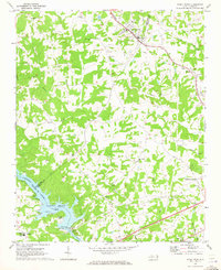
 1970 Denver1973 Print · USGSThe western Piedmont near the Catawba and Lincoln county line comes alive in the early 1970s, showing a landscape of traditional crossroads and rising lake waters. Genealogists can trace family roots through numerous local landmarks like Rock Springs Sch, Drums Crossroads, and Pooles Chapel.
 - 1970 Map of Granite Falls, 1973 Print
 1970 Granite Falls1973 Print · USGSCaldwell County's industrial and rural landscapes meet in the 1970s as the rail corridor drives growth between Granite Falls and Hudson. Genealogists and local historians can locate dozens of landmarks, from the Hudson Drag Strip to Bethel Ch and the Sunset Hyth Cem.
 - 1970 Map of Stony Point, 1973 Print
 1970 Stony Point1973 Print · USGSThe Alexander and Iredell County line comes alive in the early 1970s as the Alexander RR services rural rail stops. Local historians can trace the development of Lookout Shoals Lake and locate community hubs like Stony Point and Bunker Hill High Sch.2 unique versions available
 - 1970 Map of Reepsville, 1973 Print
 1970 Reepsville1973 Print · USGSCatawba and Lincoln Counties appear here in the early seventies, showing a landscape of established rural communities and winding Piedmont waterways. Genealogists can trace family roots through numerous sites like Wesleyan Chapel, Union Sch, and the settlement of Reepsville.
 - 1970 Map of Longview, 1973 Print
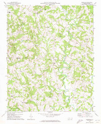
 1970 Longview1973 Print · USGSThe Burke and Catawba county line comes alive in the early 1970s as industrial towns and river-valley settlements expand. Genealogists and local historians can trace rural landmarks like Advent Crossroads, Burke Chapel, and Southwest Sch across this detailed terrain.
 - 1970 Map of Hickory, 1973 Print
 1970 Hickory1973 Print · USGSHickory and its surrounding Catawba County communities are captured here during a period of steady southward growth in the early seventies. Genealogists and local historians can trace family-named sites like Old Robinson Cem, Coulters Grove Ch, and the grounds of Lenoir Rhyne College.
 - 1970 Map of Millersville, 1973 Print
 1970 Millersville1973 Print · USGSIn the early 1970s, the Catawba River valley around the Alexander and Catawba county line saw a mix of industrial utility and new recreation. Local historians can trace family church sites like Bethel Ch and Oxford Ch alongside the industrial footprint of Oxford Dam.2 unique versions available
 - 1976 Map of Denver, 1978 Print
 1976 Denver1978 Print · USGSEastern Lincoln County is shown in the mid-seventies just as the landscape around the Catawba began to shift. Genealogists and local researchers can trace old family-named junctions like Drums Crossroads, Olivers Crossroads, and Killian Crossroads.
 - 1976 Map of Catawba, 1978 Print
 1976 Catawba1978 Print · USGSCatawba County in the mid-seventies is captured in this detailed orthophoto showing the rural Piedmont landscape. Genealogists and local historians can trace farmstead footprints and land use patterns around Catawba, Murrays Mill, and Bandy.
 - 1985 Map of Salisbury, 1986 Print
 1985 Salisbury1986 Print · USGSNorth Carolina’s industrial Piedmont region comes into focus during the mid-eighties as textile and rail towns expanded. Genealogists and historians can locate rural landmarks like Davidson College and Boones Cave State Park or trace the Southern Railway through Lexington and Salisbury.2 unique versions available
Showing maps 1-25 of 112
Top cities of Catawba County
- Hickory historical maps
- Newton historical maps
- Conover historical maps
- Long View historical maps
- Maiden historical maps
- Claremont historical maps
See more
Frequently asked questions
- What are the different types of historical maps available for Catawba County?
- What is the oldest map of Catawba County?
- Where can I purchase historical maps of Catawba County for my home or office?
- Where can I download high-res historical maps of Catawba County?
- Are there historical topographic maps available for Catawba County?
- Is there historical aerial imagery available for Catawba County?
- Where are historical maps of Catawba County sourced from?