
1970 Map of Millersville
USGS Topo · Published 1973About this map
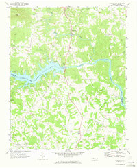
Lake Hickory and the Catawba River define this stretch of the Carolina Piedmont, where the 1970 landscape reveals a transition from traditional rural settlements to water-based recreation and industrial power. The Oxford Dam and its adjacent Powerplant harness the river's flow, creating the reservoir that supports Taylorsville Beach and several Campgrounds. Inland from the water, the map documents a dense network of local landmarks vital to genealogical research, including the Wittenburg Sch and numerous country congregations such as St Johns Ch, Friendship Ch, and Smyrna Ch.
Find a feature on this map
42 named features on this map. Tap any name to fly to it.
Don’t see what you’re looking for? This feature index may not catch every label — zoom into the map to look around manually.
Map Details
Editions of this 1970 Millersville Map
2 editions found
Other maps of this area

1895 · Hickory
USGS Topo · 1:125,000

1953 · Charlotte
USGS Topo · 1:250,000

1954 · Charlotte
USGS Topo · 1:250,000

1960 · Charlotte
USGS Topo · 1:250,000

1962 · Charlotte
USGS Topo · 1:250,000
1970 · Hiddenite
USGS Topo · 1:24,000

1970 · Bethlehem
USGS Topo · 1:24,000

1970 · Newton
USGS Topo · 1:24,000
1970 · Catawba
USGS Topo · 1:24,000
1970 · Ellendale
USGS Topo · 1:24,000