1970s Maps of Sherrills Ford, North Carolina
Explore 5 historic maps of Sherrills Ford from the 1970s. These maps offer a rare glimpse into what life looked like during the 1970s — showing old roads, neighborhoods, homes, and landmarks that have changed or disappeared over time.
Whether you're researching your family's past, planning a metal detecting trip, or studying how Sherrills Ford's landscape evolved across the 1970s, these high-resolution maps are a powerful tool for exploring the history of this region.
- Focus on a specific era: All maps on this page are from the 1970s, giving you a focused view of this time period.
- See what’s changed: Compare century-old streets, trails, and buildings to today's modern landscape using overlays and satellite layers.
- Research with precision: Use these maps for genealogy, historical research, land use analysis, or educational projects.
- View, download, or print: Maps are fully viewable online in high resolution, and can be downloaded or printed for your own records.
Start exploring Sherrills Ford's history through authentic maps from the 1970s. This is your window into the past.
Sherrills Ford, NC maps
(5)- 1970 Map of Lake Norman North, 1972 Print
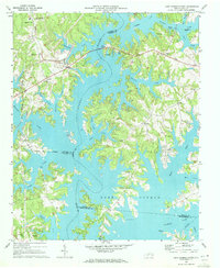 1970 Lake Norman North1972 Print · USGSThe northern reaches of Lake Norman are shown just years after the reservoir's creation, where you can trace the flooded Catawba River valley. Genealogists will find Webbs Chapel, Motto Grove Church, and the Brawley School.3 unique versions available
 - 1970 Map of Catawba, 1973 Print
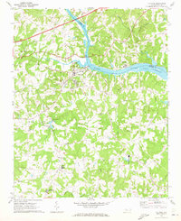 1970 Catawba1973 Print · USGSThe Catawba River valley in the early seventies shows the early years of Lake Norman and the rural communities of Iredell and Catawba counties. Genealogy and local history researchers can locate the Bunker Hill Covered Bridge, Murrays Mill, and the Catawba Rosenwald Sch.
 - 1970 Map of Denver, 1973 Print
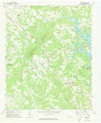 1970 Denver1973 Print · USGSThe western Piedmont near the Catawba and Lincoln county line comes alive in the early 1970s, showing a landscape of traditional crossroads and rising lake waters. Genealogists can trace family roots through numerous local landmarks like Rock Springs Sch, Drums Crossroads, and Pooles Chapel.
 - 1976 Map of Denver, 1978 Print
 1976 Denver1978 Print · USGSEastern Lincoln County is shown in the mid-seventies just as the landscape around the Catawba began to shift. Genealogists and local researchers can trace old family-named junctions like Drums Crossroads, Olivers Crossroads, and Killian Crossroads.
 - 1976 Map of Catawba, 1978 Print
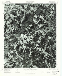
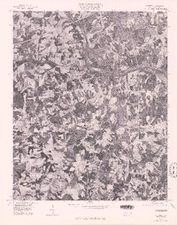 1976 Catawba1978 Print · USGSCatawba County in the mid-seventies is captured in this detailed orthophoto showing the rural Piedmont landscape. Genealogists and local historians can trace farmstead footprints and land use patterns around Catawba, Murrays Mill, and Bandy.
End of results
Showing maps 1-5 of 5
Top cities near Sherrills Ford
- Charlotte historical maps
- Huntersville historical maps
- Kannapolis historical maps
- Mooresville historical maps
- Statesville historical maps
- Cornelius historical maps
See more
Top neighborhoods of Sherrills Ford
Frequently asked questions
- What are the different types of historical maps available for Sherrills Ford?
- What is the oldest map of Sherrills Ford?
- Where can I purchase historical maps of Sherrills Ford for my home or office?
- Where can I download high-res historical maps of Sherrills Ford?
- Are there historical topographic maps available for Sherrills Ford?
- Is there historical aerial imagery available for Sherrills Ford?
- Where are historical maps of Sherrills Ford sourced from?