1970s Maps of Shelby, North Carolina
Explore 5 historic maps of Shelby from the 1970s. These maps offer a rare glimpse into what life looked like during the 1970s — showing old roads, neighborhoods, homes, and landmarks that have changed or disappeared over time.
Whether you're researching your family's past, planning a metal detecting trip, or studying how Shelby's landscape evolved across the 1970s, these high-resolution maps are a powerful tool for exploring the history of this region.
- Focus on a specific era: All maps on this page are from the 1970s, giving you a focused view of this time period.
- See what’s changed: Compare century-old streets, trails, and buildings to today's modern landscape using overlays and satellite layers.
- Research with precision: Use these maps for genealogy, historical research, land use analysis, or educational projects.
- View, download, or print: Maps are fully viewable online in high resolution, and can be downloaded or printed for your own records.
Start exploring Shelby's history through authentic maps from the 1970s. This is your window into the past.
Shelby, NC maps
(5)- 1971 Map of Blacksburg North, 1974 Print
 1971 Blacksburg North1974 Print · USGSThe Carolina borderlands come into focus in the early 1970s as the river-driven industry of the Piedmont matures. Researchers can trace family-named landmarks and rural centers like Patterson Springs, Old Falls Chapel, and the Stice Shoals Dam.
 - 1973 Map of Waco, 1976 Print
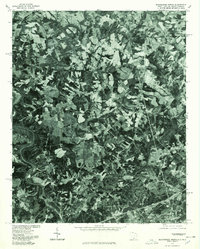
 1973 Waco1976 Print · USGSCleveland County and the Gaston County border are captured here in the early seventies as the local landscape transitioned toward modern recreation and industry. Researchers can find numerous country landmarks like Washington Sch, Hullender Cem, and the Seaboard Coast Line railroad.
 - 1976 Map of Shelby SE, 1978 Print
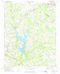
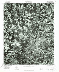 1976 Shelby SE1978 Print · USGSShelby was a hub of North Carolina textile production in the mid-seventies, surrounded by a changing Piedmont landscape. Trace the footprints of the Ora Mill and Dover Mill or follow the path of the Broad River.
 - 1976 Map of Blacksburg North, 1978 Print
 1976 Blacksburg North1978 Print · USGSThe borderlands of the Carolinas are captured in this mid-seventies aerial survey, showing the landscape as it transitioned toward modern development. Researchers can trace land use patterns around Blacksburg and locate historical structures near Earl and Patterson Springs.
 - 1976 Map of Waco, 1978 Print
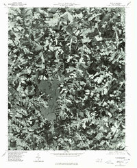 1976 Waco1978 Print · USGSCleveland County lands and the nascent shoreline of Kings Mountain Reservoir appear in this mid-seventies aerial survey. Researchers can trace the exact footprint of farms and woodlots surrounding Waco, Stubbs, and Oak Grove.
End of results
Showing maps 1-5 of 5
Top cities near Shelby
- Gaffney historical maps
- Kings Mountain historical maps
- Cherryville historical maps
- Boiling Springs historical maps
- Blacksburg historical maps
- Belwood historical maps
See more
Top neighborhoods of Shelby
- Country Club Gardens historical maps
- Idlewild Terrace Apartments historical maps
- Valleyhall historical maps
- Village Square Townhouses historical maps
- Lake Street Apartments historical maps
- Washington Heights historical maps
See more
Frequently asked questions
- What are the different types of historical maps available for Shelby?
- What is the oldest map of Shelby?
- Where can I purchase historical maps of Shelby for my home or office?
- Where can I download high-res historical maps of Shelby?
- Are there historical topographic maps available for Shelby?
- Is there historical aerial imagery available for Shelby?
- Where are historical maps of Shelby sourced from?