Old Maps of Cleveland County, North Carolina
Explore 52 old maps of Cleveland County, spanning from 1895 to today. These high-resolution historic maps reveal how streets, neighborhoods, landmarks, and natural features evolved over time — perfect for genealogy, metal detecting, research, and local history exploration.
What you can do with these maps:
- See how Cleveland County changed over time: Compare historical maps to modern-day views to trace roads, homesites, rail lines & more.
- View detailed metadata: Each map includes creators, publishers, year, scale, and archive source.
- Overlay maps with satellite & LiDAR: Visualize the past alongside modern tools to explore terrain & human change.
- Trusted historical sources: Maps sourced from the USGS, Library of Congress, and other archives.
- Access maps your way: View online, download high-res files, or order prints for personal or research use.
Start exploring old maps of Cleveland County to uncover forgotten places, hidden landmarks, and the deep history beneath your feet.
Cleveland County, NC maps
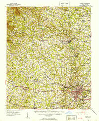
(52)- 1895 Map of Hickory
 1895 Hickory1895 Print · USGSCovers Cleveland County, including Hickory, Lenoir, and other nearby areas5 unique versions available
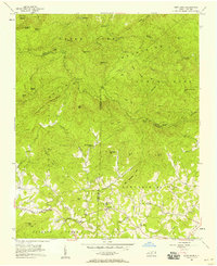
 - 1905 Map of Morganton, 1941 Print
 1905 Morganton1941 Print · USGSCovers Cleveland County, including Lenoir, Morganton, and other nearby areas2 unique versions available
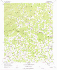
 - 1906 Map of Kings Mountain, 1970 Print
 1906 Kings Mountain1970 Print · USGSCovers Cleveland County, including Gastonia, Kings Mountain, and other nearby areas
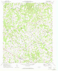
 - 1908 Map of Kings Mountain
 1908 Kings Mountain1908 Print · USGSCovers Cleveland County, including Gastonia, Kings Mountain, and other nearby areas6 unique versions available
 - 1909 Map of Gaffney
 1909 Gaffney1909 Print · USGSCovers Cleveland County, including Shelby, Gaffney, and other nearby areas4 unique versions available
 - 1909 Map of Lincolnton, 1968 Print
 1909 Lincolnton1968 Print · USGSCovers Cleveland County, including Gastonia, Shelby, and other nearby areas
 - 1911 Map of Lincolnton, 1944 Print
 1911 Lincolnton1944 Print · USGSCovers Cleveland County, including Gastonia, Shelby, and other nearby areas
 - 1950 Map of Shelby, 1952 Print
 1950 Shelby1952 Print · USGSCovers Cleveland County, including Shelby, Boiling Springs, and other nearby areas2 unique versions available
 - 1953 Map of Charlotte, 1968 Print
 1953 Charlotte1968 Print · USGSCovers Cleveland County, including Charlotte, Winston-Salem, and other nearby areas3 unique versions available
 - 1954 Map of Charlotte
 1954 Charlotte1954 Print · USGSCovers Cleveland County, including Charlotte, Winston-Salem, and other nearby areas2 unique versions available
 - 1956 Map of Benn Knob, 1958 Print
 1956 Benn Knob1958 Print · USGSCovers Cleveland County, including Casar, New Home, and other nearby areas2 unique versions available
 - 1956 Map of Casar, 1958 Print
 1956 Casar1958 Print · USGSCovers Cleveland County, including Belwood, Casar, and other nearby areas2 unique versions available
 - 1959 Map of Cowpens, 1961 Print
 1959 Cowpens1961 Print · USGSCovers Cleveland County, including Cowpens, Chesnee, and other nearby areas2 unique versions available
 - 1960 Map of Charlotte
 1960 Charlotte1960 Print · USGSCovers Cleveland County, including Charlotte, Winston-Salem, and other nearby areas2 unique versions available
 - 1962 Map of Charlotte
 1962 Charlotte1962 Print · USGSCovers Cleveland County, including Charlotte, Winston-Salem, and other nearby areas
 - 1970 Map of Banoak, 1972 Print
 1970 Banoak1972 Print · USGSCovers Cleveland County, including Belwood, Vale, and other nearby areas
 - 1971 Map of Kings Mountain, 1973 Print
 1971 Kings Mountain1973 Print · USGSCovers Cleveland County, including Gastonia, Kings Mountain, and other nearby areas
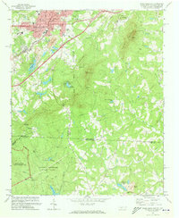
 - 1971 Map of Boiling Springs South, 1973 Print
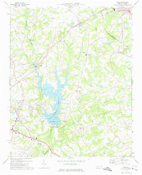
 1971 Boiling Springs South1973 Print · USGSCovers Cleveland County, including Boiling Springs, Maud, and other nearby areas3 unique versions available
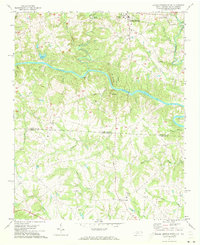
 - 1971 Map of Blacksburg North, 1974 Print
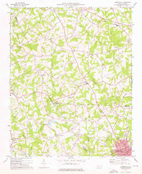
 1971 Blacksburg North1974 Print · USGSCovers Cleveland County, including Shelby, Blacksburg, and other nearby areas
 - 1971 Map of Grover, 1974 Print
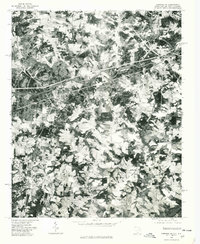
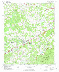 1971 Grover1974 Print · USGSCovers Cleveland County, including Kings Mountain, Grover, and other nearby areas2 unique versions available
 - 1973 Map of Bessemer City, 1976 Print
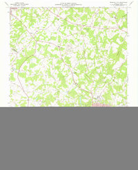 1973 Bessemer City1976 Print · USGSCovers Cleveland County, including Gastonia, Kings Mountain, and other nearby areas
 - 1973 Map of Cherryville, 1976 Print
 1973 Cherryville1976 Print · USGSCovers Cleveland County, including Cherryville, Belwood, and other nearby areas
 - 1973 Map of Waco, 1976 Print
 1973 Waco1976 Print · USGSCovers Cleveland County, including Shelby, Kings Mountain, and other nearby areas
 - 1975 Map of Cowpens NE, 1979 Print
 1975 Cowpens NE1979 Print · USGSCovers Cleveland County, including Chesnee, Cliffside, and other nearby areas
 - 1976 Map of Boiling Springs South, 1978 Print
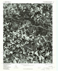 1976 Boiling Springs South1978 Print · USGSCovers Cleveland County, including Boiling Springs, Maud, and other nearby areas
Showing maps 1-25 of 52
Top cities of Cleveland County
- Shelby historical maps
- Kings Mountain historical maps
- Boiling Springs historical maps
- Belwood historical maps
- Kingstown historical maps
- Grover historical maps
See more
Frequently asked questions
- What are the different types of historical maps available for Cleveland County?
- What is the oldest map of Cleveland County?
- Where can I purchase historical maps of Cleveland County for my home or office?
- Where can I download high-res historical maps of Cleveland County?
- Are there historical topographic maps available for Cleveland County?
- Is there historical aerial imagery available for Cleveland County?
- Where are historical maps of Cleveland County sourced from?