2020s Maps of Gaston County, North Carolina
Explore 13 historic maps of Gaston County from the 2020s. These maps offer a rare glimpse into what life looked like during the 2020s — showing old roads, neighborhoods, homes, and landmarks that have changed or disappeared over time.
Whether you're researching your family's past, planning a metal detecting trip, or studying how Gaston County's landscape evolved across the 2020s, these high-resolution maps are a powerful tool for exploring the history of this region.
- Focus on a specific era: All maps on this page are from the 2020s, giving you a focused view of this time period.
- See what’s changed: Compare century-old streets, trails, and buildings to today's modern landscape using overlays and satellite layers.
- Research with precision: Use these maps for genealogy, historical research, land use analysis, or educational projects.
- View, download, or print: Maps are fully viewable online in high resolution, and can be downloaded or printed for your own records.
Start exploring Gaston County's history through authentic maps from the 2020s. This is your window into the past.
Gaston County, NC maps
(13)- 2022 Map of Lowesville, 2022 Print
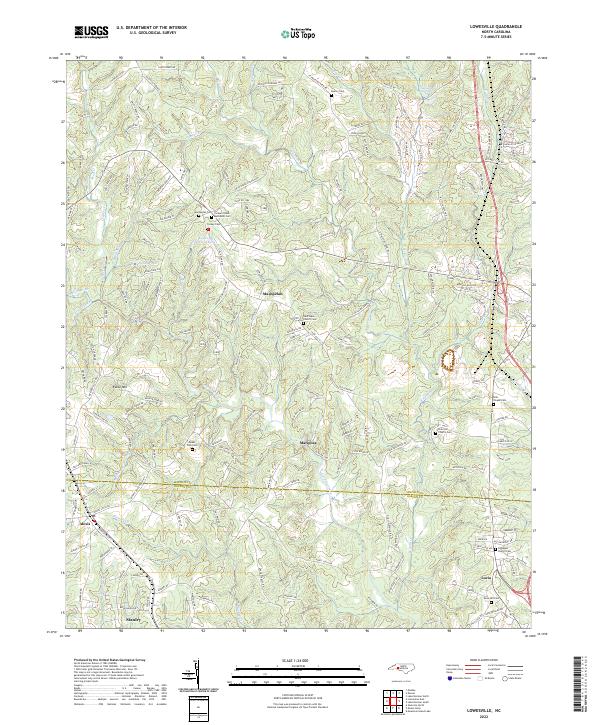 2022 Lowesville2022 Print · USGSThe Piedmont landscape of Lincoln and Gaston Counties comes into focus in this recent study of the Catawba Springs area. Genealogists can trace family burial sites across Machpelah Cem, Tuckers Grove Methodist Cem, and Snow Hill Cem.
 - 2022 Map of Lincolnton East, 2022 Print
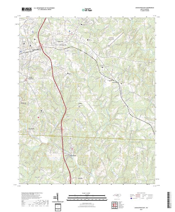 2022 Lincolnton East2022 Print · USGSEastern Lincoln County and northern Gaston County appear in the early 2020s as a mix of industrial centers and rural crossroads. Local historians can trace the community life of Iron Station and High Shoals or locate family plots at Salem Cem and Pearl Church Cem.
 - 2022 Map of Bessemer City, 2022 Print
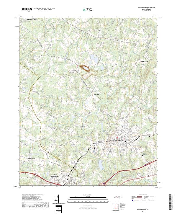 2022 Bessemer City2022 Print · USGSBessemer City and its neighbors in Gaston and Cleveland Counties are captured here during a period of modern regional growth. Researchers can trace the boundaries of Bessemer City and Kings Mountain, or locate sites like Westview Gardens Cem and Tryon.
 - 2022 Map of Mount Holly, 2022 Print
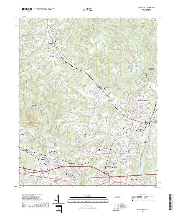 2022 Mount Holly2022 Print · USGSThe Gaston County textile corridor is captured here in the early 2020s, showcasing the river-driven development of McAdenville and Mount Holly. Researchers can locate family landmarks like Mauney Cem and explore the historic grounds of Belmont Abbey College.
 - 2022 Map of Cherryville, 2022 Print
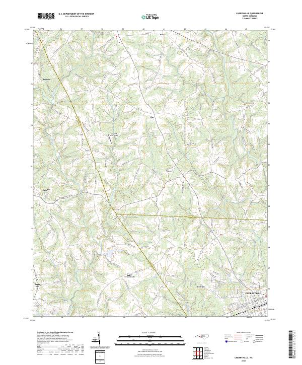 2022 Cherryville2022 Print · USGSThe foothills of the Piedmont are mapped here in the early 2020s, showcasing the intersection of Gaston, Cleveland, and Lincoln counties. Genealogists and local historians can trace family landmarks and rural crossroads like Baker Crossroads, Beam Mill, and the small community of Dellview.
 - 2022 Map of Lincolnton West, 2022 Print
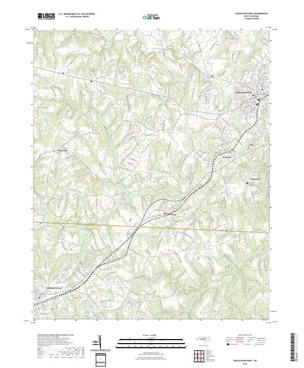 2022 Lincolnton West2022 Print · USGSThe rural landscapes between Lincolnton and Cherryville are shown here in modern detail, from the banks of the South Fork Catawba River to local crossroads. Genealogists can locate several historic burial grounds including Old White Church Cem and the Laboratory Methodist Church Cem.
 - 2022 Map of Gastonia South, 2022 Print
 2022 Gastonia South2022 Print · USGSThe North and South Carolina border comes alive in this recent survey of the corridor between GASTONIA and CLOVER. Researchers can locate family landmarks like Olney Church Cem, Mount Pleasant Church, and the distinctive community of Boogertown.
 - 2022 Map of Kings Mountain, 2022 Print
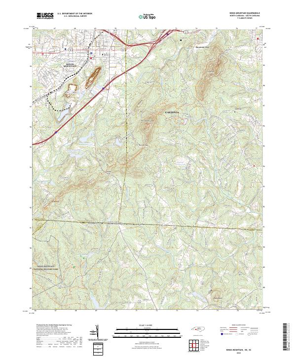 2022 Kings Mountain2022 Print · USGSThe borderlands of Cleveland and York counties come alive in this survey of the peaks and valleys surrounding the Revolutionary War site. Researchers can trace family sites near Mountain Rest Cem, the waters of Lake Montonia, and the heights of The Pinnacle.
 - 2022 Map of Belmont, 2022 Print
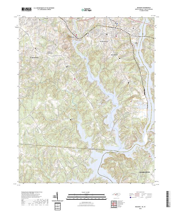 2022 Belmont2022 Print · USGSBelmont and the Catawba River corridor are captured here at a time of significant suburban development along the North Carolina border. Researchers can trace local genealogy through several listed burial sites like Mount Pleasant Cem and New Hope Church Cem or locate regional landmarks like Berry Mtn.
 - 2022 Map of Waco, 2022 Print
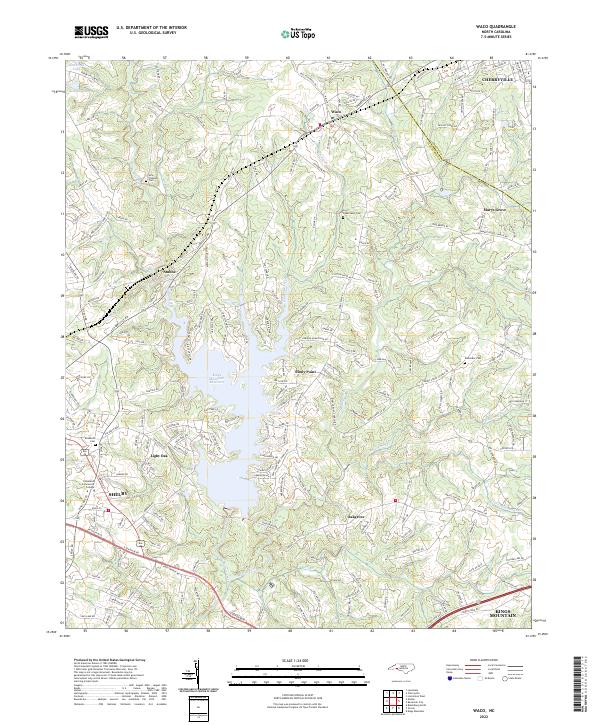 2022 Waco2022 Print · USGSIn the early 2020s, the landscape around Cleveland and Gaston counties reflects a blend of residential growth and rural heritage. Genealogists can trace local landmarks like New Prospect Cem, Hullender Cem, and the communities of Stubbs and Stony Point.
 - 2022 Map of Gastonia North, 2022 Print
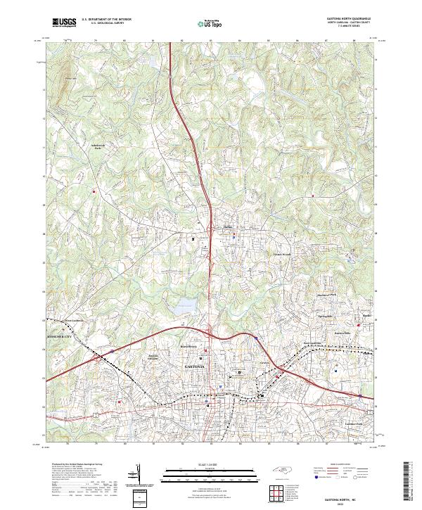 2022 Gastonia North2022 Print · USGSGaston County is shown in detail during its modern period of growth and suburban expansion. Researchers can trace family history through numerous local sites including Rose Hill Cem, Philadelphia Church, and the Gaston County Courthouse.
 - 2022 Map of Lake Norman South, 2022 Print
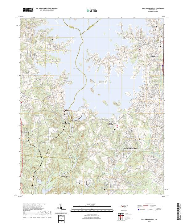 2022 Lake Norman South2022 Print · USGSMecklenburg and Lincoln counties are shown during a period of significant suburban expansion around the Lake Norman shoreline. Genealogists can trace family heritage through numerous burial sites including Caldwell Presbyterian Cem and Ebenezer Cem.
 - 2023 Map of Mountain Island Lake, 2023 Print
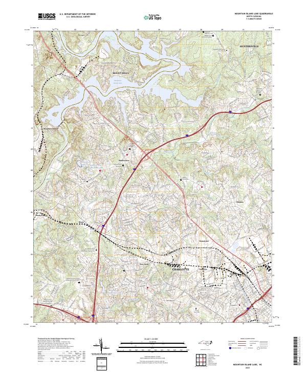 2023 Mountain Island Lake2023 Print · USGSMecklenburg and Gaston Counties are captured here in the early 2020s as the suburbs of Charlotte reach toward the Catawba River. Researchers can locate many family burial sites including Hopewell Presbyterian Church Cem and Lawing School Road Cem near Shuffletown.
End of results
Showing maps 1-13 of 13
Top cities of Gaston County
- Gastonia historical maps
- Mount Holly historical maps
- Belmont historical maps
- Cherryville historical maps
- Bessemer City historical maps
- Dallas historical maps
See more
Frequently asked questions
- What are the different types of historical maps available for Gaston County?
- What is the oldest map of Gaston County?
- Where can I purchase historical maps of Gaston County for my home or office?
- Where can I download high-res historical maps of Gaston County?
- Are there historical topographic maps available for Gaston County?
- Is there historical aerial imagery available for Gaston County?
- Where are historical maps of Gaston County sourced from?