1950s Maps of Graham County, North Carolina
Explore 9 historic maps of Graham County from the 1950s. These maps offer a rare glimpse into what life looked like during the 1950s — showing old roads, neighborhoods, homes, and landmarks that have changed or disappeared over time.
Whether you're researching your family's past, planning a metal detecting trip, or studying how Graham County's landscape evolved across the 1950s, these high-resolution maps are a powerful tool for exploring the history of this region.
- Focus on a specific era: All maps on this page are from the 1950s, giving you a focused view of this time period.
- See what’s changed: Compare century-old streets, trails, and buildings to today's modern landscape using overlays and satellite layers.
- Research with precision: Use these maps for genealogy, historical research, land use analysis, or educational projects.
- View, download, or print: Maps are fully viewable online in high resolution, and can be downloaded or printed for your own records.
Start exploring Graham County's history through authentic maps from the 1950s. This is your window into the past.
Graham County, NC maps
(9)- 1953 Map of Chattanooga
 1953 Chattanooga1953 Print · USGSSoutheast Tennessee in the early fifties shows a landscape reshaped by river management and rail power. Trace the rail lines of the Southern Ry through riverside towns or locate the preserved grounds of the Chickamauga and Chattanooga National Military Park.
 - 1955 Map of Knoxville
 1955 Knoxville1955 Print · USGSThe Southern Appalachians and the Smoky Mountains are shown here at a peak of mid-century development and conservation. Genealogists and historians can trace the early road networks connecting Gatlinburg, Waynesville, and the Cherokee Indian Reservation across the high ridges.
 - 1957 Map of Mc Daniel Bald, 1958 Print
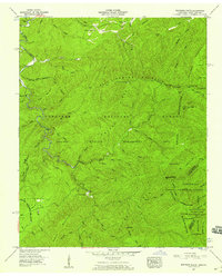
 1957 Mc Daniel Bald1958 Print · USGSCherokee County’s high ridges and national forest lands are captured in the late fifties as the Joe Brown Highway connected remote valley settlements. Researchers can trace family roots at Bryson Cemetery or locate old community centers like Grandview and White Church School.3 unique versions available
 - 1957 Map of Big Junction, 1959 Print
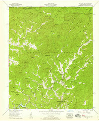
 1957 Big Junction1959 Print · USGSHigh in the Unicoi Mountains during the late fifties, this area shows the rugged meeting of the Tennessee and North Carolina borders. Researchers can locate the Hemlock Knob Lookout Tower, the Bemis Logging Camp, and the specialized Pheasant Field Rearing Pools.4 unique versions available
 - 1957 Map of Topton, 1959 Print
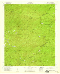
 1957 Topton1959 Print · USGSThe high mountain country of Macon and Cherokee counties is shown here during the peak of mid-century hydroelectric development. Genealogists and hikers can trace the Southern railroad through Topton or locate the remote Nantahala No 2 Ch near the reservoir.3 unique versions available
 - 1957 Map of Whiteoak Flats, 1959 Print
 1957 Whiteoak Flats1959 Print · USGSThe Unicoi Mountains and Cherokee National Forest are captured in detail during the late 1950s. Genealogists and historians can locate the Tallassee Sch, Pleasant Grove Ch, and landmarks like the Citico Warden Station.5 unique versions available
 - 1957 Map of Knoxville, 1966 Print
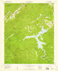
 1957 Knoxville1966 Print · USGSThe Southern Appalachians of Tennessee and North Carolina are mapped here during the mid-twentieth century as new highways reached the high country. Genealogists and historians can trace the topography between Knoxville and Asheville, locating family landmarks near Fontana Lake or along the Blue Ridge Parkway.4 unique versions available
 - 1957 Map of Chattanooga, 1966 Print
 1957 Chattanooga1966 Print · USGSEast Tennessee in the mid-1960s shows a landscape of massive hydroelectric reservoirs and emerging industrial sites like the Atomic Energy Commission (Oak Ridge Area). Trace the rail networks of the Southern Ry through Chattanooga or locate family-named ridges across the Cumberland Plateau.3 unique versions available
 - 1959 Map of Chattanooga
 1959 Chattanooga1959 Print · USGSSoutheast Tennessee is shown here during a decade of industrial growth and hydroelectric development. Trace the regional rail networks of the Southern Ry and find landmark sites like Lookout Mountain, Fall Creek Falls State Park, and Chattanooga.
End of results
Showing maps 1-9 of 9
Top cities of Graham County
Frequently asked questions
- What are the different types of historical maps available for Graham County?
- What is the oldest map of Graham County?
- Where can I purchase historical maps of Graham County for my home or office?
- Where can I download high-res historical maps of Graham County?
- Are there historical topographic maps available for Graham County?
- Is there historical aerial imagery available for Graham County?
- Where are historical maps of Graham County sourced from?