Old Maps of Northampton County, North Carolina for Genealogy
Trace your family roots with 163 historic maps of Northampton County. These high-res maps reveal old neighborhoods, homesites, landmarks, and streets — helping you uncover where your ancestors lived and how the area evolved over time.
- Explore historic neighborhoods: Identify where your relatives may have lived in the 1800s or 1900s.
- Compare maps over time: Trace the changes in streets, buildings, and landmarks for multi-generational research.
- Perfect for genealogy & ancestry research: Used by family historians and researchers to map out lineage and migration.
These maps are an incredible resource for exploring your personal connection to Northampton County's past.
Northampton County, NC maps
(163)- 1919 Map of White Plains
 1919 White Plains1919 Print · USGSSouthern Virginia and the North Carolina borderlands are captured here at the close of the Great War. Genealogists can trace early twentieth-century communities through family-named landmarks like Vincents Store, Hicks Mill, and Holly Springs Church.
 - 1919 Map of Boykins
 1919 Boykins1919 Print · USGSSouthampton County's borderlands are captured here at the end of the Great War, showing a landscape defined by river transport and rail. Genealogists can trace family footprints at Sandy Hill School, Smiths Mill, or Zion Hill Church.
 - 1919 Map of Emporia
 1919 Emporia1919 Print · USGSSouthern Virginia and the North Carolina borderlands are captured here at the height of the railroad era. Researchers can trace family roots through rural landmarks like Hopeville (Post Store), Squire School, and the Hitchcock Quarry.3 unique versions available
 - 1919 Map of Arringdale
 1919 Arringdale1919 Print · USGSSouthampton and Greensville Counties appear at the end of the Great War, showing a landscape defined by the winding Meherrin River. Researchers can trace the legacy of family farms and rural industry through sites like Jordan Crocker Mill, Haleys Bridge, and White Meadow Store.
 - 1920 Map of White Plains
 1920 White Plains1920 Print · USGSThe Virginia and North Carolina borderlands come to life in this 1920 survey of the Meherrin and Roanoke river basins. Genealogists can trace family names at Drumgoole Store and Phipps Store, or locate old schoolhouse sites like Meherrin School and Webb School.4 unique versions available
 - 1920 Map of Boykins
 1920 Boykins1920 Print · USGSCoastal plain settlements near the Virginia and North Carolina line thrive along the river systems and railroads of the post-WWI era. Genealogists can trace family roots at Ebenezer Church, Johnsons School, and mills like Smiths Mill.2 unique versions available
 - 1920 Map of Arringdale
 1920 Arringdale1920 Print · USGSCoastal plain life at the state line centered on the river and rail just after the Great War. Genealogists can locate family-named landmarks like Pearsons Millpond and several rural centers including Rising Star School, Hebron Church, and Arringdale.3 unique versions available
 - 1942 Map of Arringdale
 1942 Arringdale1942 Print · USGSCrossing the Virginia and North Carolina line in the early 1940s, this area reveals a landscape of river-bottom swamps and busy rail corridors. Genealogists can trace family locations near Little Texas or find historical rural institutions like the Morris Hill Church and Faison School.
 - 1942 Map of Emporia
 1942 Emporia1942 Print · USGSThe Virginia-North Carolina borderlands are captured here during the early years of the war, centered on the rail crossroads of Emporia. Genealogists can trace family footprints through several rural landmarks, including Hobbs Chapel, Pairs Store, and Brewers Crossroads.
 - 1953 Map of Norfolk, 1954 Print
 1953 Norfolk1954 Print · USGSCoastal Virginia and northeastern North Carolina appear here during the post-war industrial boom, showing the critical rail-and-sea connections of Hampton Roads. Genealogists can trace family roots through rural landmarks like Gethsemane Ch, the Caledonia State Prison Farm, and the vast interior of the Dismal Swamp.4 unique versions available
 - 1962 Map of Scotland Neck, 1964 Print
 1962 Scotland Neck1964 Print · USGSCoastal plain agriculture and rail-side commerce define this corner of Halifax County in the early sixties. Researchers can trace family history through numerous landmarks like Tillery Chapel Sch, Madry Cemetery, and the Atlantic Coast Line rail corridor.
 - 1962 Map of Norfleet, 1964 Print
 1962 Norfleet1964 Print · USGSCoastal North Carolina at the start of the sixties reveals a landscape shaped by its riverbanks and rail lines. Genealogists can trace family roots through numerous sites like William Chapel, Rea Cems, and the riverside community of Norfleet.
 - 1963 Map of Skippers, 1964 Print
 1963 Skippers1964 Print · USGSGreensville County, Virginia, and Northampton County, North Carolina, appear here in the early sixties as the interstate era began to reach the border. Researchers can find numerous family-named landmarks and rural hubs, from Wyche Cem and Robinson Cem to the local centers at Skippers and Dahlia.3 unique versions available
 - 1963 Map of Barley, 1964 Print
 1963 Barley1964 Print · USGSCross the state line between Virginia and North Carolina in the early sixties, where rural life centered on small crossroads like Barley. Genealogists can locate family-named sites like Garners Mill, Royland Sch, and Oak Grove Ch.3 unique versions available
 - 1963 Map of Gasburg, 1964 Print
 1963 Gasburg1964 Print · USGSThe Virginia and North Carolina borderlands appear in transition during the early sixties as the newly formed Lake Gaston reshapes the landscape. Local historians can trace family roots through numerous sites like Ebony, St Pauls Chapel, and Kirkland Cem.4 unique versions available
 - 1963 Map of Valentines, 1964 Print
 1963 Valentines1964 Print · USGSThe Virginia and North Carolina borderlands are captured in the early sixties as the reservoirs of Lake Gaston and Roanoke Rapids Lake shape the landscape. Researchers can trace rural community life through sites like Little Bethel Ch, Vultare, and the Old Railroad Grade.4 unique versions available
 - 1966 Map of Margarettsville, 1968 Print
 1966 Margarettsville1968 Print · USGSThe Virginia and North Carolina borderlands come alive in the 1960s, showing a landscape defined by the winding Meherrin River and the Seaboard Coast Line railroad. Researchers can trace rural life through landmarks like Margarettsville, Rising Star Ch, and the Southampton Speedway.4 unique versions available
 - 1966 Map of Sunbeam, 1968 Print
 1966 Sunbeam1968 Print · USGSCoastal plain life along the Virginia and North Carolina border comes into focus in the mid-1960s. Genealogists and local historians can trace rural family hubs at Newsoms, Statesville, and Como, or locate family sites near Harts Bridge and Windbourne Millpond.2 unique versions available
 - 1966 Map of Claresville, 1968 Print
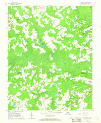 1966 Claresville1968 Print · USGSThe Virginia and North Carolina borderlands come into focus in the late 1960s, showing a landscape of timbered swamps and isolated farmsteads. Researchers can trace old family sites near Turners Crossroads, Morris Hill Ch, and the waters of Taylors Millpond.3 unique versions available
 - 1966 Map of Boykins, 1968 Print
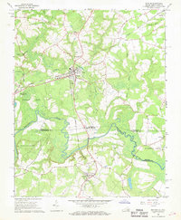 1966 Boykins1968 Print · USGSThe Virginia and North Carolina borderlands come to life in the 1960s, centered on the railroad crossing at Boykins. Researchers can trace the legacy of rural communities through markers like Beechwood Cem, Meherrin Sch, and the winding Meherrin River.2 unique versions available
 - 1973 Map of Murfreesboro, 1977 Print
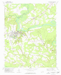 1973 Murfreesboro1977 Print · USGSMurfreesboro and the surrounding tobacco and timber country are captured here in the early 1970s. Trace local family history through numerous rural landmarks like Barretts Crossroads, Chowan College, and Worrell Millpond.
 - 1973 Map of Conway, 1977 Print
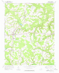 1973 Conway1977 Print · USGSNorthampton County during the 1970s is characterized by quiet rail-side hamlets and extensive swamp drainages. Genealogists and local historians can trace legacy landmarks like Roberts Chapel, Hare Sch, and the old rail path of the Seaboard Coast Line.
 - 1973 Map of Kelford, 1977 Print
 1973 Kelford1977 Print · USGSBertie County in the early 1970s is a landscape of established rail towns and productive peanut farms. Genealogists can trace family names through numerous rural cemeteries and local landmarks like Beautiful Zion Ch, West Bertie Sch, and the Peanut Belt Research Station.
 - 1973 Map of Thelma, 1977 Print
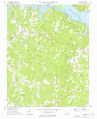 1973 Thelma1977 Print · USGSHalifax County is seen here in the 1970s as the Roanoke River reservoir system shaped the local landscape. Family historians can trace small rural communities like Summit and Gretna Green or locate churches such as Hawkins Chapel and Babbitts Chapel.2 unique versions available
 - 1974 Map of Halifax, 1977 Print
 1974 Halifax1977 Print · USGSCoastal plain life in the mid-1970s is centered on the river bend and rail lines of the Roanoke valley. Genealogists and historians can trace local landmarks like Little Zion Ch, the settlement at Mud Castle, and the sprawling Occoneechee Neck.
Showing maps 1-25 of 163
Top cities of Northampton County
- Garysburg historical maps
- Rich Square historical maps
- Gaston historical maps
- Woodland historical maps
- Conway historical maps
- Jackson historical maps
See more
Frequently asked questions
- What are the different types of historical maps available for Northampton County?
- What is the oldest map of Northampton County?
- Where can I purchase historical maps of Northampton County for my home or office?
- Where can I download high-res historical maps of Northampton County?
- Are there historical topographic maps available for Northampton County?
- Is there historical aerial imagery available for Northampton County?
- Where are historical maps of Northampton County sourced from?