Old Maps of Pamlico County, North Carolina for Hiking & Exploration
Hike through history with 123 historic maps of Pamlico County. Explore old trails, ghost towns, and forgotten backroads — perfect for outdoor adventurers and local explorers.
- Rediscover forgotten places: Map out old mining camps, roads, and footpaths that no longer exist on modern maps.
- Layer with modern tools: Combine with LiDAR or satellite views to plan hikes through historical terrain.
- Made for exploration: Popular among hikers, overlanders, and local history lovers.
Use these maps to find adventure and explore the hidden past of Pamlico County.
Pamlico County, NC maps
(123)- 1948 Map of Oriental, 1992 Print
 1948 Oriental1992 Print · USGSThe coastal waters of Pamlico County meet the riverfront during the post-war era, showing the maritime heart of the region. Local historians can trace the growth of Oriental and locate rural landmarks like Pilgrim Chapel, Whortonsville, and Bethel Ch.
 - 1949 Map of Havelock, 1952 Print
 1949 Havelock1952 Print · USGSCoastal North Carolina at the dawn of the fifties shows a landscape of deep pine forests and growing military infrastructure. Researchers can trace the early layout of the Cherry Point Air Station and locate local landmarks like Brice Creek Ch and the Croatan Lookout Tower.4 unique versions available
 - 1949 Map of Point Of Marsh, 1976 Print
 1949 Point Of Marsh1976 Print · USGSThe coastal marshes of Carteret County are documented here in the late 1940s, showing the meeting of the Neuse River and Pamlico Sound. Maritime researchers can trace the shoreline of Piney Island and locate remote navigation aids like Point of Marsh Lt and Cedar Island Bay Lt.3 unique versions available
 - 1949 Map of Merrimon, 1983 Print
 1949 Merrimon1983 Print · USGSCoastal life in mid-century North Carolina centered on the intricate waterways of the Neuse River and the Intracoastal route. Genealogists can trace family footprints through rural landmarks like Reels Chapel, Oak Grove Ch, and the Adams Creek Sch.
 - 1949 Map of Cherry Point, 1984 Print
 1949 Cherry Point1984 Print · USGSThe Neuse River shoreline just after World War II shows a landscape defined by the arrival of the Cherry Point Marine Base and the depth of the Croatan National Forest. Genealogists and local historians can trace rural landmarks like Weeping Mary Ch, Cahoogue Creek Sch, and the riverside Minnesott Beach.
 - 1950 Map of Point Of Marsh
 1950 Point Of Marsh1950 Print · USGSThe Outer Banks and Pamlico Sound waters come to life in this mid-century survey of the North Carolina coast. Marine historians and local researchers can trace the intricate shorelines of Piney Island and Hunting Quarters, or locate old navigation aids like Point of Marsh Lt.
 - 1950 Map of Vandemere, 1952 Print
 1950 Vandemere1952 Print · USGSCoastal Pamlico County is captured here in the early fifties, showing a landscape shaped by the Bay River and the local timber rail line. Genealogists and historians can locate numerous rural landmarks like Maribel Sch, St Galilee Ch, and the old settlement at Cash Corner.4 unique versions available
 - 1950 Map of Lowland, 1952 Print
 1950 Lowland1952 Print · USGSThe remote marshlands of Pamlico County are captured here in the mid-century, centered on the isolated community of Lowland. Researchers can trace old family roots at Watson Cem and locate historic rural congregations such as Antioch Ch and Shiloh Ch.4 unique versions available
 - 1950 Map of Jones Bay, 1952 Print
 1950 Jones Bay1952 Print · USGSCoastal Pamlico County comes alive in this mid-century survey of the waterways and marshes where Hobucken meets the Intracoastal Waterway. Genealogists and historians can trace the US Coast Guard Reservation, the local Cem, and traditional sites like Bills Creek Landing.4 unique versions available
 - 1950 Map of Edward, 1953 Print
 1950 Edward1953 Print · USGSCoastal North Carolina's rural interior comes into focus during the early fifties, showing the rail-dependent hamlets of Beaufort and Craven counties. Genealogists can locate family landmarks like Smyrna Ch, Coxs Crossroads, and the post office at Blounts Creek.3 unique versions available
 - 1950 Map of Upper Broad Creek, 1984 Print
 1950 Upper Broad Creek1984 Print · USGSCoastal North Carolina comes alive in this survey of the riverbanks where Craven and Pamlico counties meet. Genealogists can trace family names through Cayton Cem and Lees Landing, or locate old commerce at Scotts Store.2 unique versions available
 - 1950 Map of Arapahoe, 1984 Print
 1950 Arapahoe1984 Print · USGSPamlico County’s coastal landscape and rural settlements are captured here during the mid-century. Genealogists can trace local landmarks like St Stephens Ch, Arapahoe, and the shoreline at Minnesota Beach.2 unique versions available
 - 1951 Map of Brant Island
 1951 Brant Island1951 Print · USGSThe Pamlico Sound coastline comes into focus during the early fifties, showing the maritime boundaries of Carteret and Pamlico Counties. Trace the land-and-water interface at Brant Island, the marshes of Hunting Quarters, and the shores of Cedar Island.2 unique versions available
 - 1951 Map of Arapahoe
 1951 Arapahoe1951 Print · USGSCoastal Pamlico County is captured here in the early fifties, showing a landscape defined by its pocosin wetlands and riverine reaches. Researchers can locate family landmarks like St Matthews Ch and Holts Chapel, or trace the path of Dawson Creek.
 - 1951 Map of Merrimon
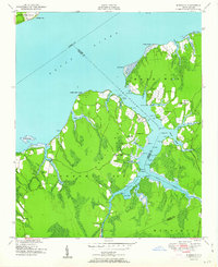 1951 Merrimon1951 Print · USGSCoastal North Carolina's maritime character is on full display in the mid-century as the Intracoastal Waterway cuts through the lowlands of Craven and Carteret counties. Genealogy researchers can trace family landmarks and rural community centers like Reels Chapel, Merrimon Ch, and Adams Creek Sch.2 unique versions available
 - 1951 Map of Cherry Point
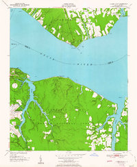 1951 Cherry Point1951 Print · USGSCoastal Craven County comes alive in the early fifties as military installations and riverfront camps began to define the Neuse River shoreline. Genealogists and historians can trace the footprint of the US Marine Corps Air Station Cherry Point or locate local landmarks like Weeping Mary Ch and Minnesott Beach.2 unique versions available
 - 1951 Map of Broad Creek
 1951 Broad Creek1951 Print · USGSThe coastal marshes of Carteret and Pamlico Counties are captured here just after mid-century, where the Neuse River meets the Sound. Genealogists and local historians can trace family land near Florence, Zion Hill Ch, and the winding Swan Creek.4 unique versions available
 - 1951 Map of Upper Broad Creek
 1951 Upper Broad Creek1951 Print · USGSThe Neuse River and its tidal creeks define the Craven and Pamlico county line in the early fifties. Genealogists can trace family names at Cayton Cem, Scotts Store, and Lees Landing along the marshy reaches of Goose Creek.2 unique versions available
 - 1951 Map of Pamlico Point, 1952 Print
 1951 Pamlico Point1952 Print · USGSThe Hyde County coast and the waters of Pamlico Sound meet in this early 1950s survey of the marshlands. Trace the intricate shoreline of the Swanquarter National Wildlife Refuge and locate family-named features like Voliva Cove and Yaupon Hammock Point.
 - 1951 Map of Great Island, 1952 Print
 1951 Great Island1952 Print · USGSCoastal Hyde County in the early fifties is mapped here at the edge of the Pamlico Sound. Maritime historians can trace navigational hazards and landmarks across the Swanquarter National Wildlife Refuge, Judith Island, and Great Island.2 unique versions available
 - 1953 Map of Rocky Mount, 1964 Print
 1953 Rocky Mount1964 Print · USGSEastern North Carolina in the mid-fifties is defined by its deep river basins and the vast wetlands of the Tidewater. Genealogists can trace family roots through hubs like Kinston and New Bern or explore the wilderness of Pettigrew State Park and Lake Mattamuskeet.4 unique versions available
 - 1953 Map of Beaufort, 1965 Print
 1953 Beaufort1965 Print · USGSThe North Carolina coastline in the mid-fifties reveals an era of massive military expansion alongside traditional maritime life. Genealogists can trace family names and small settlements from Sealevel to Sneads Ferry or locate landmarks like Fort Macon.3 unique versions available
 - 1954 Map of Rocky Mount
 1954 Rocky Mount1954 Print · USGSEastern North Carolina is mapped in the mid-fifties, showing a landscape of sounds, swamps, and steam-era rail lines. Genealogists can trace the rural road networks and rail spurs connecting towns like Tarboro, Greenville, and the remote Columbia.
 - 1954 Map of Beaufort
 1954 Beaufort1954 Print · USGSCoastal North Carolina in the mid-fifties reveals a landscape of strategic military installations, sprawling wetlands, and thriving rail towns. Genealogists and historians can trace the foundations of Wilmington, the rural reaches of Duplin County, and shoreline landmarks like Cape Lookout and Carolina Beach.
 - 1968 Map of Bayboro, 1970 Print
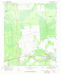 1968 Bayboro1970 Print · USGSCoastal Pamlico County was a landscape of rail and river commerce in the late sixties. Trace the Norfolk Southern line through Grantsboro or locate local landmarks like St Marks Ch and the Central Sch in Bayboro.3 unique versions available
Showing maps 1-25 of 123
Top cities of Pamlico County
- Bayboro historical maps
- Oriental historical maps
- Alliance historical maps
- Grantsboro historical maps
- Minnesott Beach historical maps
- Arapahoe historical maps
See more
Frequently asked questions
- What are the different types of historical maps available for Pamlico County?
- What is the oldest map of Pamlico County?
- Where can I purchase historical maps of Pamlico County for my home or office?
- Where can I download high-res historical maps of Pamlico County?
- Are there historical topographic maps available for Pamlico County?
- Is there historical aerial imagery available for Pamlico County?
- Where are historical maps of Pamlico County sourced from?