
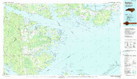
1951 Map of Pamlico Point
USGS Topo · Published 1952About this map
Swanquarter National Wildlife Refuge dominates the northeastern reaches of this coastal survey, where the marshy expanse of Judith Island meets the waters of Pamlico Sound. The landscape is defined by an intricate network of tidal features, from the protected Judith Narrows to the exposed Pamlico Point. The map details a labyrinth of coves and bays such as Voliva Cove and Big Porpoise Bay, reflecting the hydrologic complexity of the Hyde and Pamlico County boundary. This 1951 field-checked map records the shoreline as it existed before decades of modern coastal erosion, capturing local identifiers like Yaupon Hammock Point and Shell Hill Point. The interior is largely uninhabited, preserved as a wilderness where The Blowout and Bernice Cr cut through the brackish wetlands.
Find a feature on this map
59 named features on this map. Tap any name to fly to it.
Don’t see what you’re looking for? This feature index may not catch every label — zoom into the map to look around manually.
Map Details
Editions of this 1951 Pamlico Point Map
This is the sole edition of this map. No revisions or reprints were ever made.
Other maps of this area

1950 · Lowland
USGS Topo · 1:24,000

1950 · Jones Bay
USGS Topo · 1:24,000

1951 · Brant Island
USGS Topo · 1:24,000

1951 · Great Island
USGS Topo · 1:24,000

1951 · Pamlico Beach
USGS Topo · 1:24,000

1951 · Scranton
USGS Topo · 1:24,000

1951 · Swanquarter
USGS Topo · 1:24,000

1953 · Rocky Mount
USGS Topo · 1:250,000

1954 · Rocky Mount
USGS Topo · 1:250,000
1985 · Bayboro
USGS Topo · 1:100,000