Old Maps of Pender County, North Carolina for Hiking & Exploration
Hike through history with 200 historic maps of Pender County. Explore old trails, ghost towns, and forgotten backroads — perfect for outdoor adventurers and local explorers.
- Rediscover forgotten places: Map out old mining camps, roads, and footpaths that no longer exist on modern maps.
- Layer with modern tools: Combine with LiDAR or satellite views to plan hikes through historical terrain.
- Made for exploration: Popular among hikers, overlanders, and local history lovers.
Use these maps to find adventure and explore the hidden past of Pender County.
Pender County, NC maps
(200)- 1942 Map of Spicer Bay
 1942 Spicer Bay1942 Print · USGSCoastal Onslow County is shown during the early 1940s, mapping the intricate tidal system before the onset of modern beach development. Researchers can trace the original path of the Inland Waterway and locate old landmarks like Thomas Landing and Hobbs Point.
 - 1942 Map of Topsail
 1942 Topsail1942 Print · USGSThe Pender County coast was undergoing a military transformation in the early 1940s as infrastructure expanded around Camp Davis. Genealogists and historians can trace dozens of family-named water access points like Howard Landing and Edens Landing along the edge of Topsail Sound.
 - 1942 Map of Burgaw
 1942 Burgaw1942 Print · USGSMid-century Pender County reveals a fascinating mix of swamp wilderness and planned agricultural colonies. Genealogists and researchers can trace family lands in Penderlea Homesteads, explore the immigrant history of St. Helena, and locate features like the Prison Camp and Boney Mill Pond.2 unique versions available
 - 1947 Map of Rocky Point
 1947 Rocky Point1947 Print · USGSCoastal North Carolina just after the war shows a landscape of river-bend settlements and expanding rail lines. You can trace old family routes along Merricks Lane Road, locate historic sites like St. James Ch, and see the early industry at Castle Hayne.
 - 1948 Map of Maple Hill
 1948 Maple Hill1948 Print · USGSSoutheastern North Carolina is mapped here just after the war, showing the deep swamp landscapes of the coastal plain. Genealogists and researchers can trace the roads connecting Maple Hill to Camp Davis and locate rural landmarks like Waltons Store.2 unique versions available
 - 1948 Map of Topsail
 1948 Topsail1948 Print · USGSThe Pender County coastline is shown here in the late 1940s, when the maritime economy was centered on small inlets and landings. Researchers can trace the military history of Camp Davis or locate family sites at Edens Landing and Hampstead.2 unique versions available
 - 1952 Map of Spicer Bay, 1955 Print
 1952 Spicer Bay1955 Print · USGSThe Onslow County coast in the early fifties shows a landscape of tidal marshes and quiet landings before the era of modern beach development. Maritime researchers and local historians can trace the Intracoastal Waterway past Tar Landing, Ashe Island, and the coastal markers of Tower Six.3 unique versions available
 - 1953 Map of Florence, 1964 Print
 1953 Florence1964 Print · USGSThe Carolina borderlands in the mid-fifties were a landscape of vast river swamps and rising rail towns. Trace the legacy of the Seaboard Air Line through Florence or explore the wetlands surrounding Lake Waccamaw and the Green Swamp.3 unique versions available
 - 1953 Map of Beaufort, 1965 Print
 1953 Beaufort1965 Print · USGSThe North Carolina coastline in the mid-fifties reveals an era of massive military expansion alongside traditional maritime life. Genealogists can trace family names and small settlements from Sealevel to Sneads Ferry or locate landmarks like Fort Macon.3 unique versions available
 - 1954 Map of Florence
 1954 Florence1954 Print · USGSThe Carolinas borderlands come alive in the early fifties, showing the vital rail-and-river networks of the coastal plain. Genealogists can trace family footprints across the Green Swamp or through settlements like Red Springs, Chadbourn, and McColl.
 - 1954 Map of Beaufort
 1954 Beaufort1954 Print · USGSCoastal North Carolina in the mid-fifties reveals a landscape of strategic military installations, sprawling wetlands, and thriving rail towns. Genealogists and historians can trace the foundations of Wilmington, the rural reaches of Duplin County, and shoreline landmarks like Cape Lookout and Carolina Beach.
 - 1954 Map of White Lake, 1956 Print
 1954 White Lake1956 Print · USGSCoastal Bladen and Sampson counties are shown here in the mid-fifties, dominated by the unique elliptical depressions of the Carolina Bays. Family researchers can locate remote landmarks like Kates Chapel Cem, Smith Crossroads, and the various landings along the Cape Fear River.
 - 1954 Map of Acme, 1957 Print
 1954 Acme1957 Print · USGSCoastal North Carolina river life in the mid-fifties centered on the confluence of the Cape Fear and the Black River. Genealogists can trace family names at Still Bluff and Maultbys Point, or locate the historic Lincoln High Sch and Farmers Chapel.2 unique versions available
 - 1954 Map of Bolton, 1957 Print
 1954 Bolton1957 Print · USGSCoastal North Carolina's timber and rail corridor is captured here in the mid-fifties, spanning the rugged terrain between the Cape Fear River and Green Swamp. Researchers can trace old family sites and rural congregations at Weyman Chapel, New Hope Ch, and the settlement of Wananish.2 unique versions available
 - 1955 Map of Atkinson, 1957 Print
 1955 Atkinson1957 Print · USGSCoastal plain life in the mid-1950s revolves around the timberlands and rail-stops between the Black River and Moores Creek. Genealogists and historians can trace family ties through dozens of rural landmarks like Newtons Crossroads, St. Marys Ch, and Bland High Sch.2 unique versions available
 - 1970 Map of Hampstead, 1972 Print
 1970 Hampstead1972 Print · USGSCoastal Pender County at the start of the 1970s reveals a landscape of quiet sounds and growing shoreline communities. Genealogists and local historians can trace the foundations of Hampstead or locate family markers near Topsail Beach and Mallory.2 unique versions available
 - 1970 Map of Topsail, 1973 Print
 1970 Topsail1973 Print · USGSCoastal Pender County is shown in the early seventies as the barrier island developments began to grow alongside ancient swamp tracts. Trace family history and land use through the numerous rural churches like Union Bethel Ch and the vast reaches of the Holly Shelter Swamp.
 - 1970 Map of Scotts Hill, 1973 Print
 1970 Scotts Hill1973 Print · USGSCoastal New Hanover and Pender Counties appear in the early 1970s as a landscape of tidal creeks and growing mainland settlements. Genealogists can locate family landmarks like Prospect Cem, Oak Grove Ch, and the grounds of Blair Sch.3 unique versions available
 - 1970 Map of Castle Hayne, 1973 Print
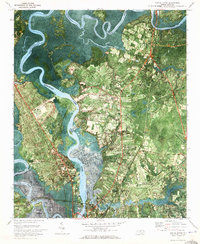 1970 Castle Hayne1973 Print · USGSThe riverfront north of Wilmington comes into focus in the early 1970s as industrial growth meets rural North Carolina. Researchers can trace family roots at Wrightsboro or explore landmarks like St Stanislaus Ch and the New Hanover County Airport.2 unique versions available
 - 1970 Map of Holly Ridge, 1973 Print
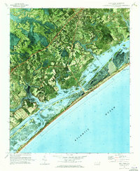 1970 Holly Ridge1973 Print · USGSCoastal Onslow and Pender counties come to life in this early 1970s orthophotomap showing the transition from forest to shore. Researchers can trace family landings like Morris Landing and Sears Landing or study the early layouts of Surf City and Topsail Beach.
 - 1970 Map of Mooretown, 1973 Print
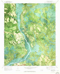 1970 Mooretown1973 Print · USGSCoastal Pender County is documented here in the early seventies, showing a landscape of deep river swamps and scattered rural industry. Genealogists can locate Ashe Cem and Union Chapel Cem or trace the riverbank near Mooretown.
 - 1970 Map of Rocky Point, 1973 Print
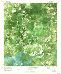 1970 Rocky Point1973 Print · USGSCoastal Pender County comes into focus in the early 1970s, showing the intersection of river life and rail transport. Researchers can trace family roots through sites like Pender Academy, Rileys Creek Cem, and the settlement at Rocky Point.2 unique versions available
 - 1972 Map of Beaufort, 1975 Print
 1972 Beaufort1975 Print · USGSThe North Carolina coast in the early seventies shows a landscape defined by massive military bases and coastal sounds. Trace rural family roots at Sarecta and Catherine Lake or explore the barrier islands of the Cape Lookout National Seashore.
 - 1980 Map of Rocky Point, 1985 Print
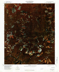 1980 Rocky Point1985 Print · USGSCoastal Pender County is shown in detail during the early eighties as agricultural fields and timberlands surrounded the river. Researchers can trace rural family sites and river landings including Rocky Point, Bells Crossroads, and Clarks Landing.
 - 1980 Map of Castle Hayne, 1985 Print
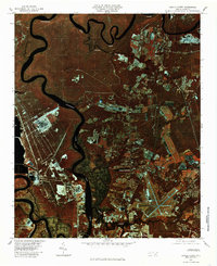 1980 Castle Hayne1985 Print · USGSThe coastal plains north of Wilmington are revealed in this 1980 infrared survey, showing the expansion of rural communities into the surrounding timberlands. Trace the winding Northeast Cape Fear River and the early footprints of Castle Hayne and Wrightsboro.2 unique versions available
Showing maps 1-25 of 200
Top cities of Pender County
- Burgaw historical maps
- Surf City historical maps
- Topsail Beach historical maps
- Atkinson historical maps
- Watha historical maps
- Hampstead historical maps
Frequently asked questions
- What are the different types of historical maps available for Pender County?
- What is the oldest map of Pender County?
- Where can I purchase historical maps of Pender County for my home or office?
- Where can I download high-res historical maps of Pender County?
- Are there historical topographic maps available for Pender County?
- Is there historical aerial imagery available for Pender County?
- Where are historical maps of Pender County sourced from?