2020s Maps of Polk County, North Carolina
Explore 14 historic maps of Polk County from the 2020s. These maps offer a rare glimpse into what life looked like during the 2020s — showing old roads, neighborhoods, homes, and landmarks that have changed or disappeared over time.
Whether you're researching your family's past, planning a metal detecting trip, or studying how Polk County's landscape evolved across the 2020s, these high-resolution maps are a powerful tool for exploring the history of this region.
- Focus on a specific era: All maps on this page are from the 2020s, giving you a focused view of this time period.
- See what’s changed: Compare century-old streets, trails, and buildings to today's modern landscape using overlays and satellite layers.
- Research with precision: Use these maps for genealogy, historical research, land use analysis, or educational projects.
- View, download, or print: Maps are fully viewable online in high resolution, and can be downloaded or printed for your own records.
Start exploring Polk County's history through authentic maps from the 2020s. This is your window into the past.
Polk County, NC maps
(14)- 2020 Map of Fingerville West, 2020 Print
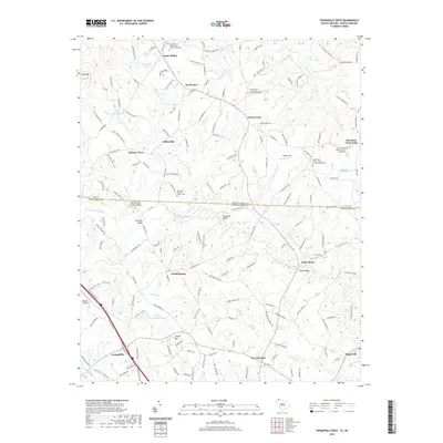 2020 Fingerville West2020 Print · USGSCovers Polk County, including Campobello, Green Creek, and other nearby areas
 - 2020 Map of Landrum, 2020 Print
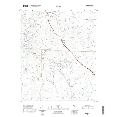 2020 Landrum2020 Print · USGSCovers Polk County, including Landrum, Tryon, and other nearby areas
 - 2020 Map of Fingerville East, 2020 Print
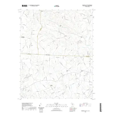 2020 Fingerville East2020 Print · USGSCovers Polk County, including Cooley Springs, Sandy Springs, and other nearby areas
 - 2022 Map of Rutherfordton South, 2022 Print
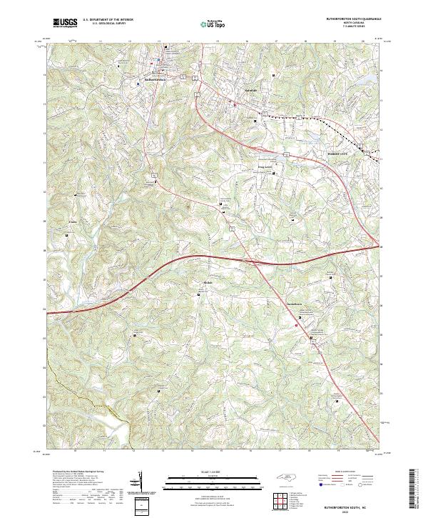 2022 Rutherfordton South2022 Print · USGSThe Rutherfordton and Forest City area comes into clear focus in this modern era, showing the growth of the Piedmont corridor. Family researchers can trace dozens of sites including Adaville Baptist Church Cem, Frog Level, and the Rutherford County Courthouse.
 - 2022 Map of Pea Ridge, 2022 Print
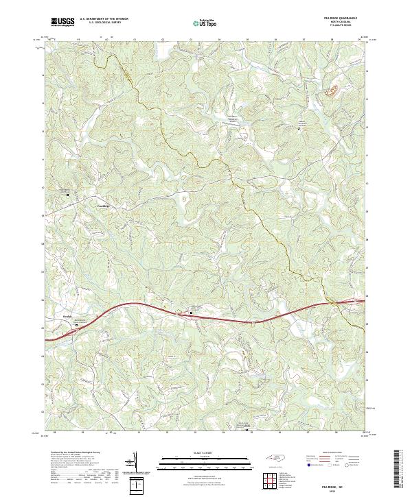 2022 Pea Ridge2022 Print · USGSThe rolling hills of Polk and Rutherford counties come alive in this survey, showing a landscape of traditional farmsteads and riverside communities. Researchers can trace family ties at the Beulah Baptist Church Graveyard or explore the rural layout near Pea Ridge.
 - 2022 Map of Shingle Hollow, 2022 Print
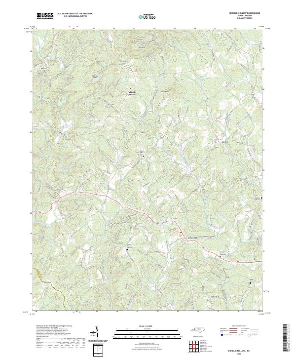 2022 Shingle Hollow2022 Print · USGSThis Rutherford County landscape shows the rural communities of Shingle Hollow and Green Hill in the early 2020s. Genealogists can locate several historic burial sites, including Miller-Twitty Cemetery and Mountain Creek Cemetery.
 - 2022 Map of Lake Lure, 2022 Print
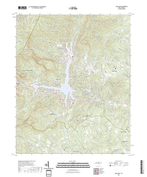 2022 Lake Lure2022 Print · USGSThe Blue Ridge foothills of Rutherford County are shown here in the early 2020s, centered on the waters of Lake Lure. Genealogists can locate family burial sites at Cane Creek Church Graveyard or Grassy Knob Church Cem and trace the community roots of Uree and Bills Creek.
 - 2022 Map of Bat Cave, 2022 Print
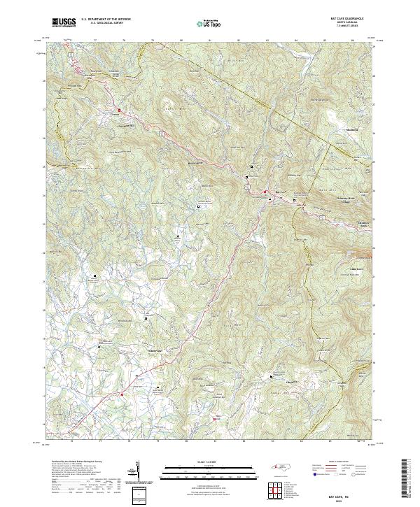 2022 Bat Cave2022 Print · USGSThe high peaks and deep gorges of Henderson County are captured here in the early 2020s, showing the settlement patterns along the Broad River. Genealogists can locate family burial sites at Barnwell Family Cem, Conner Cem, or the Saint Paul Cem.
 - 2022 Map of Cliffield Mountain, 2022 Print
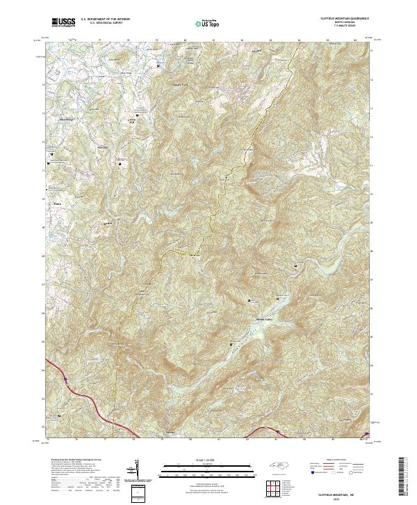 2022 Cliffield Mountain2022 Print · USGSThe Blue Ridge highlands of North Carolina are shown here in modern detail, centered on the historic mountain communities and churches of the Henderson and Polk county line. Researchers can locate numerous family burial grounds including Stepp Round Hill Cem, Patty Cem, and the Macedonia Baptist Church-Graveyard.
 - 2022 Map of Mill Spring, 2022 Print
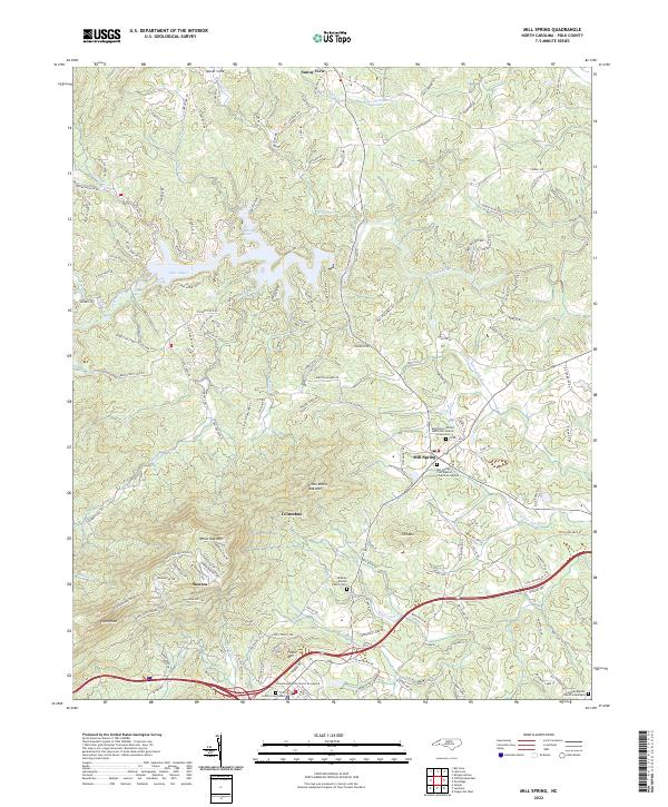 2022 Mill Spring2022 Print · USGSIn the foothills of Polk County during the 2020s, the landscape is defined by the rise of White Oak Mtn and the waters of Lake Adger. Family historians can locate several historic burial grounds, including Midway Baptist Church Cem and Mill Spring First Baptist Church Graveyard.
 - 2022 Map of Saluda, 2022 Print
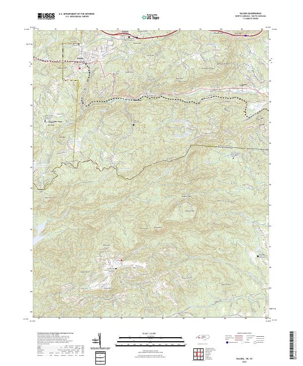 2022 Saluda2022 Print · USGSThe Blue Ridge escarpment comes alive in this contemporary survey of the North Carolina and South Carolina borderlands. Local historians can trace family plots at Saluda City Cem or Rock Springs Baptist Church Graveyard and locate landmarks like Mine Mtn and the Pacolet River.
 - 2024 Map of Landrum, 2024 Print
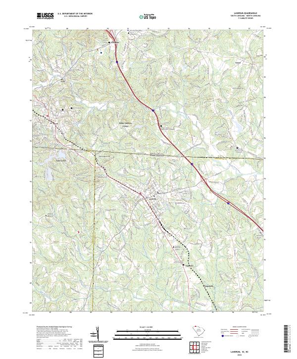 2024 Landrum2024 Print · USGSThe Carolina borderlands come into focus in this contemporary study of the rolling foothills near the Blue Ridge. Genealogists and local historians can trace family locations through numerous sites like Polk Memorial Gardens, Burnt Chimney Corner, and Morgan Chapel Graveyard.
 - 2024 Map of Fingerville West, 2024 Print
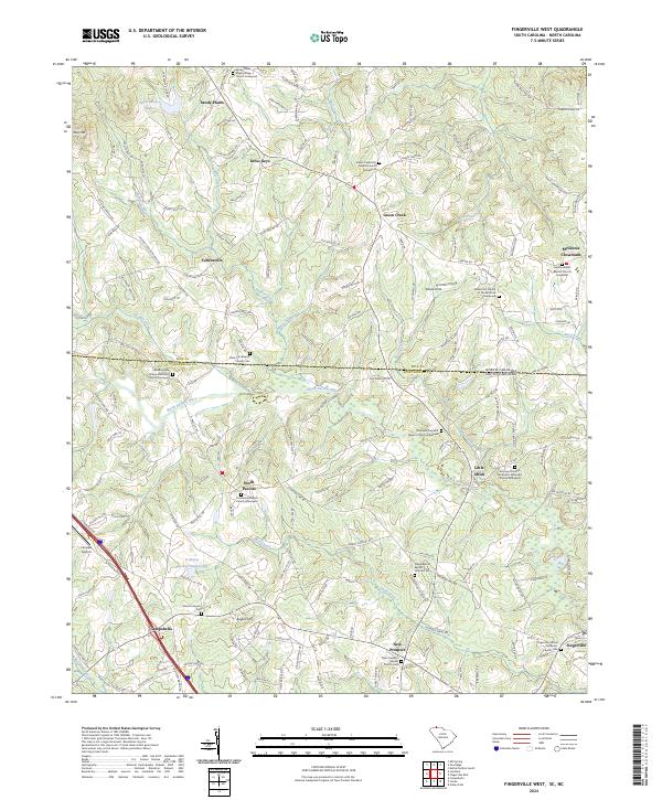 2024 Fingerville West2024 Print · USGSThe borderlands of Spartanburg County and North Carolina appear here in the modern era, showing a landscape shaped by the North Pacolet River. Family historians can trace local roots through numerous sites like Little Africa and the Fairview Christian Methodist Episcopal Church Graveyard.
 - 2024 Map of Fingerville East, 2024 Print
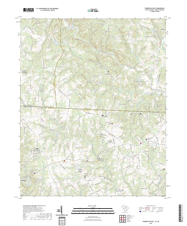 2024 Fingerville East2024 Print · USGSSpartanburg County, South Carolina, is documented here in the early 2020s as it borders North Carolina along the Broad River. Researchers can locate numerous family and church burial sites, including Thorn Cem, Robbins Cem, and the Cooley Springs Baptist Church Cem.
End of results
Showing maps 1-14 of 14
Top cities of Polk County
Frequently asked questions
- What are the different types of historical maps available for Polk County?
- What is the oldest map of Polk County?
- Where can I purchase historical maps of Polk County for my home or office?
- Where can I download high-res historical maps of Polk County?
- Are there historical topographic maps available for Polk County?
- Is there historical aerial imagery available for Polk County?
- Where are historical maps of Polk County sourced from?