Old Maps of Polk County, North Carolina for Academic Research
Study the evolution of Polk County with 92 high-resolution historic maps. Whether you're teaching, researching, or modeling changes in land use, these maps provide essential visual documentation of urban, environmental, and geographic change.
- Analyze long-term change: Track patterns in development, transportation, and natural features.
- Ideal for environmental or urban studies: Support academic projects with primary historical map data.
- Use in the classroom or lab: Educators and researchers rely on these maps to bring historical context to life.
These maps are a powerful tool for teaching, research, and visualizing how Polk County has changed over the decades.
Polk County, NC maps
(92)- 1907 Map of Saluda
 1907 Saluda1907 Print · USGSNorth Carolina's mountain frontier meets the South Carolina foothills in this 1900s survey of the Blue Ridge. Genealogists and researchers can trace the early rail network through Saluda and locate old landmarks like Rockcliff PO and Pleasant Grove Church.3 unique versions available
 - 1935 Map of Batcave
 1935 Batcave1935 Print · USGSThe Henderson County highlands come into focus in the mid-1930s as mountain communities like Edneyville organized around small rural hubs. Local researchers can trace family roots through landmarks like Edneyville Cem or search for old homesteads near Blue Ridge Ch and Raven Rock.
 - 1935 Map of Fishtop
 1935 Fishtop1935 Print · USGSHenderson County settlement is centered around the mountain gaps and valley creeks in the mid-1930s. Genealogists and local historians can trace rural family sites near Refuge Cem, Edith Grove Ch, and the small community of Dana.
 - 1946 Map of Bat Cave, 1957 Print
 1946 Bat Cave1957 Print · USGSHenderson County in the 1940s reveals a network of mountain communities and remote creek valleys. Genealogists and historians can trace family locations near Maxwell Mill, Edneyville Cem, and numerous country churches like Mt Moriah Ch.6 unique versions available
 - 1946 Map of Cliffield Mtn, 1957 Print
 1946 Cliffield Mtn1957 Print · USGSHenderson and Polk counties appear here just after the war, showing a landscape of high mountain ridges and river gorges. Researchers can trace family history through several rural burial grounds like Jones Cem and Bradley Cem, or locate landmarks like Bradley Falls.4 unique versions available
 - 1947 Map of Bat Cave
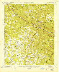 1947 Bat Cave1947 Print · USGSHenderson County's mountain communities and river valleys are captured here just after the war. Researchers can locate family landmarks like Edneyville Cem, rural institutions such as St Peters Sch, and local hubs like Gerton.2 unique versions available
 - 1947 Map of Cliffield Mtn.
 1947 Cliffield Mtn.1947 Print · USGSHenderson and Polk counties appear in the late 1940s, showing a landscape defined by the Blue Ridge and high peaks. Genealogists can trace family names at Jones-Price Cem and Bradley Cem or locate the site of the old Dana Sch.2 unique versions available
 - 1953 Map of Charlotte, 1968 Print
 1953 Charlotte1968 Print · USGSThe North Carolina Piedmont and South Carolina borderlands are shown in detail during a period of significant growth and reservoir development. Trace the rail corridors of the Southern Railway or find family roots in towns like China Grove, Misenheimer, and Lincolnton.3 unique versions available
 - 1954 Map of Charlotte
 1954 Charlotte1954 Print · USGSThe North Carolina Piedmont in the mid-1950s shows a region of rapid growth and industrial expansion centered around Charlotte. Trace the era's infrastructure through the Southern railroad lines and locate significant landmarks like the Charlotte Naval Ammunition Depot and Lake Norman.2 unique versions available
 - 1955 Map of Knoxville
 1955 Knoxville1955 Print · USGSThe Southern Appalachians and the Smoky Mountains are shown here at a peak of mid-century development and conservation. Genealogists and historians can trace the early road networks connecting Gatlinburg, Waynesville, and the Cherokee Indian Reservation across the high ridges.
 - 1957 Map of Knoxville, 1966 Print
 1957 Knoxville1966 Print · USGSThe Southern Appalachians of Tennessee and North Carolina are mapped here during the mid-twentieth century as new highways reached the high country. Genealogists and historians can trace the topography between Knoxville and Asheville, locating family landmarks near Fontana Lake or along the Blue Ridge Parkway.4 unique versions available
 - 1959 Map of Lake Lure, 1960 Print
 1959 Lake Lure1960 Print · USGSWestern North Carolina’s foothills are captured here in the late fifties, showcasing the early development around Lake Lure and Lake Adger. Local historians can trace old homesteads and community hubs like Shingle Hollow, Mullen Bible Sch, and numerous family-named mountain peaks.2 unique versions available
 - 1959 Map of Cowpens, 1961 Print
 1959 Cowpens1961 Print · USGSThe borderlands of the Carolinas are shown here in the late fifties, featuring a mix of textile mill towns and rural farming communities. Researchers can trace family roots through numerous local landmarks like Cannons Camp Ground, Gaffney Chapel, and Cooley Springs.2 unique versions available
 - 1959 Map of Tigerville, 1963 Print
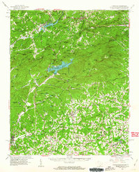 1959 Tigerville1963 Print · USGSThe Carolina borderlands come into focus in the late fifties as the Blue Ridge foothills balance mountain industry and rural education. Researchers can trace the Southern railroad line through Tuxedo or locate local landmarks like North Greenville Junior College and Berrys Millpond.2 unique versions available
 - 1960 Map of Knoxville
 1960 Knoxville1960 Print · USGSThe Southern Appalachians come alive in the 1950s, showing the intersection of new national park tourism and deep-rooted mountain industry. Trace old rail lines like the Clinchfield RR and find high-altitude landmarks from Mt Le Conte to the Cherokee Indian Reservation.2 unique versions available
 - 1960 Map of Charlotte
 1960 Charlotte1960 Print · USGSMid-century North Carolina and South Carolina meet in this 1960 survey of the Piedmont's industrial and textile heartland. Trace the growth of Charlotte alongside historic landmarks like Kings Mountain National Military Park and the Charlotte Naval Ammunition Depot.2 unique versions available
 - 1961 Map of Inman, 1964 Print
 1961 Inman1964 Print · USGSUpper Spartanburg County and Polk County thrive in the early sixties as the textile industry and new reservoirs reshape the landscape. Genealogists can locate family names at Morgan Chapel Cem and Polk Memorial Gardens, or trace early industrial hubs like Inman Mills.
 - 1962 Map of Charlotte
 1962 Charlotte1962 Print · USGSThe North Carolina Piedmont in the early sixties showcases a landscape transformed by massive reservoirs and industrial growth. Researchers can trace the development of Lake Norman, locate the Charlotte Naval Ammunition Depot, or find family landmarks like Wesley Chapel and Brown & Norcott Mills.
 - 1964 Map of Knoxville
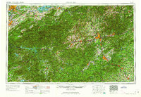 1964 Knoxville1964 Print · USGSThe Southern Appalachians and Great Smokies are captured here during the mid-sixties, showing the rugged borderlands of Tennessee and North Carolina. Researchers can trace historic mountain routes like U S 441, the expanse of Pisgah National Forest, and the growing footprints of Asheville and Knoxville.
 - 1966 Map of Rutherfordton South, 1968 Print
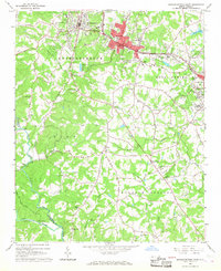 1966 Rutherfordton South1968 Print · USGSRutherford County in the mid-sixties shows the industrial hubs of Spindale and Rutherfordton linked by the Southern Railway. Researchers can locate dozens of rural landmarks like Kistlers Chapel, Washburn Bridge, and New Hope Sch.
 - 1968 Map of Landrum, 1992 Print
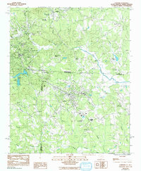 1968 Landrum1992 Print · USGSAs the mid-century era transitioned into the late 1980s, the border between the Carolinas remained a vital corridor for the SOUTHERN railroad. Genealogists and historians can trace family locations near Burnt Chimney Corner, Peniel, and numerous landmarks like Morgan Chapel or the Pacolet Hills Ch.
 - 1975 Map of Cowpens NW, 1979 Print
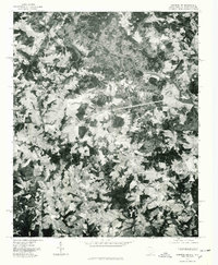 1975 Cowpens NW1979 Print · USGSThe South Carolina and North Carolina borderlands come into focus in the mid-1970s, showing the rural landscape along the Broad River. Genealogists and local historians can trace the roads and homesteads surrounding Cooley Springs, Harris, and Fingerville.
 - 1982 Map of Pea Ridge, 1983 Print
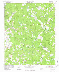 1982 Pea Ridge1983 Print · USGSThe river valleys of Polk and Rutherford counties are captured here in the early eighties. Genealogists can trace family landmarks and rural congregations like Pea Ridge, Byars Cem, and Zion Grove Ch along the Green River.
 - 1982 Map of Lake Lure, 1983 Print
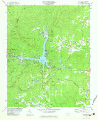 1982 Lake Lure1983 Print · USGSThe Hickory Nut Gorge area near the start of the 1980s reveals a landscape of high peaks and deep waters centered on Lake Lure. Genealogists and historians can locate rural landmarks like St Johns Ch, Cooper Gap Ch, and the small settlement at Uree.3 unique versions available
 - 1982 Map of Shingle Hollow, 1983 Print
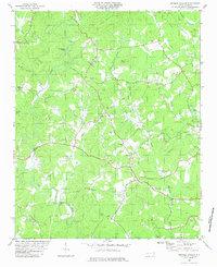 1982 Shingle Hollow1983 Print · USGSRutherford County in the early 1980s is shown here as a landscape of rural congregations and river bends. Genealogists can locate family landmarks like Mathews Ch, Mtn Creek Cem, and the community of Shingle Hollow.
Showing maps 1-25 of 92
Top cities of Polk County
Frequently asked questions
- What are the different types of historical maps available for Polk County?
- What is the oldest map of Polk County?
- Where can I purchase historical maps of Polk County for my home or office?
- Where can I download high-res historical maps of Polk County?
- Are there historical topographic maps available for Polk County?
- Is there historical aerial imagery available for Polk County?
- Where are historical maps of Polk County sourced from?