1900s (20th Century) Maps of Ellerbe, North Carolina
Explore 10 historic maps of Ellerbe from the 1900s (20th Century). These maps offer a rare glimpse into what life looked like during the 1900s — showing old roads, neighborhoods, homes, and landmarks that have changed or disappeared over time.
Whether you're researching your family's past, planning a metal detecting trip, or studying how Ellerbe's landscape evolved across the 1900s, these high-resolution maps are a powerful tool for exploring the history of this region.
- Focus on a specific era: All maps on this page are from the 1900s, giving you a focused view of this time period.
- See what’s changed: Compare century-old streets, trails, and buildings to today's modern landscape using overlays and satellite layers.
- Research with precision: Use these maps for genealogy, historical research, land use analysis, or educational projects.
- View, download, or print: Maps are fully viewable online in high resolution, and can be downloaded or printed for your own records.
Start exploring Ellerbe's history through authentic maps from the 1900s. This is your window into the past.
Ellerbe, NC maps
(10)- 1942 Map of Troy
 1942 Troy1942 Print · USGSMid-century central North Carolina comes alive through this 1940s survey of the rail-linked towns between the Uwharrie hills and the Sandhills. Trace the historic Norfolk Southern line through Troy, Star, and Biscoe, or locate the Morrison Training School and local springs.
 - 1949 Map of Millstone Lake, 1953 Print
 1949 Millstone Lake1953 Print · USGSRichmond County in the late nineteen-forties shows a landscape of conservation and community, from the state fish hatchery to scattered country parishes. Trace family history at Watson Cem and Lincoln Sch, or locate the historic McKinney Lake Fish Hatchery and Camp Millstone.3 unique versions available
 - 1949 Map of Jackson Springs, 1954 Print
 1949 Jackson Springs1954 Print · USGSThe North Carolina Sandhills were undergoing a transition in the late 1940s as military footprints expanded alongside rural farming communities. Genealogists and historians can trace the foundations of Camp Mackall and find local landmarks like the Morrison Training Sch and Jackson Springs.
 - 1953 Map of Raleigh, 1965 Print
 1953 Raleigh1965 Print · USGSCentral North Carolina in the early sixties shows a landscape of growing towns and military hubs before the full expansion of the interstate system. Genealogists can trace family footprints across the Piedmont through Wake Forest, Siler City, and the large Fort Bragg Military Reservation.4 unique versions available
 - 1954 Map of Raleigh
 1954 Raleigh1954 Print · USGSThe North Carolina Piedmont and Sandhills are captured in the mid-fifties during a period of steady regional growth. Genealogists and historians can trace the development of towns like Siler City or locate landmarks such as Falls of Neuse and Camp Mackall.
 - 1956 Map of Ellerbe, 1957 Print
 1956 Ellerbe1957 Print · USGSMid-century Richmond County comes into focus as the town of Ellerbe and the surrounding rural districts develop near the Pee Dee River. Researchers can trace the heritage of local communities through landmarks like Chappell Grove Ch, the Mineral Springs Sch, and Lenzton.3 unique versions available
 - 1957 Map of Jackson Springs, 1961 Print
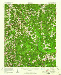 1957 Jackson Springs1961 Print · USGSMoore and Richmond counties in the late 1950s reflect a mix of military presence and quiet rural life. Researchers can trace families near Jackson Springs, locate the old Hoffman High Sch, or find rural landmarks like Marcus Grove Ch and Millstone Lake.
 - 1976 Map of Millstone Lake, 1978 Print
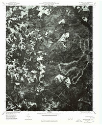 1976 Millstone Lake1978 Print · USGSNorth Carolina's sandhills region is captured in the mid-seventies through this detailed aerial survey of Richmond County. Genealogists and land historians can trace property boundaries and land use near Millstone Lake and the valley of Beaver Creek.
 - 1976 Map of Ellerbe, 1978 Print
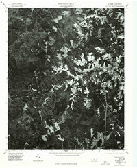 1976 Ellerbe1978 Print · USGSRichmond County in the mid-seventies is documented here through high-altitude aerial photography. Genealogists and local historians can trace the street layout of Ellerbe, follow the course of the Pee Dee River, or locate family properties near Sandy Ridge.
 - 1982 Map of Southern Pines, 1983 Print
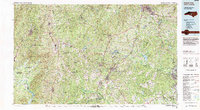 1982 Southern Pines1983 Print · USGSCentral North Carolina in the early eighties shows a landscape defined by military expansion and historic rail corridors. Researchers can trace the legacy of the Seaboard Coast Line through Pinehurst or locate landmarks like the Town Creek Indian Mound State Historic Site.
End of results
Showing maps 1-10 of 10
Top cities near Ellerbe
- Rockingham historical maps
- Hamlet historical maps
- Seven Lakes historical maps
- East Rockingham historical maps
- Cordova historical maps
- Candor historical maps
See more
Frequently asked questions
- What are the different types of historical maps available for Ellerbe?
- What is the oldest map of Ellerbe?
- Where can I purchase historical maps of Ellerbe for my home or office?
- Where can I download high-res historical maps of Ellerbe?
- Are there historical topographic maps available for Ellerbe?
- Is there historical aerial imagery available for Ellerbe?
- Where are historical maps of Ellerbe sourced from?