Old Maps of Hestertown, North Carolina for Hiking & Exploration
Hike through history with 11 historic maps of Hestertown. Explore old trails, ghost towns, and forgotten backroads — perfect for outdoor adventurers and local explorers.
- Rediscover forgotten places: Map out old mining camps, roads, and footpaths that no longer exist on modern maps.
- Layer with modern tools: Combine with LiDAR or satellite views to plan hikes through historical terrain.
- Made for exploration: Popular among hikers, overlanders, and local history lovers.
Use these maps to find adventure and explore the hidden past of Hestertown.
Hestertown, NC maps
(11)- 1953 Map of Florence, 1964 Print
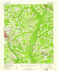
 1953 Florence1964 Print · USGSThe Carolina borderlands in the mid-fifties were a landscape of vast river swamps and rising rail towns. Trace the legacy of the Seaboard Air Line through Florence or explore the wetlands surrounding Lake Waccamaw and the Green Swamp.3 unique versions available
 - 1954 Map of Florence
 1954 Florence1954 Print · USGSThe Carolinas borderlands come alive in the early fifties, showing the vital rail-and-river networks of the coastal plain. Genealogists can trace family footprints across the Green Swamp or through settlements like Red Springs, Chadbourn, and McColl.
 - 1957 Map of Bladenboro, 1958 Print
 1957 Bladenboro1958 Print · USGSCoastal plain swamp lands and small railroad towns meet in the 1950s along the border of Robeson and Bladen counties. Genealogists can trace family landmarks like Floyd Temple Ch, the Littlefield High Sch, and the historic path of the Old Stage Road.
 - 1982 Map of Elizabethtown, 1983 Print
 1982 Elizabethtown1983 Print · USGSSoutheastern North Carolina's coastal plain is captured here in the early eighties, showcasing a landscape defined by the Cape Fear River and mysterious Carolina Bays. Genealogists and researchers can trace the rail network of the Seaboard Coast Line through rural communities like Autryville, Ivanhoe, and the recreational hub of White Lake.
 - 1986 Map of Southeast Lumberton, 1987 Print
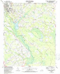 1986 Southeast Lumberton1987 Print · USGSSoutheast of Lumberton in the mid-1980s, the landscape is a complex puzzle of river bluffs and mysterious Carolina bays. Genealogists and local historians can trace rural communities around Smyrna Ch, Long Branch Sch, and the landings along the Lumber River.
 - 1997 Map of Southeast Lumberton, 2000 Print
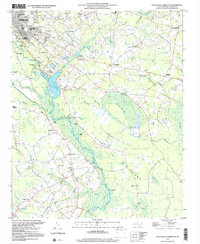 1997 Southeast Lumberton2000 Print · USGSSoutheast of Lumberton in the late nineties, the landscape was a mosaic of Carolina bays and riverside landings along the Lumber River. Genealogists and local historians can trace legacy sites like the Long Branch Sch, Robeson Memorial Park, and the Warwick Mill Pond area.
 - 2010 Map of Southeast Lumberton, 2010 Print
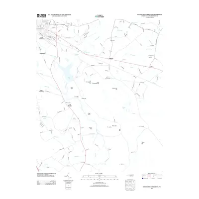
 2010 Southeast Lumberton2010 Print · USGSCovers Hestertown, including Lumberton, Bellamy, and other nearby areas
 - 2013 Map of Southeast Lumberton, 2013 Print
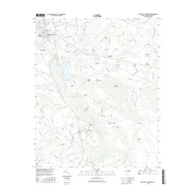
 2013 Southeast Lumberton2013 Print · USGSCovers Hestertown, including Lumberton, Bellamy, and other nearby areas
 - 2016 Map of Southeast Lumberton, 2016 Print
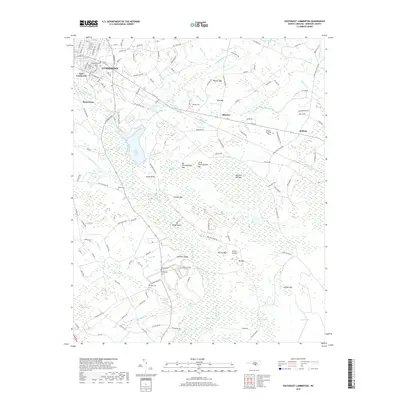
 2016 Southeast Lumberton2016 Print · USGSCovers Hestertown, including Lumberton, Bellamy, and other nearby areas
 - 2019 Map of Southeast Lumberton, 2019 Print
 2019 Southeast Lumberton2019 Print · USGSCovers Hestertown, including Lumberton, Bellamy, and other nearby areas
 - 2022 Map of Southeast Lumberton, 2022 Print
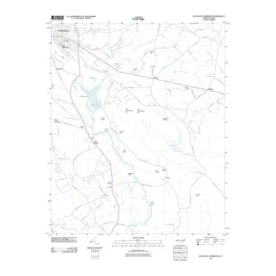
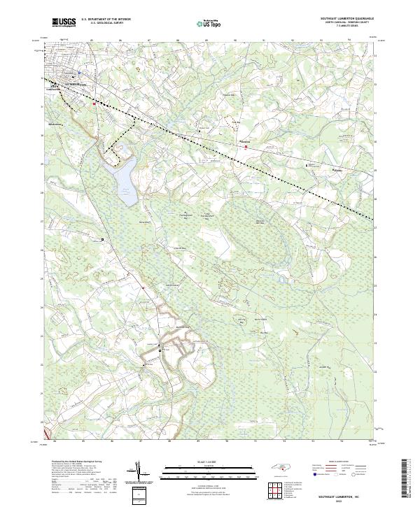 2022 Southeast Lumberton2022 Print · USGSCoastal plain wetlands and small communities define the area southeast of Lumberton in the early 2020s. Researchers can locate family landmarks like Wishart Cem and Britt Cem, or trace the winding course of the Lumber River and Jacob Swamp.
End of results
Showing maps 1-11 of 11
Top cities near Hestertown
- Lumberton historical maps
- Fairmont historical maps
- Pembroke historical maps
- Bladenboro historical maps
- Rennert historical maps
- Butters historical maps
See more
Frequently asked questions
- What are the different types of historical maps available for Hestertown?
- What is the oldest map of Hestertown?
- Where can I purchase historical maps of Hestertown for my home or office?
- Where can I download high-res historical maps of Hestertown?
- Are there historical topographic maps available for Hestertown?
- Is there historical aerial imagery available for Hestertown?
- Where are historical maps of Hestertown sourced from?