2020s Maps of Pilot Mountain, North Carolina
Explore 2 historic maps of Pilot Mountain from the 2020s. These maps offer a rare glimpse into what life looked like during the 2020s — showing old roads, neighborhoods, homes, and landmarks that have changed or disappeared over time.
Whether you're researching your family's past, planning a metal detecting trip, or studying how Pilot Mountain's landscape evolved across the 2020s, these high-resolution maps are a powerful tool for exploring the history of this region.
- Focus on a specific era: All maps on this page are from the 2020s, giving you a focused view of this time period.
- See what’s changed: Compare century-old streets, trails, and buildings to today's modern landscape using overlays and satellite layers.
- Research with precision: Use these maps for genealogy, historical research, land use analysis, or educational projects.
- View, download, or print: Maps are fully viewable online in high resolution, and can be downloaded or printed for your own records.
Start exploring Pilot Mountain's history through authentic maps from the 2020s. This is your window into the past.
Pilot Mountain, NC maps
(2)- 2022 Map of Pinnacle, 2022 Print
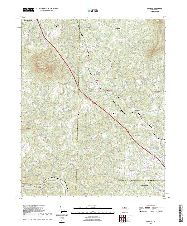 2022 Pinnacle2022 Print · USGSSurry and Stokes counties appear in their modern configuration during the 2020s, anchored by the iconic landmark of Pilot Mountain. Genealogists can trace family connections through numerous sites like Mount Zion Cemetery and Friends Union Cemetery.
 - 2022 Map of Pilot Mountain, 2022 Print
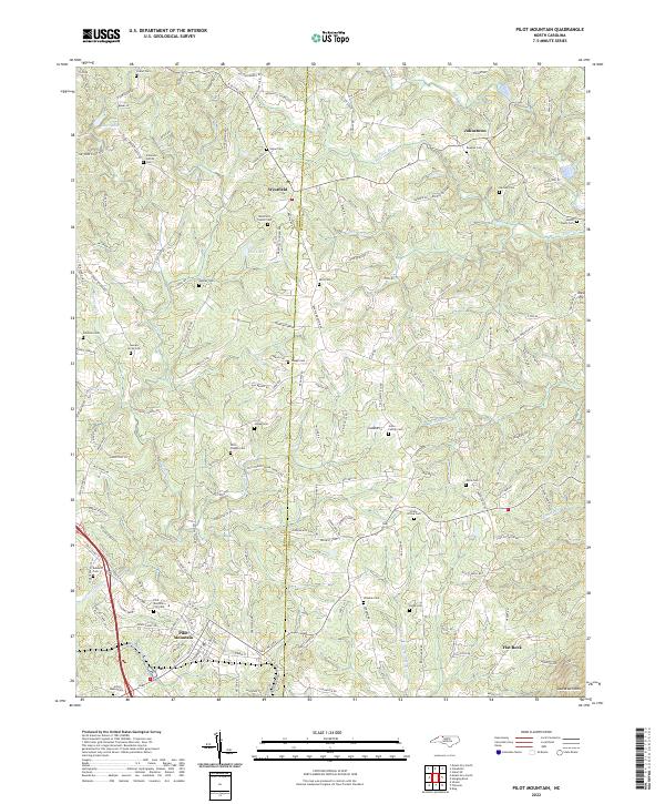 2022 Pilot Mountain2022 Print · USGSThe Surry and Stokes county line divides this North Carolina Piedmont landscape during its recent period of rural continuity. Genealogists can trace family lineages through dozens of sites like the Westfield Friends Cem, Brims Grove Cem, and the Mica Pit.
End of results
Showing maps 1-2 of 2
Top cities near Pilot Mountain
- Winston-Salem historical maps
- Lewisville historical maps
- Mount Airy historical maps
- Rural Hall historical maps
- Cana historical maps
- Boonville historical maps
See more
Frequently asked questions
- What are the different types of historical maps available for Pilot Mountain?
- What is the oldest map of Pilot Mountain?
- Where can I purchase historical maps of Pilot Mountain for my home or office?
- Where can I download high-res historical maps of Pilot Mountain?
- Are there historical topographic maps available for Pilot Mountain?
- Is there historical aerial imagery available for Pilot Mountain?
- Where are historical maps of Pilot Mountain sourced from?