1900s (20th Century) Maps of Carson Mill, North Carolina
Explore 11 historic maps of Carson Mill from the 1900s (20th Century). These maps offer a rare glimpse into what life looked like during the 1900s — showing old roads, neighborhoods, homes, and landmarks that have changed or disappeared over time.
Whether you're researching your family's past, planning a metal detecting trip, or studying how Carson Mill's landscape evolved across the 1900s, these high-resolution maps are a powerful tool for exploring the history of this region.
- Focus on a specific era: All maps on this page are from the 1900s, giving you a focused view of this time period.
- See what’s changed: Compare century-old streets, trails, and buildings to today's modern landscape using overlays and satellite layers.
- Research with precision: Use these maps for genealogy, historical research, land use analysis, or educational projects.
- View, download, or print: Maps are fully viewable online in high resolution, and can be downloaded or printed for your own records.
Start exploring Carson Mill's history through authentic maps from the 1900s. This is your window into the past.
Carson Mill, NC maps
(11)- 1933 Map of Bushnell
 1933 Bushnell1933 Print · USGSSwain County high country in the late 1920s is defined by a remote landscape of steep ridges and small mountain schools. Researchers can trace the locations of Mill Creek Sch and School No 2 or identify family landmarks like Loudermilk Ridge and Welch Bald.
 - 1936 Map of Judson
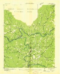 1936 Judson1936 Print · USGSThe confluence of the Little Tennessee and Tuckasegee rivers is captured here in the mid-1930s, just before the landscape was transformed by reservoir projects. Researchers can trace the original rail stops and riverside communities of Bushnell, Judson, and Almond, along with rural landmarks like Mt Zion Ch and Noland Creek Sch.
 - 1940 Map of Judson
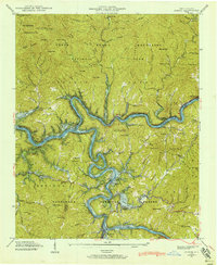 1940 Judson1940 Print · USGSSwain County's river valleys appear here just before the completion of the Fontana Dam transformed the landscape. Genealogists can locate family landmarks like Woody Cem and Monteith Cem or trace the old Southern Railway through the now-submerged town of Judson.
 - 1941 Map of Judson
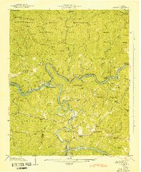 1941 Judson1941 Print · USGSSwain County's river valleys and mountain gaps are documented here just before the era of major hydroelectric flooding. Researchers can trace vanished homesites, family cemeteries like Woody Cem, and defunct mountain schools including Round Hill Sch and Noland Creek Sch.
 - 1955 Map of Knoxville
 1955 Knoxville1955 Print · USGSThe Southern Appalachians and the Smoky Mountains are shown here at a peak of mid-century development and conservation. Genealogists and historians can trace the early road networks connecting Gatlinburg, Waynesville, and the Cherokee Indian Reservation across the high ridges.
 - 1957 Map of Knoxville, 1966 Print
 1957 Knoxville1966 Print · USGSThe Southern Appalachians of Tennessee and North Carolina are mapped here during the mid-twentieth century as new highways reached the high country. Genealogists and historians can trace the topography between Knoxville and Asheville, locating family landmarks near Fontana Lake or along the Blue Ridge Parkway.4 unique versions available
 - 1960 Map of Knoxville
 1960 Knoxville1960 Print · USGSThe Southern Appalachians come alive in the 1950s, showing the intersection of new national park tourism and deep-rooted mountain industry. Trace old rail lines like the Clinchfield RR and find high-altitude landmarks from Mt Le Conte to the Cherokee Indian Reservation.2 unique versions available
 - 1961 Map of Noland Creek, 1964 Print
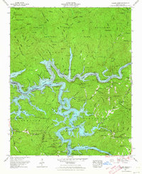 1961 Noland Creek1964 Print · USGSThe North Carolina Smokies are shown here in the early sixties as the massive reservoirs of the TVA reshaped the mountain valleys. Genealogists and hikers can trace remote burial sites like Panther Creek Cem and shoreline landmarks including Sawyer Dock.5 unique versions available
 - 1964 Map of Knoxville
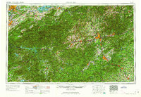 1964 Knoxville1964 Print · USGSThe Southern Appalachians and Great Smokies are captured here during the mid-sixties, showing the rugged borderlands of Tennessee and North Carolina. Researchers can trace historic mountain routes like U S 441, the expanse of Pisgah National Forest, and the growing footprints of Asheville and Knoxville.
 - 1976 Map of Noland Creek, 1978 Print
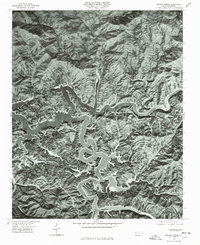 1976 Noland Creek1978 Print · USGSSwain County in the mid-1970s is defined by the expansive, winding waters of Fontana Lake as it snakes through the mountain terrain. Researchers can trace the original river paths of the Tuckasegee River and find landmarks like Roundhill.
 - 1983 Map of Fontana Lake
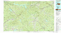 1983 Fontana Lake1983 Print · USGSWestern North Carolina's high peaks and reservoir-carved valleys are documented here during the early eighties. Genealogists and local historians can trace the mountain communities of Bryson City and Franklin or explore the boundaries of the Qualla Boundary.2 unique versions available
End of results
Showing maps 1-11 of 11
Top cities near Carson Mill
Frequently asked questions
- What are the different types of historical maps available for Carson Mill?
- What is the oldest map of Carson Mill?
- Where can I purchase historical maps of Carson Mill for my home or office?
- Where can I download high-res historical maps of Carson Mill?
- Are there historical topographic maps available for Carson Mill?
- Is there historical aerial imagery available for Carson Mill?
- Where are historical maps of Carson Mill sourced from?