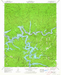
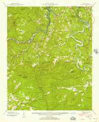
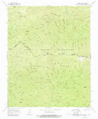
1961 Map of Noland Creek
USGS Topo · Published 1964This historical map portrays the area of Noland Creek in 1961, primarily covering Swain County as well as portions of Graham County. Featuring a scale of 1:24000, this map provides a highly detailed snapshot of the terrain, roads, buildings, counties, and historical landmarks in the Noland Creek region at the time. Published in 1964, it is one of 5 known editions of this map due to revisions or reprints.
Find a feature on this map
89 named features on this map. Tap any name to fly to it.
Don’t see what you’re looking for? This feature index may not catch every label — zoom into the map to look around manually.
Map Details
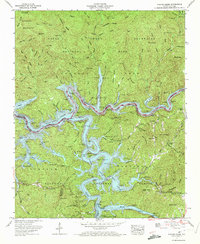
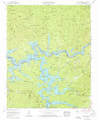
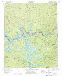
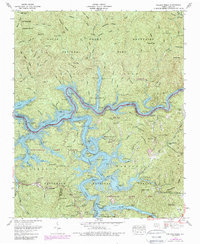
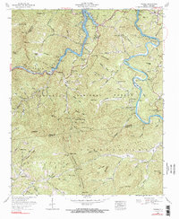
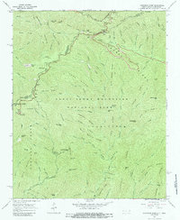
Editions of this 1961 Noland Creek Map
5 editions found
Historical Maps of Carson Mill Through Time
35 maps found

1933 Bryson
Swain County, NC

1933 Bushnell
Swain County, NC

1936 Alarka
Swain County, NC

1936 Bryson
Swain County, NC

1936 Bunches Bald
Swain County, NC

1936 Judson
Swain County, NC

1936 Proctor
Swain County, NC

1936 Ravensford
Swain County, NC

1936 Wesser
Swain County, NC

1940 Alarka
Swain County, NC

1940 Bryson
Swain County, NC

1940 Judson
Swain County, NC

1940 Proctor
Swain County, NC
1940 Wesser
Swain County, NC

1941 Alarka
Swain County, NC

1941 Bryson
Swain County, NC

1941 Judson
Swain County, NC

1941 Proctor
Swain County, NC
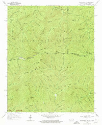
1961 Noland Creek
Swain County, NC

1961 Tuskeegee
Swain County, NC
1961 Wesser
Swain County, NC

1964 Bunches Bald
Swain County, NC
1964 Clingmans Dome
Swain County, NC
1964 Silers Bald
Swain County, NC

1964 Smokemont
Swain County, NC
1964 Thunderhead Mtn
Swain County, NC

1976 Bunches Bald
Swain County, NC

1976 Clingmans Dome
Swain County, NC

1976 Noland Creek
Swain County, NC

1976 Silers Bald
Swain County, NC

1976 Tuskeegee
Swain County, NC

1976 Wesser
Swain County, NC

2000 Bunches Bald
Swain County, NC

2000 Clingmans Dome
Swain County, NC

2000 Smokemont
Swain County, NC