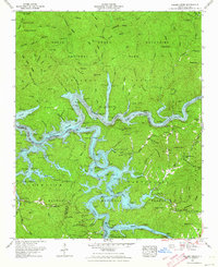
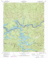
1961 Map of Noland Creek
USGS Topo · Published 1964About this map
Fontana Lake dominates this 1961 landscape, its branching fingers filling the valleys where the Little Tennessee River, Tuckasegee River, and Nantahala River converge. The creation of the reservoir transformed the region, yet traditional markers of the mountain communities remain visible. Small family burying grounds like Woody Cem, McClure Cem, and Panther Creek Cem are found along the high ground above the water's edge, preserving the names of early settlers.
Find a feature on this map
89 named features on this map. Tap any name to fly to it.
Don’t see what you’re looking for? This feature index may not catch every label — zoom into the map to look around manually.
Map Details
Editions of this 1961 Noland Creek Map
5 editions found
Other maps of this area

1886 · Knoxville
USGS Topo · 1:125,000

1891 · Cowee
USGS Topo · 1:125,000

1892 · Knoxville
USGS Topo · 1:125,000

1893 · Mt Guyot
USGS Topo · 1:125,000

1894 · Knoxville
USGS Topo · 1:125,000

1895 · Knoxville
USGS Topo · 1:125,000

1897 · Cowee
USGS Topo · 1:125,000

1901 · Knoxville
USGS Topo · 1:125,000

1907 · Cowee
USGS Topo · 1:125,000

1912 · Mt Guyot
USGS Topo · 1:125,000