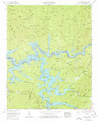
1961 Map of Noland Creek
USGS Topo · Published 1977About this map
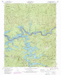
Fontana Lake dominates this 1961 revision of the Smoky Mountains landscape, its waters filling the valleys of the Little Tennessee River and Tuckasegee River. The map illustrates a transitional period where industrial water management meets wilderness preservation, showing numerous floating moorages such as Greasy Branch Dock and Dowell Dock along the irregular shoreline. The rugged interior is defined by significant ridges like Welch Ridge and Pilot Ridge, which divide the drainages of Chambers Creek and Forney Creek.
Find a feature on this map
114 named features on this map. Tap any name to fly to it.
Don’t see what you’re looking for? This feature index may not catch every label — zoom into the map to look around manually.
Map Details
Editions of this 1961 Noland Creek Map
5 editions found
Other maps of this area

1886 · Knoxville
USGS Topo · 1:125,000

1891 · Cowee
USGS Topo · 1:125,000

1892 · Knoxville
USGS Topo · 1:125,000

1893 · Mt Guyot
USGS Topo · 1:125,000

1894 · Knoxville
USGS Topo · 1:125,000

1895 · Knoxville
USGS Topo · 1:125,000

1897 · Cowee
USGS Topo · 1:125,000

1901 · Knoxville
USGS Topo · 1:125,000

1907 · Cowee
USGS Topo · 1:125,000

1912 · Mt Guyot
USGS Topo · 1:125,000