Old Maps of Swain County, North Carolina for Genealogy
Trace your family roots with 192 historic maps of Swain County. These high-res maps reveal old neighborhoods, homesites, landmarks, and streets — helping you uncover where your ancestors lived and how the area evolved over time.
- Explore historic neighborhoods: Identify where your relatives may have lived in the 1800s or 1900s.
- Compare maps over time: Trace the changes in streets, buildings, and landmarks for multi-generational research.
- Perfect for genealogy & ancestry research: Used by family historians and researchers to map out lineage and migration.
These maps are an incredible resource for exploring your personal connection to Swain County's past.
Swain County, NC maps
(192)- 1886 Map of Knoxville
 1886 Knoxville1886 Print · USGSEast Tennessee in the late nineteenth century was a landscape of river ferries and mountain coves centered around the growing hub of Knoxville. Genealogists can locate family landmarks like Spencer Cabin, Montvale Springs, and the old Brabsons Ferry river crossing.
 - 1891 Map of Cowee
 1891 Cowee1891 Print · USGSWestern North Carolina's high mountain reaches are captured here in the late nineteenth century as the railroad began to transform the region. Trace early transport routes like the Western North Carolina Railroad and Cowee Tunnel alongside old settlements at Franklin and Quallatown.
 - 1892 Map of Knoxville
 1892 Knoxville1892 Print · USGSEastern Tennessee in the late nineteenth century shows a landscape of river-valley commerce transitioning into the Great Smokies. Genealogists can trace early homesteads near Sevierville or locate landmarks like Porter Academy and Boyd Ferry.
 - 1893 Map of Mt Guyot
 1893 Mt Guyot1893 Print · USGSThe Tennessee and North Carolina borderlands are captured here in the 1890s, when isolated mountain coves and river towns relied on the Virginia and Georgia Railroad. Researchers can trace old family sites and transport routes through Fair Garden, Jones Cove, and along the Elliot Ferry Road.3 unique versions available
 - 1894 Map of Knoxville
 1894 Knoxville1894 Print · USGSThe Tennessee valley meets the high Smokies in the 1890s, revealing a landscape of river ferries, mountain coves, and emerging rail towns. Genealogists and historians can trace early crossings at Boyd Ferry, established schools like Porter Academy, and the early footprints of Gatlinburg and Pigeon Forge.
 - 1895 Map of Knoxville
 1895 Knoxville1895 Print · USGSThe Tennessee and French Broad Rivers converge in this late-nineteenth-century survey of East Tennessee’s rising landscape. Trace the early rail lines and mountain crossings that shaped life for families in Sevierville, Gatlinburg, and Maryville.2 unique versions available
 - 1897 Map of Cowee
 1897 Cowee1897 Print · USGSThe Great Smoky Mountains and Blue Ridge foothills appear here in the 1890s, when the railroad first began to penetrate the high gaps. Trace family roots and mountain industry through old settlements like Quallatown, Sylva, and the Cowee Tunnel engineering site.4 unique versions available
 - 1901 Map of Knoxville
 1901 Knoxville1901 Print · USGSThe East Tennessee borderlands meet the high Smokies at the turn of the century. Genealogists can trace early homesteads and crossroads near Sevierville and Maryville, or find landmarks like Cade Cove and Gatlinburg before they became tourist hubs.5 unique versions available
 - 1907 Map of Cowee
 1907 Cowee1907 Print · USGSWestern North Carolina at the turn of the century shows a landscape of rail-connected river towns and high mountain gaps. Genealogists can trace early homesteads and industry through landmarks like West Mill, Roanes Mill, and the many settlements along the Southern Railway.5 unique versions available
 - 1912 Map of Mt Guyot
 1912 Mt Guyot1912 Print · USGSThe Tennessee and North Carolina borderlands come into focus in the early twentieth century, prior to the creation of the Great Smoky Mountains National Park. Trace ancestral locations like Cataloochee and Smokemont or follow the Southern RR to Newport.5 unique versions available
 - 1933 Map of Bryson
 1933 Bryson1933 Print · USGSThe mountain valleys of Swain County are captured in the early 1930s, showing the early settlement patterns of the Great Smoky Mountains. Genealogists and historians can trace community roots through schoolhouses like Lands Creek Sch and Indian Creek Sch.
 - 1933 Map of Bushnell
 1933 Bushnell1933 Print · USGSSwain County high country in the late 1920s is defined by a remote landscape of steep ridges and small mountain schools. Researchers can trace the locations of Mill Creek Sch and School No 2 or identify family landmarks like Loudermilk Ridge and Welch Bald.
 - 1935 Map of Fontana
 1935 Fontana1935 Print · USGSGraham County and the Little Tennessee River valley are shown here just prior to the massive Tennessee Valley Authority dam projects of the late 1930s. Researchers can trace the original river course and rail lines, locating the Fontana Copper Mine, Rymers Ferry, and the Yellow Creek Cem.
 - 1935 Map of Calderwood
 1935 Calderwood1935 Print · USGSBlount County and the Little Tennessee River valley are documented here in the mid-1930s as industrial power and conservation efforts reshaped the region. Genealogists and local historians can trace family sites in Happy Valley, Strawberry Hollow, and the rural community around Redtop Ch.
 - 1935 Map of Tapoco
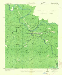 1935 Tapoco1935 Print · USGSThe border of North Carolina and Tennessee comes alive in the 1930s as massive hydroelectric projects reshape the high country. Trace the early Appalachian Trail through Deals Gap alongside industrial landmarks like Cheoah Dam and Tapoco.
 - 1936 Map of Proctor
 1936 Proctor1936 Print · USGSThe Little Tennessee River valley is captured here in the mid-1930s just as the Tennessee Valley Authority began its regional transformations. Genealogists can trace family names at Proctor Cem and Sawyer Creek Cem, or locate schools like Calhoun Coburn Sch.
 - 1936 Map of Greens Creek
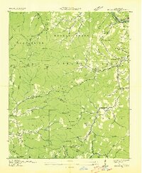 1936 Greens Creek1936 Print · USGSJackson and Swain counties are captured here in the mid-1930s as the TVA and USGS collaborated on surveying the mountain heartland. Genealogists can trace family roots through the many local landmarks like Old Savannah Ch, Greens Creek Sch, and Lisle Knob.
 - 1936 Map of Wesser
 1936 Wesser1936 Print · USGSThe Southern Appalachian highlands are captured here in the mid-1930s, showing a landscape defined by timber flumes and the Southern Railway. Genealogists can locate family landmarks like Wright Place, early schools such as Silvermine Sch, and numerous mountain burials including Euchulla Cem.
 - 1936 Map of Hewitt
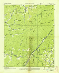 1936 Hewitt1936 Print · USGSGraham County's high ridges and river gorges are captured here in the mid-1930s, just as the regional infrastructure was being formalized by the Tennessee Valley Authority. Researchers can trace the early Appalachian Trail or locate family sites like Jenkins Cem, Rowlin Sch, and the Cheoah Mill.
 - 1936 Map of Bunches Bald
 1936 Bunches Bald1936 Print · USGSThe high ridges and tribal lands of Swain and Jackson counties are documented here in the mid-1930s as the national park system was taking shape. Genealogists and hikers can trace the Bunches Trail, locate the Peach Tree Ch, and study the early layout of the Cherokee Indian Reservation.
 - 1936 Map of Judson
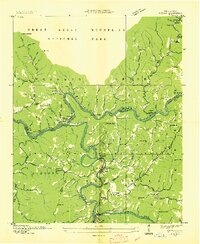 1936 Judson1936 Print · USGSThe confluence of the Little Tennessee and Tuckasegee rivers is captured here in the mid-1930s, just before the landscape was transformed by reservoir projects. Researchers can trace the original rail stops and riverside communities of Bushnell, Judson, and Almond, along with rural landmarks like Mt Zion Ch and Noland Creek Sch.
 - 1936 Map of Whittier
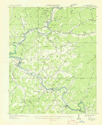 1936 Whittier1936 Print · USGSJackson and Swain Counties are documented here during the mid-thirties as the national park and reservation boundaries were being finalized. Researchers can locate the State Prison Camp No 512, the Southern Railway line through Wilmot, and old landmarks like Worley Chapel.
 - 1936 Map of Bryson
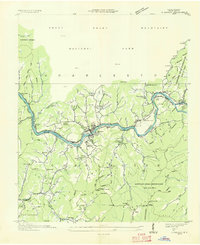 1936 Bryson1936 Print · USGSIn the mid-1930s, the area around Bryson was a hub of river activity and mountain life where the Southern Railway met the Tuckasegee River. Researchers can trace old family roots at Bird Cem and locate community landmarks like Franklin Grove Ch or the East Alarka Sch.
 - 1936 Map of Ravensford
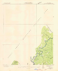 1936 Ravensford1936 Print · USGSSwain County, North Carolina, appears here in the mid-1930s as the national park boundary was being established adjacent to tribal lands. Genealogists and local historians can locate the Big Cove Sch, Piney Grove Ch, and the riverside settlement of Ravensford.
 - 1936 Map of Cartertown
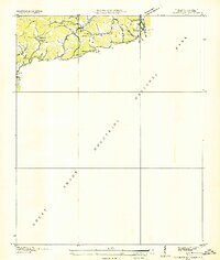 1936 Cartertown1936 Print · USGSSevier County communities sit along the edge of the newly established national park in the mid-1930s. Researchers can locate family landmarks like the Mc Carter Cem and Proffitt Cem or trace early school sites including Roaring Fork Sch.2 unique versions available
Showing maps 1-25 of 192
Top cities of Swain County
Frequently asked questions
- What are the different types of historical maps available for Swain County?
- What is the oldest map of Swain County?
- Where can I purchase historical maps of Swain County for my home or office?
- Where can I download high-res historical maps of Swain County?
- Are there historical topographic maps available for Swain County?
- Is there historical aerial imagery available for Swain County?
- Where are historical maps of Swain County sourced from?