Old Maps of Transylvania County, North Carolina for Academic Research
Study the evolution of Transylvania County with 137 high-resolution historic maps. Whether you're teaching, researching, or modeling changes in land use, these maps provide essential visual documentation of urban, environmental, and geographic change.
- Analyze long-term change: Track patterns in development, transportation, and natural features.
- Ideal for environmental or urban studies: Support academic projects with primary historical map data.
- Use in the classroom or lab: Educators and researchers rely on these maps to bring historical context to life.
These maps are a powerful tool for teaching, research, and visualizing how Transylvania County has changed over the decades.
Transylvania County, NC maps
(137)- 1891 Map of Cowee
 1891 Cowee1891 Print · USGSWestern North Carolina's high mountain reaches are captured here in the late nineteenth century as the railroad began to transform the region. Trace early transport routes like the Western North Carolina Railroad and Cowee Tunnel alongside old settlements at Franklin and Quallatown.
 - 1897 Map of Cowee
 1897 Cowee1897 Print · USGSThe Great Smoky Mountains and Blue Ridge foothills appear here in the 1890s, when the railroad first began to penetrate the high gaps. Trace family roots and mountain industry through old settlements like Quallatown, Sylva, and the Cowee Tunnel engineering site.4 unique versions available
 - 1905 Map of Pisgah, 1956 Print
 1905 Pisgah1956 Print · USGSThe North Carolina high country around the turn of the century reveals a land of timber tracts and emerging mountain retreats. Genealogists and hikers can trace early routes to Buck Spring Lodge, follow the Southern RR tracks, and locate vanished settlements like Angeline and Calhoun.
 - 1906 Map of Pisgah, 1934 Print
 1906 Pisgah1934 Print · USGSThe Blue Ridge highlands at the turn of the century reveal a landscape of mountain river valleys and early timber frontiers. Genealogists and historians can trace family-named bridges and crossings like Graham Bridge or locate vanished settlements such as Grange and Retreat.2 unique versions available
 - 1907 Map of Cowee
 1907 Cowee1907 Print · USGSWestern North Carolina at the turn of the century shows a landscape of rail-connected river towns and high mountain gaps. Genealogists can trace early homesteads and industry through landmarks like West Mill, Roanes Mill, and the many settlements along the Southern Railway.5 unique versions available
 - 1935 Map of Cruso
 1935 Cruso1935 Print · USGSHigh in the Blue Ridge during the mid-thirties, the East Fork Pigeon River valley reveals a landscape of isolated mountain settlements and forest. Genealogists and hikers can trace old homesteads near Cruso, locate the Quinn Cem, and follow the original path of State Highway No 284.
 - 1935 Map of Brevard
 1935 Brevard1935 Print · USGSBrevard and the French Broad River valley are shown here in the mid-1930s as the region balanced traditional mountain farming with new hydroelectric and recreational development. Genealogists and local historians can trace family-named sites like Breeses Mill, Gillespie Cem, and rural schools including Holden Sch.
 - 1935 Map of Eastatoe Gap
 1935 Eastatoe Gap1935 Print · USGSThe Blue Ridge mountain crest and state borderlands are captured in this mid-1930s survey of the French Broad River headwaters. Genealogists and hikers can trace historic crossings at Eastatoe Gap, locate the Middle Fork Ch, and find the Fire Tower on Sassafras Mtn.
 - 1935 Map of Standingstone Mtn.
 1935 Standingstone Mtn.1935 Print · USGSThe Blue Ridge mountain borderlands are captured here in the mid-1930s as modern utility lines began to cross the wilderness. Genealogists and hikers can trace the original paths to Holly Springs Ch, the waters of Triple Falls, and the high ridges of Standingstone Mtn.
 - 1935 Map of Sam Knob
 1935 Sam Knob1935 Print · USGSThe high peaks of the Blue Ridge are captured in the mid-1930s just as the New Deal transformed the forest. Trace early landmarks like CCC Camp NC F 25 and Charley Creek Sch, or locate natural features like Devils Court House and Sam Knob.
 - 1935 Map of Horse Shoe
 1935 Horse Shoe1935 Print · USGSWestern North Carolina's river valleys and mountain ridges are documented here in the mid-1930s as the Southern Railroad winds along the French Broad River. Researchers can trace old family sites and rural infrastructure including Prison Camp No 511, Oakdale Cem, and the historic Sewell House.
 - 1935 Map of Cashiers
 1935 Cashiers1935 Print · USGSJackson County and the North Carolina-South Carolina border appear here in the mid-1930s as modern surveying techniques were first being applied. Researchers can trace early state infrastructure such as St Hy No 106 as it passes through the Nantahala National Forest.
 - 1935 Map of Rosman
 1935 Rosman1935 Print · USGSTransylvania County in the mid-1930s is a rugged landscape where the forks of the French Broad River meet amidst a flurry of New Deal activity. Genealogists can trace family landmarks like Whitmire Cem, Shoal Creek Sch, and the State Prison Camp near Calvert.
 - 1935 Map of Lake Toxaway
 1935 Lake Toxaway1935 Print · USGSThe high ridges of Transylvania and Jackson Counties come into focus in the mid-1930s as the regional forest service and TVA mapped the headwaters. Researchers can trace ancestral ties at Woods Cem, Quebec Sch, and Macedonia Ch along the winding mountain branches.
 - 1935 Map of Reid
 1935 Reid1935 Print · USGSThe high ridges of Transylvania County are captured here in the mid-1930s as federal surveyors first mapped the area using aerial photography. Researchers can trace the early mountain roads like State No 28 near the settlement of Reid and the headwaters of Morton Creek.
 - 1935 Map of Table Rock
 1935 Table Rock1935 Print · USGSThe Carolina borderlands and the upper reaches of the French Broad River are captured here in the mid-1930s. Genealogists and researchers can trace family-named watercourses like Bradley Creek and Cantrell Creek near Dunns Rock.
 - 1935 Map of Shining Rock
 1935 Shining Rock1935 Print · USGSThe high country of Transylvania and Haywood counties is mapped here in the mid-1930s as federal conservation efforts took hold. Researchers can trace the early footprint of CCC Camp F 1 and locate landmarks like Silvermine and Lookingglass Rock.
 - 1935 Map of Pisgah Forest
 1935 Pisgah Forest1935 Print · USGSThe headwaters of the French Broad River valley are shown in the mid-1930s as the national forest system expanded. Trace old family landmarks like Davidson River Cem and community hubs including Turkey Creek Ch and Penrose Sch.
 - 1936 Map of Dunsmore Mountain
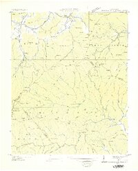 1936 Dunsmore Mountain1936 Print · USGSThe Pisgah National Forest region comes alive in the mid-1930s, showing a landscape of remote mountain churches and early forest management. Genealogists can trace family landmarks like Kelly Cem, Stony Fork Sch, and the high-elevation Buck Spring Lodge.
 - 1941 Map of Cruso, 1957 Print
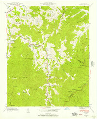 1941 Cruso1957 Print · USGSThe high ridges of Haywood County meet the Buncombe line in the 1940s, showing the mountain coves of the Pisgah National Forest. Genealogists can trace early homesteads and landmarks like Quinn Cem, Springdale Sch, and Meadow Grove Ch.6 unique versions available
 - 1942 Map of Cruso
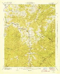 1942 Cruso1942 Print · USGSHaywood County is shown in the early 1940s as a high-mountain landscape of scattered cove settlements and national forest land. Researchers can locate family landmarks such as Quinn Cem, Mt Zion Ch, and the high-altitude Lookout Tower near Fryingpan Mountain.
 - 1942 Map of Horse Shoe
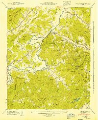 1942 Horse Shoe1942 Print · USGSThe French Broad River valley is captured here in the early 1940s as a thriving network of rail-side settlements and mountain gaps. Genealogists and historians can trace family landmarks like Mc Carson Cem, Oak Forest Ch, and the old Southern Railway line.2 unique versions available
 - 1942 Map of Dunsmore Mountain, 1957 Print
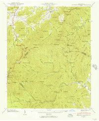 1942 Dunsmore Mountain1957 Print · USGSThe high peaks and deep coves of the Pisgah National Forest are meticulously mapped here in the early 1940s. Genealogists and local historians can locate early landmarks such as Buck Spring Lodge, the Kelly Cem, and Pisgah Ch.2 unique versions available
 - 1943 Map of Dunsmore Mountain
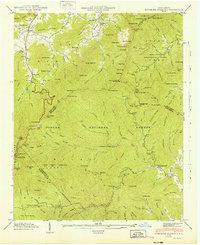 1943 Dunsmore Mountain1943 Print · USGSThe high peaks of the Blue Ridge were a focus of federal forest management and early recreation during the early 1940s. Genealogists and hikers can trace the geography of Buck Spring Lodge, The Pink Beds, and the Kelly Cem.
 - 1945 Map of Brevard, 1956 Print
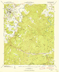 1945 Brevard1956 Print · USGSBrevard and the French Broad River valley are shown in the mid-1940s as a hub of mountain industry and education. Genealogists and historians can trace family plots at Gillespie Cem, visit the campus of Brevard College, or locate old landmarks like Breese Mill.2 unique versions available
Showing maps 1-25 of 137
Top cities of Transylvania County
Frequently asked questions
- What are the different types of historical maps available for Transylvania County?
- What is the oldest map of Transylvania County?
- Where can I purchase historical maps of Transylvania County for my home or office?
- Where can I download high-res historical maps of Transylvania County?
- Are there historical topographic maps available for Transylvania County?
- Is there historical aerial imagery available for Transylvania County?
- Where are historical maps of Transylvania County sourced from?