2020s Maps of Indian Trail, North Carolina
Explore 4 historic maps of Indian Trail from the 2020s. These maps offer a rare glimpse into what life looked like during the 2020s — showing old roads, neighborhoods, homes, and landmarks that have changed or disappeared over time.
Whether you're researching your family's past, planning a metal detecting trip, or studying how Indian Trail's landscape evolved across the 2020s, these high-resolution maps are a powerful tool for exploring the history of this region.
- Focus on a specific era: All maps on this page are from the 2020s, giving you a focused view of this time period.
- See what’s changed: Compare century-old streets, trails, and buildings to today's modern landscape using overlays and satellite layers.
- Research with precision: Use these maps for genealogy, historical research, land use analysis, or educational projects.
- View, download, or print: Maps are fully viewable online in high resolution, and can be downloaded or printed for your own records.
Start exploring Indian Trail's history through authentic maps from the 2020s. This is your window into the past.
Indian Trail, NC maps
(4)- 2022 Map of Midland, 2022 Print
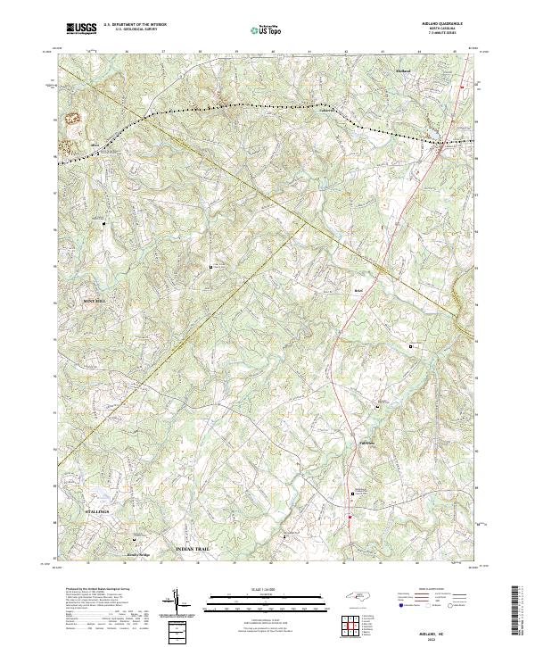 2022 Midland2022 Print · USGSMidland and the surrounding Piedmont countryside are shown here at a time of steady suburban growth along the county borders. Genealogists can locate several historic burial sites, including Dulins Grove Advent Christian Church Cem and Rock Hill Church Cem.
 - 2022 Map of Bakers, 2022 Print
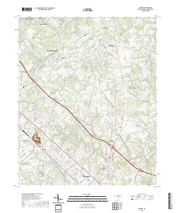 2022 Bakers2022 Print · USGSThe northern Union County landscape near Indian Trail and Monroe is captured here during a period of modern growth. Genealogists can locate several family and church burial grounds, including the Scott Family Cem, Benton Family Cem, and Union Chapel Cem.
 - 2022 Map of Mint Hill, 2022 Print
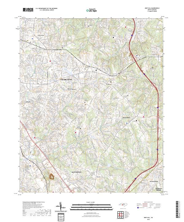 2022 Mint Hill2022 Print · USGSThe eastern edges of Mecklenburg County are shown here in the 2020s, documenting the suburban growth and historic community hubs of MINT HILL and MATTHEWS. Genealogists can locate numerous community landmarks such as Bethel AME Zion Church Cem and Morning Star Lutheran Church Cem.
 - 2022 Map of Matthews, 2022 Print
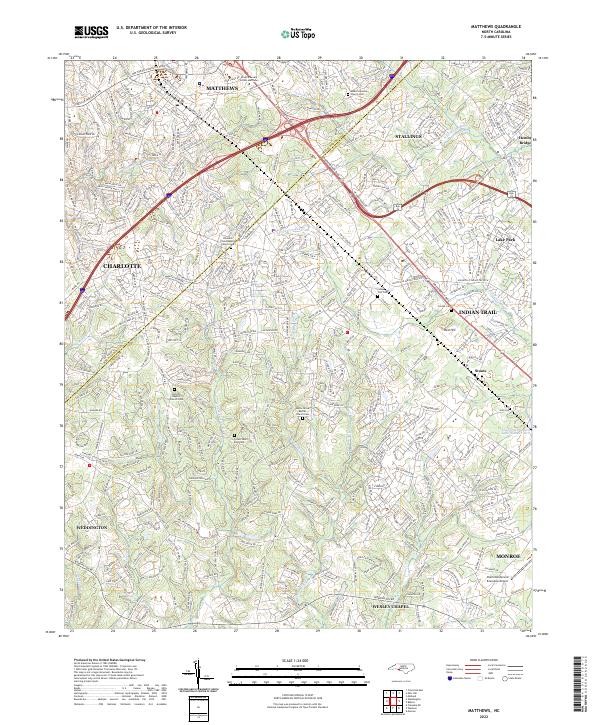 2022 Matthews2022 Print · USGSMecklenburg and Union Counties meet in this modern survey of the growing corridor southeast of Charlotte. Trace the suburban evolution of Matthews and Indian Trail while locating family sites at Antioch Baptist Church Cem and the Seaboard Coast Line RR.
End of results
Showing maps 1-4 of 4
Top cities near Indian Trail
- Charlotte historical maps
- Monroe historical maps
- Matthews historical maps
- Indian Land historical maps
- Mint Hill historical maps
- Pineville historical maps
See more
Top neighborhoods of Indian Trail
Frequently asked questions
- What are the different types of historical maps available for Indian Trail?
- What is the oldest map of Indian Trail?
- Where can I purchase historical maps of Indian Trail for my home or office?
- Where can I download high-res historical maps of Indian Trail?
- Are there historical topographic maps available for Indian Trail?
- Is there historical aerial imagery available for Indian Trail?
- Where are historical maps of Indian Trail sourced from?